Elevation of Cibitoke, Burundi
Location: Burundi >
Longitude: 29.1855785
Latitude: -2.8102897
Elevation: 1547m / 5075feet
Barometric Pressure: 84KPa
Elevation Map:
Satellite Map:
Related Photos:

IMG_4420_DxO

UNHCR News Story: Hounded from home, raped Congolese woman seeks refugee in Burundi

Since when does this happen in Africa!!?!?
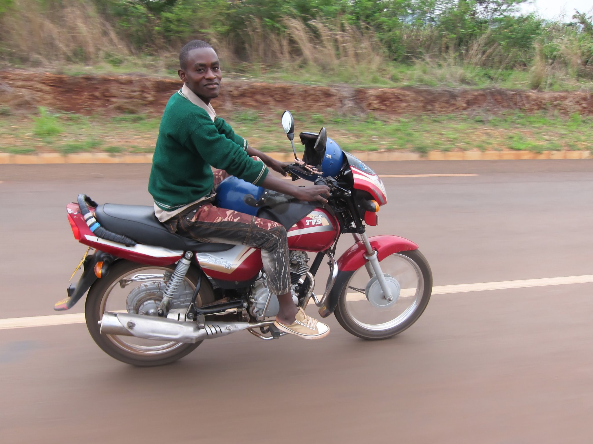
This fellow rode with me after crossing into Burundi for 20km. He even used his leg when we were climbing a hill to help me up.
Topographic Map of Cibitoke, Burundi
Find elevation by address:

Places in Cibitoke, Burundi:
Places near Cibitoke, Burundi:
Rugombo
Rusizi
Nyaruguru
Kitabi Eco-center
Giheke High School
Gisuma
Bukavu
Nyamagabe
Kigeme Refugee Camp
Muko
Mushubi Catholic Church
Mushubi Health Centre
Walungu
Karambo
Kaduha
Kaduha Hospital
Kahuzi-biega
Karongi
Western Province
Mount Kahuzi
Recent Searches:
- Elevation of Corso Fratelli Cairoli, 35, Macerata MC, Italy
- Elevation of Tallevast Rd, Sarasota, FL, USA
- Elevation of 4th St E, Sonoma, CA, USA
- Elevation of Black Hollow Rd, Pennsdale, PA, USA
- Elevation of Oakland Ave, Williamsport, PA, USA
- Elevation of Pedrógão Grande, Portugal
- Elevation of Klee Dr, Martinsburg, WV, USA
- Elevation of Via Roma, Pieranica CR, Italy
- Elevation of Tavkvetili Mountain, Georgia
- Elevation of Hartfords Bluff Cir, Mt Pleasant, SC, USA