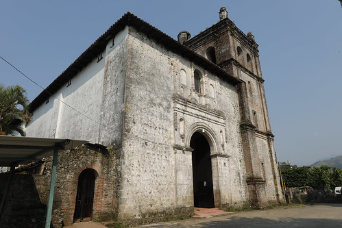
Elevation of Chichonal, Chiapas, Mexico
Location: Mexico > Chiapas >
Longitude: -93.229454
Latitude: 17.3604112
Elevation: 883m / 2897feet
Barometric Pressure: 91KPa
Related Photos:
Topographic Map of Chichonal, Chiapas, Mexico
Find elevation by address:

Places near Chichonal, Chiapas, Mexico:
Ocotepec
Tecpatán
Tecpatán
San Lucía
Calle Central Sur Ote. 18, San Lucía, Tecpatán, Chis., Mexico
Tapilula
Primera Pte. Sur, Tapilula, Chis., Mexico
Juárez
Av. Benito Juárez 12, San Juanito, Juárez, Chis., Mexico
San Juanito
Teapa
Tacotalpa
Centro
Tacotalpa
Domingo Borrego 43, Centro, Tacotalpa, Tab., Mexico
Bochil
Primera Pte. Nte. 4, Centro, Bochil, Chis., Mexico
Centro
Malpaso
Soyaló
Recent Searches:
- Elevation of Corso Fratelli Cairoli, 35, Macerata MC, Italy
- Elevation of Tallevast Rd, Sarasota, FL, USA
- Elevation of 4th St E, Sonoma, CA, USA
- Elevation of Black Hollow Rd, Pennsdale, PA, USA
- Elevation of Oakland Ave, Williamsport, PA, USA
- Elevation of Pedrógão Grande, Portugal
- Elevation of Klee Dr, Martinsburg, WV, USA
- Elevation of Via Roma, Pieranica CR, Italy
- Elevation of Tavkvetili Mountain, Georgia
- Elevation of Hartfords Bluff Cir, Mt Pleasant, SC, USA

