Elevation map of Bungoma County, Kenya
Location: Kenya >
Longitude: 34.597132
Latitude: 0.8084283
Elevation: 1648m / 5407feet
Barometric Pressure: 83KPa
Elevation Map:
Satellite Map:
Related Photos:

AVCD OFSP Western Kenya

AVCD OFSP Western Kenya

AVCD OFSP Western Kenya

Good morning
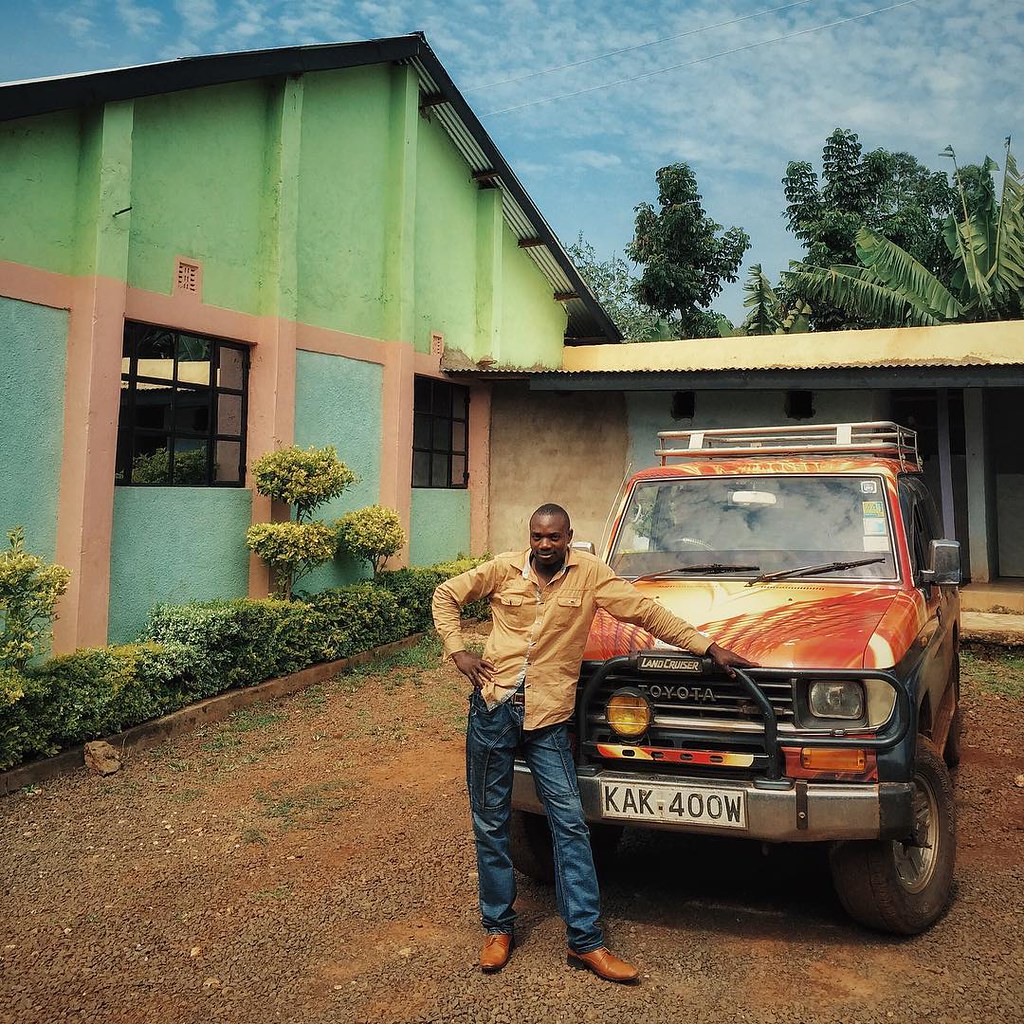
Meet Oliver. He's been graciously piloting us around the difficult roads of Mt. Elgon in Western Kenya the last couple of days.

Portrait 4/9 for my article about Huruma Womengroup, for widows who are Hiv-positive

Portrait 5/9 for my article about Huruma Womengroup, for widows who are Hiv-positive

Portrait 6/9 for my article about Huruma Womengroup, for widows who are Hiv-positive

Portrait 7/9 for my article about Huruma Womengroup, for widows who are Hiv-positive
Topographic Map of Bungoma County, Kenya
Find elevation by address:

Places in Bungoma County, Kenya:
Places near Bungoma County, Kenya:
Chwele
Cheptais Town Centre
Konna
Bubulo
Bungoma
Adanya
Webuye
Busekere Church Of Uganda
Mt Elgon National Park Chiron Gate
Mount Elgon National Park Uganda
Trans-nzoia County
St. Mary Immaculate Shihome Primary School
Kitale
Shianda
Turbo
Bukwo
Bukwo
Lugulu
Busia County
Matunda
Recent Searches:
- Elevation of Corso Fratelli Cairoli, 35, Macerata MC, Italy
- Elevation of Tallevast Rd, Sarasota, FL, USA
- Elevation of 4th St E, Sonoma, CA, USA
- Elevation of Black Hollow Rd, Pennsdale, PA, USA
- Elevation of Oakland Ave, Williamsport, PA, USA
- Elevation of Pedrógão Grande, Portugal
- Elevation of Klee Dr, Martinsburg, WV, USA
- Elevation of Via Roma, Pieranica CR, Italy
- Elevation of Tavkvetili Mountain, Georgia
- Elevation of Hartfords Bluff Cir, Mt Pleasant, SC, USA