Elevation of Bonghwa-gun, Gyeongsangbuk-do, South Korea
Location: South Korea > Gyeongsangbuk-do >
Longitude: 128.7323752
Latitude: 36.8930933
Elevation: 214m / 702feet
Barometric Pressure: 0KPa
Related Photos:

Another view

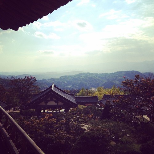
View from the Buddhist Temple

영주 부석사
무량수전 앞 경치...

영주시 금광리

영주시 금광리

영주시 금광리

Korea, Bonghwa

2011_12_04_내성천

2011_10_14_내성천

2011_10_14_내성천

부석사 Buseok Temple

의젓한 자세

Love the pattern the water makes

2015-08-01 at 19.19.01

I can see for miles!
Topographic Map of Bonghwa-gun, Gyeongsangbuk-do, South Korea
Find elevation by address:

Places in Bonghwa-gun, Gyeongsangbuk-do, South Korea:
Places near Bonghwa-gun, Gyeongsangbuk-do, South Korea:
Yeongju-si
Andong
Yecheon-gun
Seokpo-myeon
Taebaek-si
Yeongwol-gun
Jeongseon-gun
Pyeongchang-gun
Jeongseon Alpine Centre
Sukam-ri
Mungyeong-si
Bugu-ri, Buk-myeon
Olympic-ro
Pyeongchang Olympic Stadium
Gangneung-si
Korea
Gangwon-do
Recent Searches:
- Elevation of Pasing, Munich, Bavaria, 81241, Germany
- Elevation of 24, Auburn Bay Crescent SE, Auburn Bay, Calgary, Alberta, T3M 0A6, Canada
- Elevation of Denver, 2314, Arapahoe Street, Five Points, Denver, Colorado, 80205, USA
- Elevation of Community of the Beatitudes, 2924, West 43rd Avenue, Sunnyside, Denver, Colorado, 80211, USA
- Elevation map of Litang County, Sichuan, China
- Elevation map of Madoi County, Qinghai, China
- Elevation of 3314, Ohio State Route 114, Payne, Paulding County, Ohio, 45880, USA
- Elevation of Sarahills Drive, Saratoga, Santa Clara County, California, 95070, USA
- Elevation of Town of Bombay, Franklin County, New York, USA
- Elevation of 9, Convent Lane, Center Moriches, Suffolk County, New York, 11934, USA
- Elevation of Saint Angelas Convent, 9, Convent Lane, Center Moriches, Suffolk County, New York, 11934, USA
- Elevation of 131st Street Southwest, Mukilteo, Snohomish County, Washington, 98275, USA
- Elevation of 304, Harrison Road, Naples, Cumberland County, Maine, 04055, USA
- Elevation of 2362, Timber Ridge Road, Harrisburg, Cabarrus County, North Carolina, 28075, USA
- Elevation of Ridge Road, Marshalltown, Marshall County, Iowa, 50158, USA
- Elevation of 2459, Misty Shadows Drive, Pigeon Forge, Sevier County, Tennessee, 37862, USA
- Elevation of 8043, Brightwater Way, Spring Hill, Williamson County, Tennessee, 37179, USA
- Elevation of Starkweather Road, San Luis, Costilla County, Colorado, 81152, USA
- Elevation of 5277, Woodside Drive, Baton Rouge, East Baton Rouge Parish, Louisiana, 70808, USA
- Elevation of 1139, Curtin Street, Shepherd Park Plaza, Houston, Harris County, Texas, 77018, USA