Elevation of Bomet, Kenya
Location: Kenya > Bomet County >
Longitude: 35.3356518
Latitude: -0.7777854
Elevation: 1953m / 6407feet
Barometric Pressure: 80KPa
Elevation Map:
Satellite Map:
Related Photos:
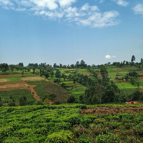
Tea farms on rolling hills in Kapkoros, Bomet County. #kenya #landscapes #bomet #sky #clouds #nature
20160213-12-48-38_C016618 with WM HD PRO

IMG_0989.jpg

IMG_1008.jpg

IMG_0876.jpg

IMG_0875.jpg

Bomet Town in Kenya @mexturesapp #mexturesapp #igkenya @africaknows #africaknows #tembeakenya @igkenya @igersnairobi #sky #architecture

Bomet Sunset

Bomet County Peace Platform Action Planning

Road to Kisii
Topographic Map of Bomet, Kenya
Find elevation by address:

Places near Bomet, Kenya:
Bomet County
Aic Komirmir
Kugerwet
Kimolwet Dispensary
Siongiroi
Migingo
Kaboson
Fairmont Mara Safari Club
Ololulunga
Kericho
Kipkoiyan
Kapnandet Primary School
Chebara
Borborwet Secondary School
Borborwet
Chebara Primary School
Kapsoit Ilhub Petrol Station
Kapsoit
Olare Mara Kempinski Masai Mara
Porini Lion Camp
Recent Searches:
- Elevation of Corso Fratelli Cairoli, 35, Macerata MC, Italy
- Elevation of Tallevast Rd, Sarasota, FL, USA
- Elevation of 4th St E, Sonoma, CA, USA
- Elevation of Black Hollow Rd, Pennsdale, PA, USA
- Elevation of Oakland Ave, Williamsport, PA, USA
- Elevation of Pedrógão Grande, Portugal
- Elevation of Klee Dr, Martinsburg, WV, USA
- Elevation of Via Roma, Pieranica CR, Italy
- Elevation of Tavkvetili Mountain, Georgia
- Elevation of Hartfords Bluff Cir, Mt Pleasant, SC, USA