Elevation of Bernal Ave, Burlingame, CA, USA

Location: United States > California > San Mateo County > Burlingame > Easton Addition >

Longitude: -122.37546

Latitude: 37.5845271

Elevation: 17m / 56feet

Barometric Pressure: 101KPa

Elevation Map:

elevation map of Bernal Ave, Burlingame, CA, USA

Satellite Map:

Satellite map of Bernal Ave, Burlingame, CA, USA

Related Photos:

longexposure seascape bay ngc bayarea wave ocean shore seaside coast california westcoast pacificocean landscape outdoor clouds sky water rock mountain rollinghills sea sand beach cliff nature highway1 architecture house
Cloudy Seascape
sanmateobridge sr92 coyotepointpark burlingame california sanmateo–haywardbridge longexposure dusk seascape bay ngc bayarea wave ocean shore seaside coast westcoast pacificocean landscape outdoor clouds sky water rock mountain rollinghills sea sand beach cliff nature wetlands evening nightphotography nightscene bridge
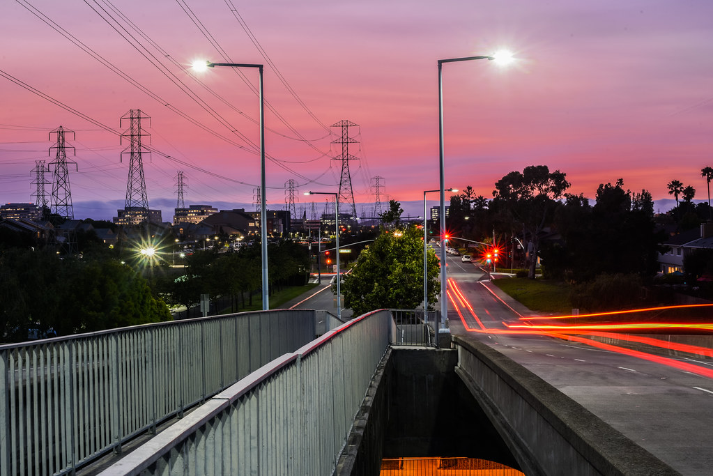
Night Bridge and Its Reflections
lighttrails sanfranciscointernationalairport millbrae sanfrancisco lowfog foginsf cityscape longexposure dusk seascape bay ngc bayarea wave ocean shore seaside coast california landscape outdoor clouds sky water nightphotography nightscene traffictrails
Flew into the Night Clouds
sfo longexposure dusk california sky evening nightphotography nightscene traffictrails traillights airplane aircraft house sanfranciscointernationalairport airport
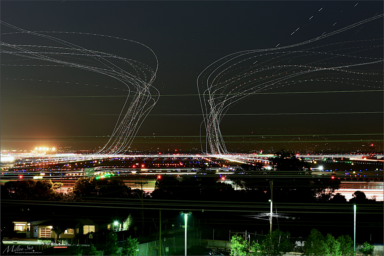
SFO’s Saturday Night
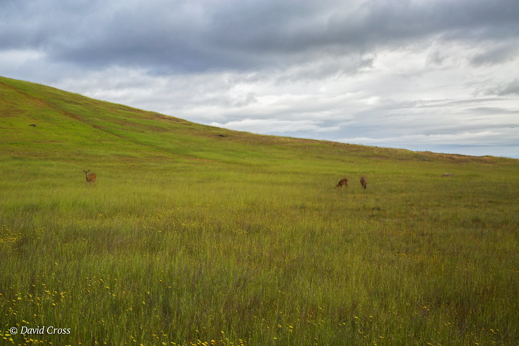
trafficlighttrails lighttrails interstate280 route92 sanmateo lowfog foginsf longexposure dusk seascape bay ngc bayarea wave ocean shore seaside coast california landscape outdoor clouds sky mountain rollinghills evening sunset traffictrails summer
On Their Way Home
sanfranciscoskyline sealpoint sanmateo northerncalifornia sanfrancisco cityscape dusk seascape bay ngc bayarea wave ocean shore seaside coast california westcoast pacificocean landscape outdoor clouds sky water rock mountain rollinghills sea sand beach cliff architecture building baybridge
San Francisco Skyline in the Far Distance
graywhalecovebeach statebeach devilsslide sanmateocounty california montara longexposure seascape bay ngc bayarea wave ocean shore seaside coast northerncalifornia westcoast pacificocean landscape outdoor clouds sky water rock mountain rollinghills sea sand beach cliff nature meadows tree flowers green highway1 wildflowers
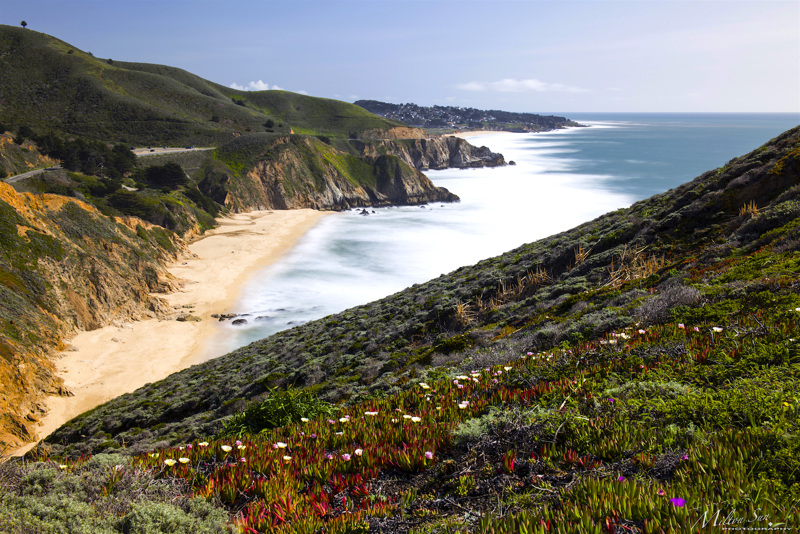
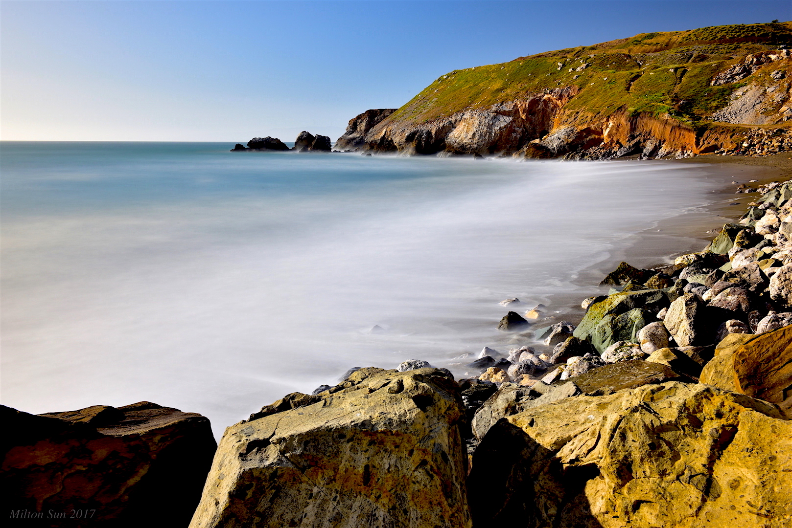
Gray Whale Cove Beach
sanmateojapanesegarden house window california architecture building sanmateocounty trees spring garden green
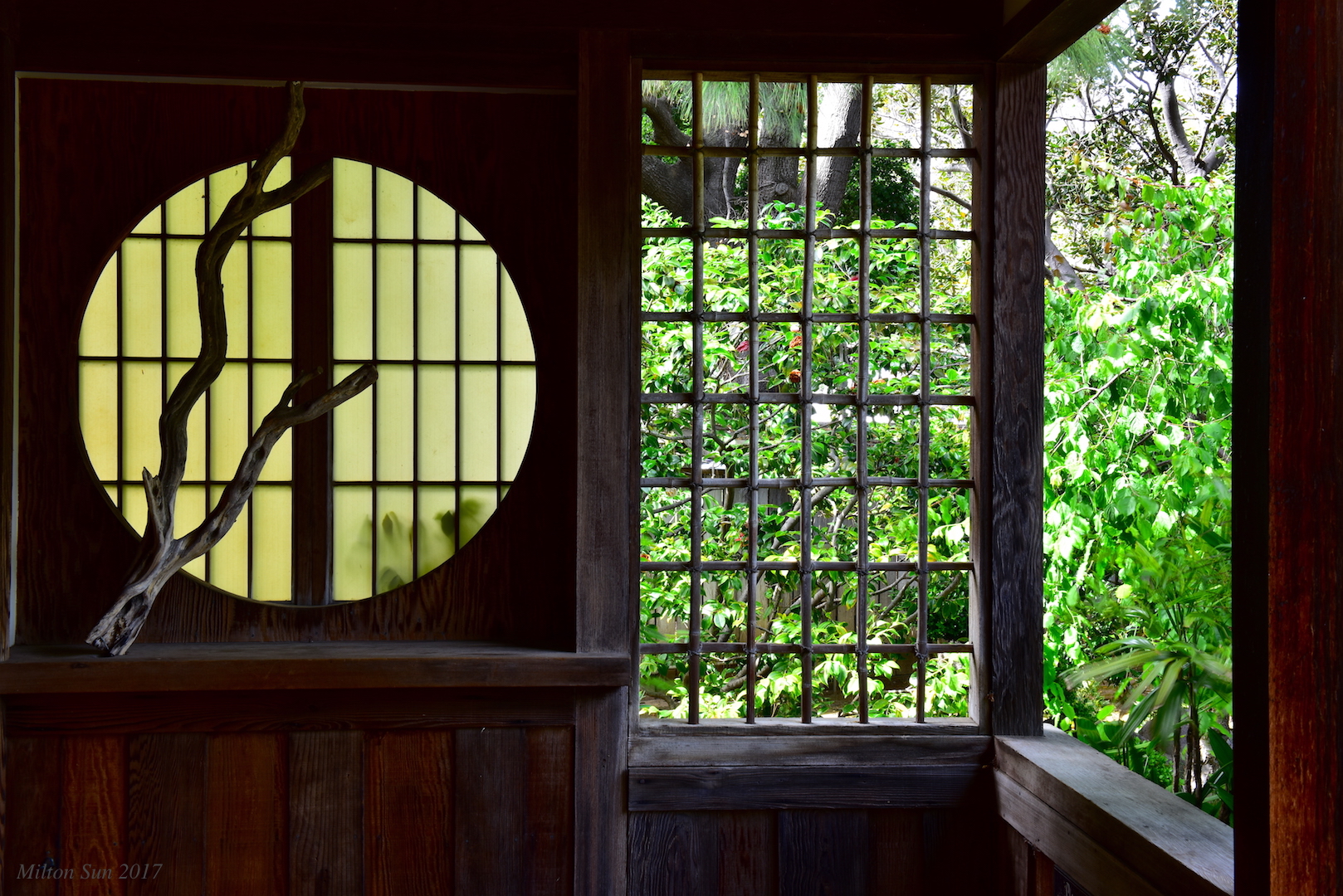
Tea House Window|San Mateo Japanese Garden
pacifica sunset redskies california ocean coast view
Sunset on the Rocks
californiacoastline graywhalecovebeach montara devilsslide longexposure dusk seascape bay ngc bayarea wave ocean shore seaside coast california northerncalifornia westcoast pacificocean landscape outdoor clouds sky water rocks mountains rollinghills sea sand beach cliff nature summer flowers highway1 wildflowers bluesea
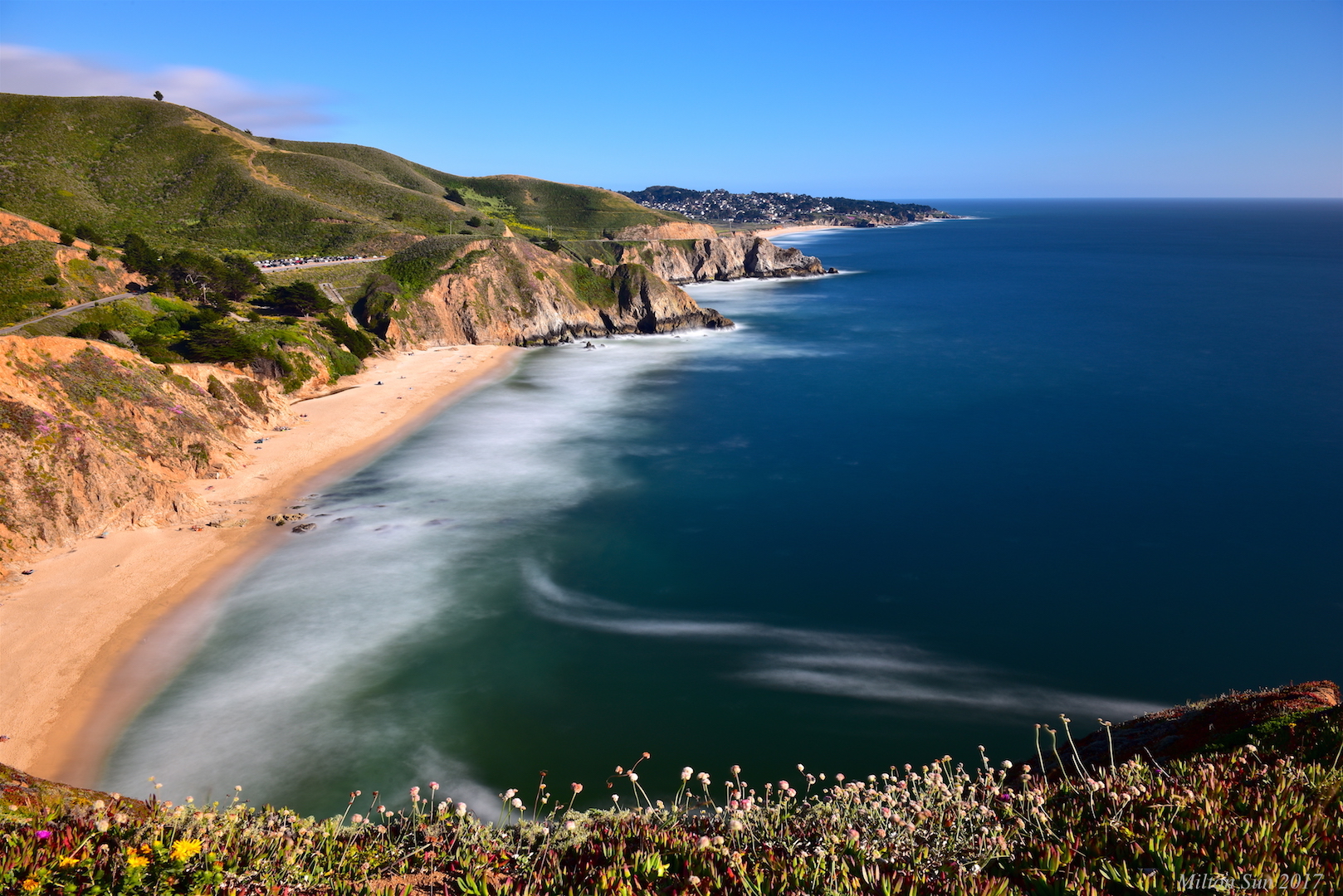
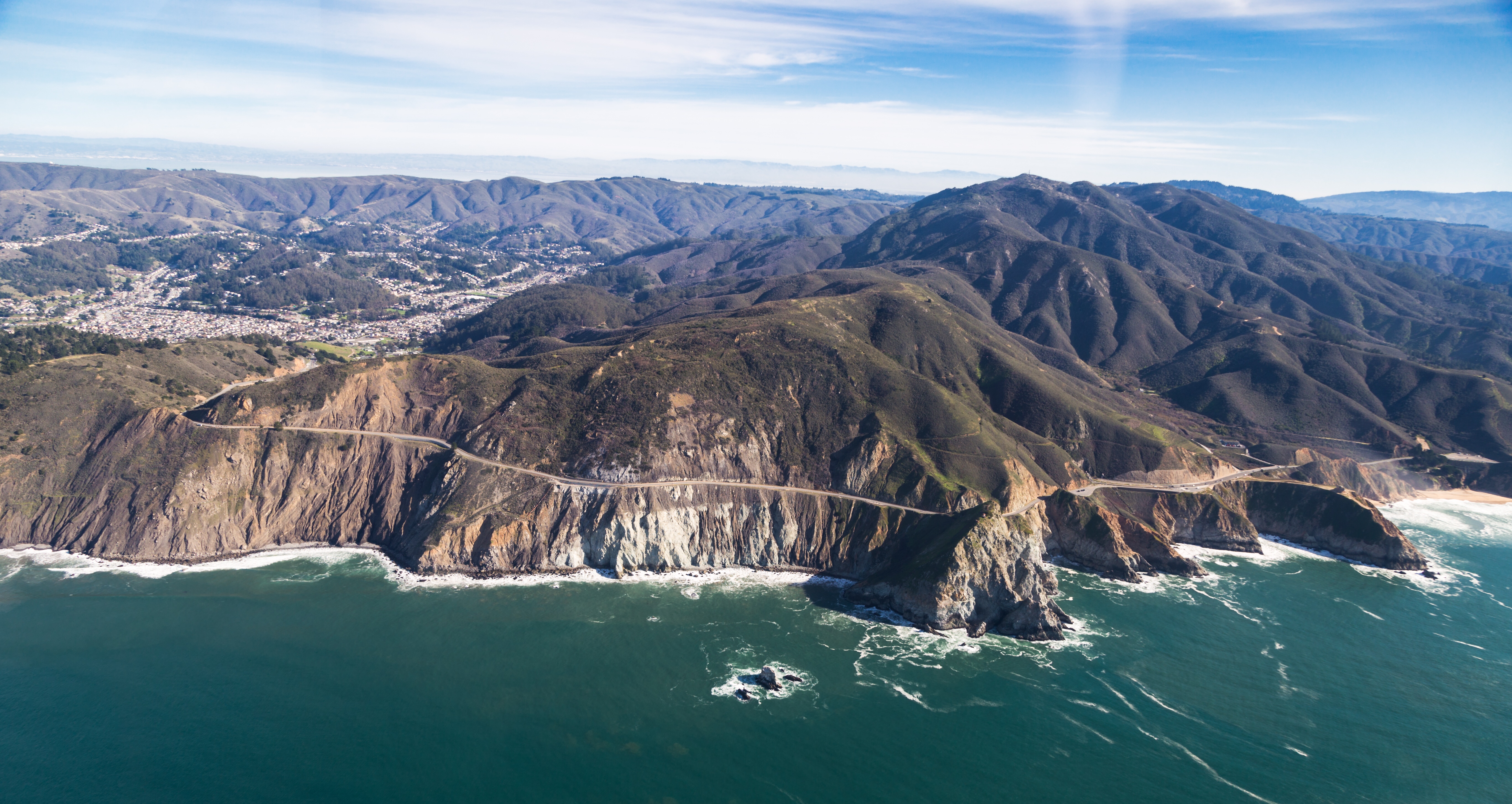
California Coastline
california bayarea nikon d810 color boury pbo31 august 2016 summer southsanfrancisco sanmateocounty signhillpark over view night dark black john davis silhouette lightstream motion traffic 101 sanfranciscointernational airport sfo runway overlook
j. davis at the sign hill summit
white bird interestingness bravo 11 explore egret strut snowyegret shorebird egrettathula naturesfinest 255 theintimidator specanimal impressedbeauty avianexcellence
Egret Strut
sfo
Welcome back to San Francisco!
sanandreaslake sanbruno sanfrancisco lowfog longexposure bay ngc bayarea california westcoast sanmateocounty foginsf rollinghills landscape mountains clouds sky skyline nature
[Rolling...] at San Andreas Lake, San Bruno, CA
blue sunset color pier long exposure pacifica calmness top20longexposure
Moment of the day
california bayarea nikon d810 color august 2016 summer boury pbo31 northerncalifornia fostercity sanmateocounty bridge sunset light pole lightstream traffic skyline urban pink sky motion over view infinity
forever circling
bayarea california nikon d810 color night dark black november 2018 boury pbo31 southsanfrancisco sanmateocounty lightstream motion traffic roadway 101 curve over view red signhillpark
over gateway curve
ocean california ca building horizontal stairs outside mural day unitedstates wave overcast nopeople grill stool pacifica largeformat satellitedish wideangleview asaalanwgeorge
0P40_5481-9
fog cloud atmosphere weather upslopefog watervapor ground forest mountain droplets nature risingterrain marvel outdoor tree sky mist
Upslope Fog
ON TOP OF THE WORLD
california bayarea nikon d810 august 2016 summer boury pbo31 color night dark over view sanmateocounty musselrock shore westcoast beach pacifica pacific ocean john davis silhouette blue black bluehour stand fault line
fault line guardian
halfmoonbay california unitedstates us
Pacifica, San Francisco
sunset clouds rockawaybeach pacifica northerncalifornia dusk seascape bay ngc bayarea wave ocean shore seaside coast westcoast pacificocean landscape outdoor sky water rock mountain rollinghills sea sand beach cliff nature highway1
Watching the sunset and dramatic clouds
pier oysterpoint southsanfrancisco california bridge longexposure seascape bay ngc bayarea wave ocean shore seaside coast landscape outdoor clouds sky water rock sea sand beach
A Small Pier on the Bay
dusk seascape bay ngc bayarea wave ocean shore seaside coast california westcoast pacificocean landscape outdoor clouds sky water rock mountain rollinghills sea sand beach cliff nature highway1 longexposure lindamar sanmateocounty
Early Evening on Saturday
rockawaybeach northerncalifornia longexposure dusk seascape bay ngc bayarea wave ocean shore seaside coast california westcoast pacificocean landscape outdoor clouds sky water rocks mountains rollinghills sea sand beach cliff nature summer highway1 sanmateocounty
Can I Calm Down the Waves?
california canon5dmarkiii canonef24105mmf4lisusm clouds edgewoodpreserve landscape lightroom5 muledeer sanmateocounty topazsw
A Cloudy Day
devilsslide sanmateocounty california dusk seascape bay ngc bayarea wave ocean shore seaside coast northerncalifornia westcoast pacificocean landscape outdoor clouds sky water rock mountain rollinghills sea sand beach cliff nature meadows highway1
Cars Are Prohibited to Go Through Nowadays
moripoint california pacifica nikon sea coastline
Fancy that
Batter milk sky today
Foot prints in the sand..
graywhalecovestatebeach californiastatepark cabrillohigtway higtway1 pacificcoast california unitedstates canon
Graywhale Cove State Beach
Pillar Point Reef
world cemetery dead soldier sadness golden nikon gate war sad military cemetary vietnam national serene d1x golddragon goldmedalwinner platinumphoto thatsclassy goldstaraward nikonflickraward
Golden Gate National Cemetary
Pillar Point Reef
Pacifica, no one we know..
california sunset usa pacifica tallguy
Pacifica Beach.
unitedairlines united n2142u n2138u boeing777 boeing777300 boeing777300er boeing777322er boeing 777 777300 777300er 777322er b77w ksfo sfo sanfranciscointernationalairport sanfranciscoairport sanfrancisco
Boeing 777-322/ER face off at SFO
california sunset usa pacifica tallguy
Sunset, Pacifica Jetty.