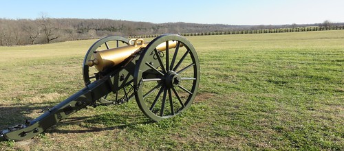
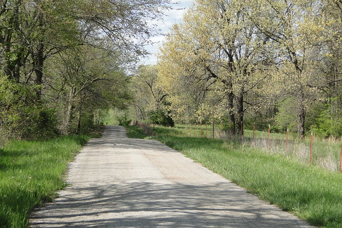
Latitude: 37.0032977
Longitude: -93.7232005
Elevation: 405 meters / 1329 feet
Barometric Pressure 966KPa

Related Photos

Old Barn by dgstheartist, This is an old barn near my house. I had my camera with me on a walk and just had to take the pictur
Old Barn by dgstheartist
Fill 'er up by dv over dt, Snake's eye view of the resurrected Sinclair station at Paris Springsroute66 neon missouri garyturne
Fill 'er up by dv over dt
Gay Parita gas station, Ozark Township, MO by Paul Perton, Street shooter or travel(ing) photographer? Click through to DearSusan - a Web site specifically for
Gay Parita gas station, Ozark Township, MO by Paul Perton
Just as it was - Gay Parita gas station, Ozark Township, MO by Paul Perton, Street shooter or travel(ing) photographer? Click through to DearSusan - a Web site specifically for
Just as it was - Gay Parita gas station, Ozark Township, MO by Paul Perton
.....For Hire by dv over dt, Or Breakdown Dead Ahead.  All depends on your point of view.

Route 66. Missouri Ozarks. The land th
.....For Hire by dv over dt
Artillery piece by 1hr photo, Wilson's Creek National Battlefield, Missouri.

Wilsons Creek was one of the first battles of the Am
Artillery piece by 1hr photo
Sunflowers before the storm by yetanotherstephanie, The sky changes rapidly when it rains in the Ozarks—I came across a field of sunflowers I'd never sp
Sunflowers before the storm by yetanotherstephanie
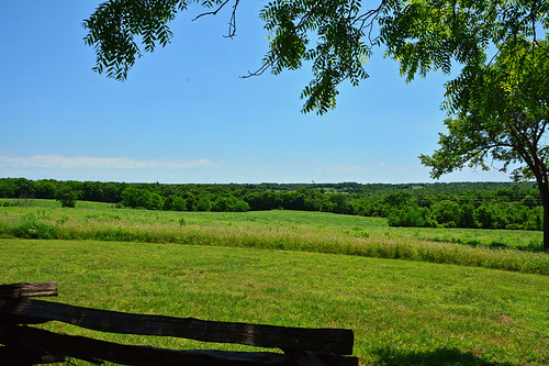
Missouri - Wilson's Creek National Battlefield by Jim Strain, The Second major battle of the Civil War on 8/10/1861. This view is of the field where the Union Arm
Missouri - Wilson's Creek National Battlefield by Jim Strain
BNSF and A&M Monett, Mo. East by lionel682, Went from Rogers, Ark to Monett, Mo. hoping to catch either Arkansas and Missouri or BNSF. Sadly I f
BNSF and A&M Monett, Mo. East by lionel682
The view out of Paris Springs looking west on old 66 by dv over dt, This is what you'll see as you top the hill coming from Springfield on MO-266.  

I drove by the fir
The view out of Paris Springs looking west on old 66 by dv over dt
Wide View of Old Residence on Route 66 in Halltown, Missouri by eoscatchlight, Copyright Robert W. Dickinson. Unauthorized use of this image without my express permission is a vio
Wide View of Old Residence on Route 66 in Halltown, Missouri by eoscatchlight
Fall in Wilson's Creek National Battlefield by _JackCook_, wilsons creek national battlefield republic missouri fall tree yellow light trees art landscape natu
Fall in Wilson's Creek National Battlefield by _JackCook_
Galena Y Bridge- Side View by US 71, Side view of Y Bridge over the James River at Galena, Missouribridges missouri jamesriver galena
Galena Y Bridge- Side View by US 71
BNSF and A&M Monett, Mo. West by lionel682, Went from Rogers, Ark to Monett, Mo. hoping to catch either Arkansas and Missouri or BNSF. Sadly I f
BNSF and A&M Monett, Mo. West by lionel682
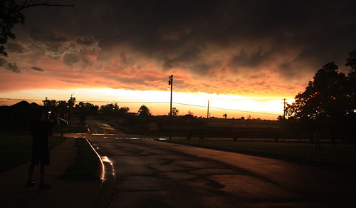
After the Storm: Neighbors Gather by Frank.om.photos.former, This photograph was taken near the corner of Grace Street and Main Avenue in Republic, Missouri, jus
After the Storm: Neighbors Gather by Frank.om.photos.former
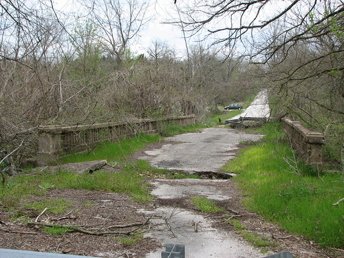
Green Valley Creek- West Approach by US 71, West approach to abandoned bridge over Green Valley Creek between Nixa and Clever, Missouri. Mind th
Green Valley Creek- West Approach by US 71
Sunflower 1 by _JackCook_, missouri sunflower sunset landscape flower
Sunflower 1 by _JackCook_
Marionville Diamond-DX -- South Side by US 71, South view abandoned Diamond-DX station in Marionville, MO the garage area appears to have been adde
Marionville Diamond-DX -- South Side by US 71
Marionville Diamond-DX --North Side by US 71, North view of abandoned Diamond-DX station n Marionville, MOmissouri servicestations us60 abandoned
Marionville Diamond-DX --North Side by US 71
Stone County Courthouse (Galena, Missouri) by courthouselover, C. H. Sudhoelder designed this lovely 1920 courthouse. It was constructed by the Pauly Construction
Stone County Courthouse (Galena, Missouri) by courthouselover
country by Josh Hartman, xhorse field landscape cow photo midwest mt cows farm country panoramic pasture missouri land vernon
country by Josh Hartman
Wilson's Creek National Battlefield Cannon (Christian and Greene Counties, Missouri) by courthouselover, Wilson's Creek National Battlefield at 6424 West Farm Road 182 near Republic, Missouri, preserves th
Wilson's Creek National Battlefield Cannon (Christian and Greene Counties, Missouri) by courthouselover
After the Snow by rreedpc, Our house just before sunrise after our first real snow of the 2009-2010 winter.

3 exposure HDR.

<
After the Snow by rreedpc
Set for Christmas Dinner by rreedpc, The dining room set for Christmas dinner by my sister in law.  A tree in every room.

3 exposure HDR
Set for Christmas Dinner by rreedpc
STOP Sign With Glasses? by US 71, STOP sign with blinders on old 66 at Mo 96 west of Halltown. missouri highways highwaysigns roadsign
STOP Sign With Glasses? by US 71
Y-Bridge and James River (Galena, Missouri) by courthouselover, Built by the Missouri Highway Department's Bureau of Bridges in 1926, this special Art Deco, Y-shape
Y-Bridge and James River (Galena, Missouri) by courthouselover
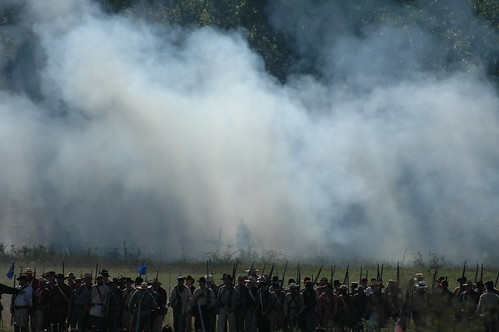
wilsons creek 950 by Joe_Waters, 150th Wilsons Creek, MO civil war reenactmentwilsonscreek
wilsons creek 950 by Joe_Waters
Haybales by Keith Pulles, Republic, MOhay haybales farmfield
Haybales by Keith Pulles
cows at sunset... by mike ambs,
cows at sunset... by mike ambs
HipstaPrint by mike ambs,
HipstaPrint by mike ambs
Wilson's Creek National Battlefield (Christian and Greene Counties, Missouri) by courthouselover, Wilson's Creek National Battlefield at 6424 West Farm Road 182 near Republic, Missouri, preserves th
Wilson's Creek National Battlefield (Christian and Greene Counties, Missouri) by courthouselover
The Wire Road at Wilson's Creek National Battlefield (MO) by Ron Cogswell, Photo taken by Ron Cogswell, April 2008, using a Pentax Optio A10.

<a href="http://www.civilwar.org
The Wire Road at Wilson's Creek National Battlefield (MO) by Ron Cogswell
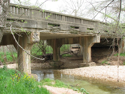
Green Valley Creek- Side View by US 71, Sideview (looking northeast) of abandoned bridge over Green Valley Creek between Nixa and Clever, Mi
Green Valley Creek- Side View by US 71
Flat Creek SIde View by US 71, Sideview of bridge over Flat Creek along Farm Road 1215 near Jenkins, Missouri.bridges missouri flat
Flat Creek SIde View by US 71
Missouri, Lawrence County (Front and East Elevation) by EC Leatherberry, The hipped-roof structure in Lawrence County, Missouri on old US 66 was originally a schoolhouse.  T
Missouri, Lawrence County (Front and East Elevation) by EC Leatherberry
Missouri, Lawrence County (Front and West Elevation) by EC Leatherberry, The hipped-roof structure in Lawrence County, Missouri on old US 66 was originally a schoolhouse.
Missouri, Lawrence County (Front and West Elevation) by EC Leatherberry
Wilson's Creek National Battlefield (Greene County, Missouri) by courthouselover, Wilson's Creek National Battlefield at 6424 West Farm Road 182 near Republic, Missouri, preserves th
Wilson's Creek National Battlefield (Greene County, Missouri) by courthouselover
Sharp Farm Site -- Wilson's Creek National Battlefield (MO) by Ron Cogswell, Photo by Ron Cogswell, April 19, 2008, using a Pentax Optio A10.

<a href="http://www.civilwar.org"
Sharp Farm Site -- Wilson's Creek National Battlefield (MO) by Ron Cogswell
Wilson's Creek National Battlefield (Christian and Greene Counties, Missouri) by courthouselover, Wilson's Creek National Battlefield at 6424 West Farm Road 182 near Republic, Missouri, preserves th
Wilson's Creek National Battlefield (Christian and Greene Counties, Missouri) by courthouselover
Sad and All Alone by Fly Sandman, Found on a walk in the woods. Not my woods by the way.....

<a href="http://bighugelabs.com/onblack.
Sad and All Alone by Fly Sandman
Ray Cornfield -- Wilson's Creek National Battlefield (MO) by Ron Cogswell, Photo by Ron Cogswell, April 19, 2008, using a Pentax Option A10.

<a href="http://www.civilwar.org"
Ray Cornfield -- Wilson's Creek National Battlefield (MO) by Ron Cogswell

Seed Pod by victorbrownphotography, This is a seed pod of a looks like a dandylion bloom only it was the size of a tennis ball. 5 photos
Seed Pod by victorbrownphotography
Flat Creek 1142-Side View by US 71, Side view of bridge over Flat Creek on Farm Road 1142 near Butterfield.bridges missouri flatcreek
Flat Creek 1142-Side View by US 71
Y-Bridge (Galena, Missouri) by courthouselover, Built by the Missouri Highway Department's Bureau of Bridges in 1926, this special Art Deco, Y-shape
Y-Bridge (Galena, Missouri) by courthouselover
Ray Cornfield -- Wilson's Creek National Battlefield (MO) by Ron Cogswell, Photo by Ron Cogswell, April 19, 2008, using a Pentax Optio A10.

<a href="http://www.civilwar.org"
Ray Cornfield -- Wilson's Creek National Battlefield (MO) by Ron Cogswell
20110417_007.jpg by My Blue Van, unitedstates kayaking clever jamesriver
20110417_007.jpg by My Blue Van
Kelly Creek-Side View by US 71, Side view of Kelly Creek bridge along County Ave in Monett, MO.bridges missouri
Kelly Creek-Side View by US 71
Y-Bridge (Galena, Missouri) by courthouselover, Built by the Missouri Highway Department's Bureau of Bridges in 1926, this special Art Deco, Y-shape
Y-Bridge (Galena, Missouri) by courthouselover
wilsons creek 947 by Joe_Waters, 150th Wilsons Creek, MO civil war reenactmentwilsonscreek
wilsons creek 947 by Joe_Waters
Country Road by smoketronics, OK, I was lost. On the way to Jollification (Jolly Mill Park) in southwest Missouriroad view country
Country Road by smoketronics
waiting for spring by yetanotherstephanie, Frozen creek beside a cemetery, near bypassed Route 66, east of Springfield, MO trees winter ice rur
waiting for spring by yetanotherstephanie
Wilson's Creek National Battlefield (Greene County, Missouri) by courthouselover, Wilson's Creek National Battlefield at 6424 West Farm Road 182 near Republic, Missouri, preserves th
Wilson's Creek National Battlefield (Greene County, Missouri) by courthouselover
Wilson's Creek National Battlefield (Greene County, Missouri) by courthouselover, Wilson's Creek National Battlefield at 6424 West Farm Road 182 near Republic, Missouri, preserves th
Wilson's Creek National Battlefield (Greene County, Missouri) by courthouselover
Flat Creek 2080-Side View by US 71, Side view of truss bridge on Farm Road 2080 at Flat Creekbridges missouri flatcreek
Flat Creek 2080-Side View by US 71
Clear Creek-From South by US 71, View from south of abandoned bridge over Clear Creek along S. Central St in Monett.bridges missouri
Clear Creek-From South by US 71
Y-Bridge and James River (Galena, Missouri) by courthouselover, Built by the Missouri Highway Department's Bureau of Bridges in 1926, this special Art Deco, Y-shape
Y-Bridge and James River (Galena, Missouri) by courthouselover
Wilson's Creek National Battlefield (Greene County, Missouri) by courthouselover, Wilson's Creek National Battlefield at 6424 West Farm Road 182 near Republic, Missouri, preserves th
Wilson's Creek National Battlefield (Greene County, Missouri) by courthouselover
Y-Bridge and James River (Galena, Missouri) by courthouselover, Built by the Missouri Highway Department's Bureau of Bridges in 1926, this special Art Deco, Y-shape
Y-Bridge and James River (Galena, Missouri) by courthouselover
Y-Bridge (Galena, Missouri) by courthouselover, Built by the Missouri Highway Department's Bureau of Bridges in 1926, this special Art Deco, Y-shape
Y-Bridge (Galena, Missouri) by courthouselover
Y-Bridge (Galena, Missouri) by courthouselover, Built by the Missouri Highway Department's Bureau of Bridges in 1926, this special Art Deco, Y-shape
Y-Bridge (Galena, Missouri) by courthouselover