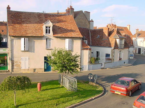
Elevation of 10 Rue Eugène Menet, Saint-Denis-de-Jouhet, France
Location: France > Centre > Indre > Saint-denis-de-jouhet >
Longitude: 1.8600957
Latitude: 46.5285862
Elevation: 293m / 961feet
Barometric Pressure: 98KPa
Related Photos:
Topographic Map of 10 Rue Eugène Menet, Saint-Denis-de-Jouhet, France
Find elevation by address:

Places near 10 Rue Eugène Menet, Saint-Denis-de-Jouhet, France:
Saint-denis-de-jouhet
Sarzay
21 Violet, Sarzay, France
26 Le Grand Pommier, La Forêt-du-Temple, France
La Forêt-du-temple
La Châtre
51 Rue du Faubourg Saint-Abdon, La Châtre, France
1 Place de la Mairie, Méasnes, France
Méasnes
Nohant-vic
4 D, Nohant-Vic, France
Maillet
Ardentes
13 La Ballerie, Malicornay, France
Malicornay
57 Rue du Huit Mai, Ardentes, France
3 La Paillauderie, Maillet, France
Champillet
2 Route de Chateaumeillant, Champillet, France
Allée de Lourouer les Bois, Le Poinçonnet, France
Recent Searches:
- Elevation of Corso Fratelli Cairoli, 35, Macerata MC, Italy
- Elevation of Tallevast Rd, Sarasota, FL, USA
- Elevation of 4th St E, Sonoma, CA, USA
- Elevation of Black Hollow Rd, Pennsdale, PA, USA
- Elevation of Oakland Ave, Williamsport, PA, USA
- Elevation of Pedrógão Grande, Portugal
- Elevation of Klee Dr, Martinsburg, WV, USA
- Elevation of Via Roma, Pieranica CR, Italy
- Elevation of Tavkvetili Mountain, Georgia
- Elevation of Hartfords Bluff Cir, Mt Pleasant, SC, USA
