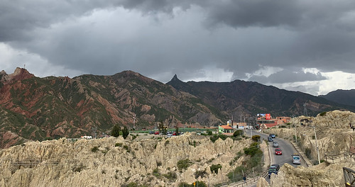
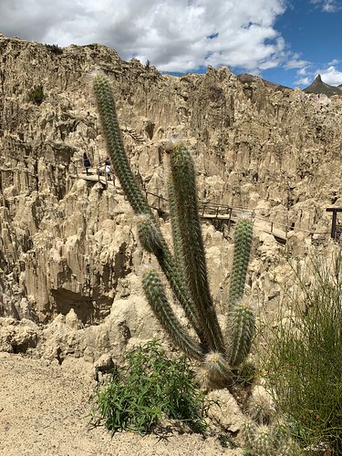
Latitud: -16.333333
Longitud: -68
Elevación: 4157 metros / 13638 pies
Presión barométrica 604KPa

Fotos relacionadas

El Valle de la Luna by Michel Renouleau, At the gates of La Paz, the Valley of the Moon is a sort of desert of rocks sculpted by the elements
El Valle de la Luna by Michel Renouleau
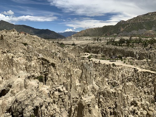
El Valle de la Luna (Valle de la Luna) a 3.100 metros (10.170 pies) sobre el nivel del mar, La Paz, Bolivia. by ER's Eyes - Our planet is so beautiful., About 10km down the canyon of the Río Choqueyapu from the city center, Valle de la Luna is a slightl
El Valle de la Luna (Valle de la Luna) a 3.100 metros (10.170 pies) sobre el nivel del mar, La Paz, Bolivia. by ER's Eyes - Our planet is so beautiful.
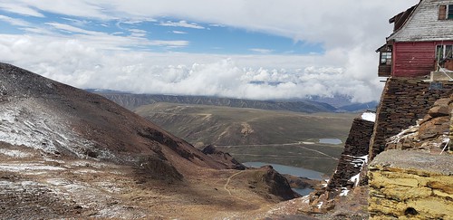
(Un antiguo resort de esquí) - El Monte Chacaltaya a 5.421 metros (17.785 pies) sobre el nivel del mar, la Cordillera Real, Bolivia, Sudamérica. by ER's Eyes - Our planet is so beautiful., Former Sky Resort on our right.
La Paz is just above the third lake.


***


The view would have loo
(Un antiguo resort de esquí) - El Monte Chacaltaya a 5.421 metros (17.785 pies) sobre el nivel del mar, la Cordillera Real, Bolivia, Sudamérica. by ER's Eyes - Our planet is so beautiful.
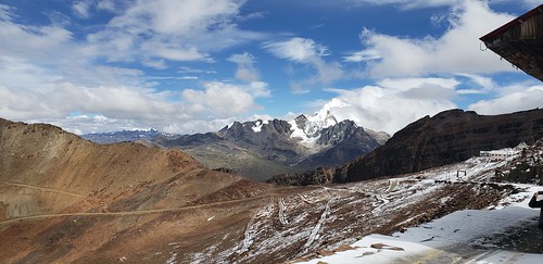
Huayna Potosí a 6.088 metros (19.974 pies) sobre el nivel del mar, la Cordillera Real, Bolivia, Sudamérica. by ER's Eyes - Our planet is so beautiful., Huayna Potosí is the closest high mountain to La Paz. Surrounded by high mountains, it is roughly 15
Huayna Potosí a 6.088 metros (19.974 pies) sobre el nivel del mar, la Cordillera Real, Bolivia, Sudamérica. by ER's Eyes - Our planet is so beautiful.
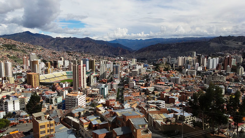
La Paz - Bolivia by Rogg4n, The spectacular view on La Paz City in Bolivia, one of the highest (if not the highest) city in the
La Paz - Bolivia by Rogg4n
Un paisaje árido by Michel Renouleau, We can see on this photo the aridity of the region of La Paz.

_____________________________
Un pays
Un paisaje árido by Michel Renouleau
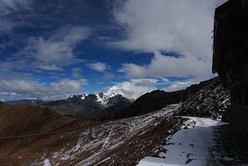
LA PAZ. CHACALTAYA by RLuna (Charo de la Torre fotografía), ©Todos los derechos reservados.

La carretera que sube al Chacaltaya es una de las más altas del mun
LA PAZ. CHACALTAYA by RLuna (Charo de la Torre fotografía)
Camino de los Yungas by Joost10000, Not the best picture in terms of focus. It does however give a real sense of what travelling on the
Camino de los Yungas by Joost10000
Cordillera Real by Mono Andes,  Laguna Khellualkota, cerro Wyoming (al centro) y cerro Jisthaña (derecha).

Cordillera Real, Bolivi
Cordillera Real by Mono Andes
Huayna Potosí a 6.088 metros (19.974 pies) sobre el nivel del mar, la Cordillera Real, Bolivia, Sudamérica. by ER's Eyes - Our planet is so beautiful., Huayna Potosí is the closest high mountain to La Paz. Surrounded by high mountains, it is roughly 15
Huayna Potosí a 6.088 metros (19.974 pies) sobre el nivel del mar, la Cordillera Real, Bolivia, Sudamérica. by ER's Eyes - Our planet is so beautiful.
Paisaje en el Valle de la Luna cerca de La Paz, Bolivia by sandeepachetan.com, <a href="http://www.sandeepachetan.com" rel="nofollow">Website</a>  | <a href="http://instagram.com/
Paisaje en el Valle de la Luna cerca de La Paz, Bolivia by sandeepachetan.com
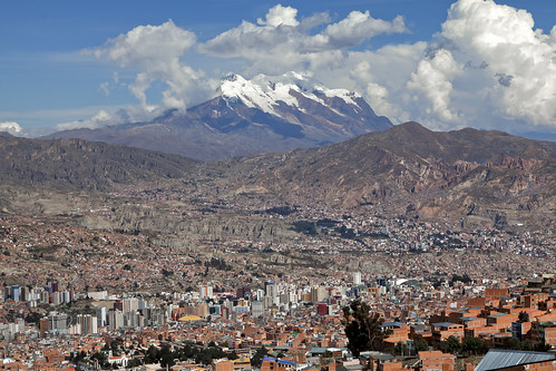
Vista desde el Mirador Faro Murillo, La Paz, Bolivia by JH_1982, mirador faro murillo lighthouse el alto illimani andes anden 安地斯山脈 アンデス山脈 안데스산맥 cordillera mountains
Vista desde el Mirador Faro Murillo, La Paz, Bolivia by JH_1982
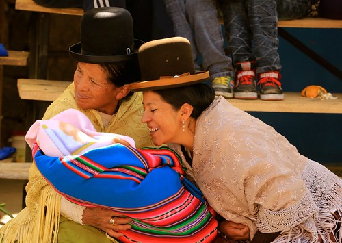
Un niño y una calle con sombreros de volante en La Paz Sudamérica by In Memoriam Ngaire Hart, altiplano arid bolivia bowlerhat city cobbledstreet costume dailylife dress dry dwellings elderly er
Un niño y una calle con sombreros de volante en La Paz Sudamérica by In Memoriam Ngaire Hart
Manejo en el borde by Joost10000, The old Coroico to La Paz road, nicknamed the death road (camino del muerte) for obvious reasons. Th
Manejo en el borde by Joost10000
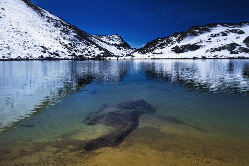
Lago Vizcacha by aldo_146, High land waterscape, derived from melts originated in the Huayna Potosí snowy mountains, La Paz, Bo
Lago Vizcacha by aldo_146
Camino a Los Yungas II by Mono Andes, Bajada a la selva y Coroico.

Boliviaandes bolivia coroico rutadelamuerte caminoalosyungas ruta cami
Camino a Los Yungas II by Mono Andes
Ruta de la Muerte by Mono Andes, O camino a Los Yungas, en bajada hacia Coroico. Busque a los ciclistas.

Bolivia.andes bolivia rutad
Ruta de la Muerte by Mono Andes
Panorama de La Paz - Bolivia by Ole Begemann, Stitched from 13 frames. No tripod. This really has to be seen at least <a href="http://www.flickr.c
Panorama de La Paz - Bolivia by Ole Begemann
Huayna Potosí a 6.088 metros (19.974 pies) sobre el nivel del mar, la Cordillera Real, Bolivia, Sudamérica. by ER's Eyes - Our planet is so beautiful., The Cerro Chacaltaya peak, 5,395 meters high, on top of an ancient glacier (decreased over several d
Huayna Potosí a 6.088 metros (19.974 pies) sobre el nivel del mar, la Cordillera Real, Bolivia, Sudamérica. by ER's Eyes - Our planet is so beautiful.
La Madre Luna, el Valle de la Luna (Valle de la Luna) a 3.100 metros (10.170 pies) sobre el nivel del mar, La Paz, Bolivia. by ER's Eyes - Our planet is so beautiful., About 10km down the canyon of the Río Choqueyapu from the city center, Valle de la Luna is a slightl
La Madre Luna, el Valle de la Luna (Valle de la Luna) a 3.100 metros (10.170 pies) sobre el nivel del mar, La Paz, Bolivia. by ER's Eyes - Our planet is so beautiful.
La Paz by .Okular., View over the city to the 6483m high Illimanianden bolivien lapaz landscape sony travel art bolivia
La Paz by .Okular.
La Paz by Joost10000, View over La Paz taken from the route from El Alto. El Alto is the location of the international air
La Paz by Joost10000
Illimani Mountain Estadio Hernando Siles Stadium La Paz Bolivia South America by In Memoriam Ngaire Hart, Estadio Hernando Siles is a sports stadium in La Paz, Bolivia. It is the country's largest sports co
Illimani Mountain Estadio Hernando Siles Stadium La Paz Bolivia South America by In Memoriam Ngaire Hart
2018_07_407_Südamerika_Bolivien_LaPaz_in Explore by @AS, La Paz, eine Stadt mit Höhen und Tiefen. 
La Paz ist die Stadt mit dem größten Höhenunterschied inne
2018_07_407_Südamerika_Bolivien_LaPaz_in Explore by @AS
La Paz, Bolivia by Filippo Manaresi, Vista di La Paz.

<a href="http://www.youtube.com/watch?v=hyKCvOQBmXI" rel="nofollow">Peru and Boliv
La Paz, Bolivia by Filippo Manaresi
Up in La Paz, Bolivia by Tobias Mayr, See the Timelapse Video of South America: <a href="https://youtu.be/y5cv3fxJxl0" rel="nofollow">yout
Up in La Paz, Bolivia by Tobias Mayr
Camino a Los Yungas by Mono Andes, Por el histórico "Camino de la Muerte" desde La Paz a Coroico.

Bolivia.       andes boliv
Camino a Los Yungas by Mono Andes
The Valley of the Moon (Valle de la Luna), La Paz, Bolivia. by ER's Eyes - Our planet is so beautiful., The Devil's Tooth (Muella del Diablo) is in the middle. It is the last mountain.

Take some time off
The Valley of the Moon (Valle de la Luna), La Paz, Bolivia. by ER's Eyes - Our planet is so beautiful.
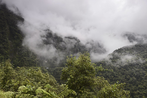
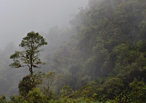
Driving through the jungle by Joost10000, This picture was taken on the old single track road from La Paz to Coroico - Bolivia.
The road was c
Driving through the jungle by Joost10000
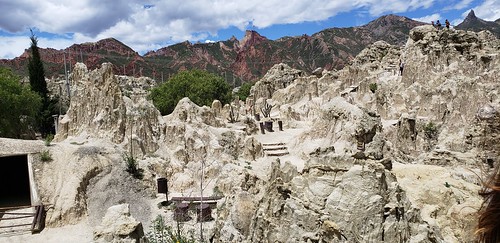
The Devil's Tooth (Muella del Diablo) on the right, from the Moon Valley (Valle de la Luna) at 3,100 meters (10,170 ft) above sea level, La Paz, Bolivia. by ER's Eyes - Our planet is so beautiful., Take some time off from the hustle and bustle of the city and visit Muela del Diablo, a distinct roc
The Devil's Tooth (Muella del Diablo) on the right, from the Moon Valley (Valle de la Luna) at 3,100 meters (10,170 ft) above sea level, La Paz, Bolivia. by ER's Eyes - Our planet is so beautiful.
Nevado Condoriri - 5648 mts by Mono Andes,           andes bolivia cordillerareal condoriri
Nevado Condoriri - 5648 mts by Mono Andes
Curva en el camino by Miradortigre, El camino de Noryungas de La Paz a Coroico, conocido como la ruta de la muerte

The Bolivian death r
Curva en el camino by Miradortigre
Dancers in Red & Gold Street Shot La Paz South America by In Memoriam Ngaire Hart, altiplano arid beauties bolivia bowlerhat city cobbledstreet costume dailylife dress dry dwellings e
Dancers in Red & Gold Street Shot La Paz South America by In Memoriam Ngaire Hart
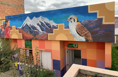
Mirador Killi Killi, La Paz, Bolivia. by ER's Eyes - Our planet is so beautiful., Located atop a steep hill in the neighborhood of Villa Pabon sits one of La Paz’s most impressive vi
Mirador Killi Killi, La Paz, Bolivia. by ER's Eyes - Our planet is so beautiful.
A rooftop view in La Paz, Bolivia by Matthew Straubmuller, latinamerica southamerica la paz bolivia panoramic andes bo lapaz iphone plazamurillo iphone5
A rooftop view in La Paz, Bolivia by Matthew Straubmuller
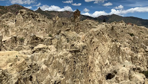
The Moon Valley (Valle de la Luna) at 3,100 meters (10,170 ft) above sea level, La Paz, Bolivia. by ER's Eyes - Our planet is so beautiful., About 10km down the canyon of the Río Choqueyapu from the city center, Valle de la Luna is a slightl
The Moon Valley (Valle de la Luna) at 3,100 meters (10,170 ft) above sea level, La Paz, Bolivia. by ER's Eyes - Our planet is so beautiful.
Alturas de La Paz  |  La Paz Heights. by Benjamín Moreno | Photographer, La Paz. Bolivia.city america canon photography la view south centro paz bolivia ciudad panoramic pan
Alturas de La Paz | La Paz Heights. by Benjamín Moreno | Photographer
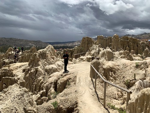
The Moon Valley (Valle de la Luna) at 3,100 meters (10,170 ft) above sea level, La Paz, Bolivia. by ER's Eyes - Our planet is so beautiful., "It is no good for a man to conquer the moon, but he loses the earth."

François Mauriacva
The Moon Valley (Valle de la Luna) at 3,100 meters (10,170 ft) above sea level, La Paz, Bolivia. by ER's Eyes - Our planet is so beautiful.
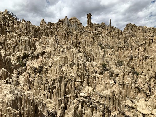
The Mother Moon (Madre Luna), the Moon Valley (Valle de la Luna) at 3,100 meters (10,170 ft) above sea level, La Paz, Bolivia. by ER's Eyes - Our planet is so beautiful., valledelaluna valedalua bolívia bolivia lapaz trails trilhas erosão badlands choma sanpedrocactus th
The Mother Moon (Madre Luna), the Moon Valley (Valle de la Luna) at 3,100 meters (10,170 ft) above sea level, La Paz, Bolivia. by ER's Eyes - Our planet is so beautiful.
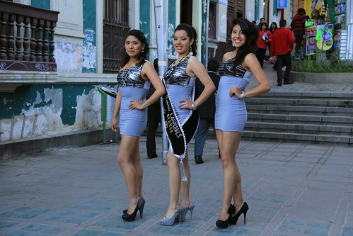
Lilac and High Heels Street Shot La Paz Bolivia South America by In Memoriam Ngaire Hart, life city travel houses people southamerica fashion photography costume scenery highheels quiet dres
Lilac and High Heels Street Shot La Paz Bolivia South America by In Memoriam Ngaire Hart
A sight of La Paz by David Baggins, A last sight of La Paz before saying good bye to this wonderful city. I like this view from Hotel Eu
A sight of La Paz by David Baggins
"Can you feel it, see it, hear it today?" - Huayna Potosi - Bolívia by TLMELO, andes bolívia cordillerareal cordilheirareal southamerica américadosul altiplano climb climber mount
"Can you feel it, see it, hear it today?" - Huayna Potosi - Bolívia by TLMELO
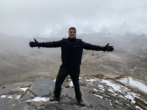
The Mount Chacaltaya at 5,421 meters (17,785 ft) above sea level, the Cordillera Real, Bolívia, South America. by ER's Eyes - Our planet is so beautiful., Chacaltaya is a mountain in the Cordillera Real, one of the mountain ranges of the Cordillera Orient
The Mount Chacaltaya at 5,421 meters (17,785 ft) above sea level, the Cordillera Real, Bolívia, South America. by ER's Eyes - Our planet is so beautiful.
The Moon Valley (Valle de la Luna) at 3,100 meters (10,170 ft) above sea level, La Paz, Bolivia. by ER's Eyes - Our planet is so beautiful., "Each of us is a moon and has a dark side that never shows anyone."

Mark Twainvaledalua t
The Moon Valley (Valle de la Luna) at 3,100 meters (10,170 ft) above sea level, La Paz, Bolivia. by ER's Eyes - Our planet is so beautiful.
The Moon Valley (Valle de la Luna) at 3,100 meters (10,170 ft) above sea level, La Paz, Bolivia. by ER's Eyes - Our planet is so beautiful., Drove us crazy.
Twice there.

There are two paths, a 45-m and 15-m walk-path.
valedalua themoonvalle
The Moon Valley (Valle de la Luna) at 3,100 meters (10,170 ft) above sea level, La Paz, Bolivia. by ER's Eyes - Our planet is so beautiful.
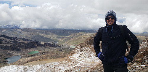
The Mount Chacaltaya at 5,421 meters (17,785 ft) above sea level, the Cordillera Real, Bolívia, South America. by ER's Eyes - Our planet is so beautiful., We are at 5,300 meters high or 17,388 ft. high at the moment.secondsummitofchacaltaya trekchacaltaya
The Mount Chacaltaya at 5,421 meters (17,785 ft) above sea level, the Cordillera Real, Bolívia, South America. by ER's Eyes - Our planet is so beautiful.
Huayna Potosi - Bolívia by TLMELO, andes bolívia cordillerareal cordilheirareal southamerica américadosul altiplano climb climber mount
Huayna Potosi - Bolívia by TLMELO
The Palacio Quemado, La Paz, Bolivia. by ER's Eyes - Our planet is so beautiful., View of Plaza Murillo looking towards Presidential Palace and Cathedral.

***

The lamppost where Gu
The Palacio Quemado, La Paz, Bolivia. by ER's Eyes - Our planet is so beautiful.
Mirador Killi Killi, La Paz, Bolivia. by ER's Eyes - Our planet is so beautiful., Located atop a steep hill in the neighborhood of Villa Pabon sits one of La Paz’s most impressive vi
Mirador Killi Killi, La Paz, Bolivia. by ER's Eyes - Our planet is so beautiful.
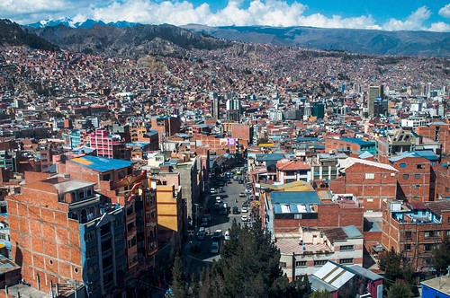
La Paz, Bolivia by David Baggins, Views from the new cable car and its station in El Alto.bolivia cablecar lapaz teleférico
La Paz, Bolivia by David Baggins
The Moon Valley (Valle de la Luna) at 3,100 meters (10,170 ft) above sea level, La Paz, Bolivia. by ER's Eyes - Our planet is so beautiful., Several species of cactus grow here, including the hallucinogenic choma (San Pedro cactus).

Oh, YEP
The Moon Valley (Valle de la Luna) at 3,100 meters (10,170 ft) above sea level, La Paz, Bolivia. by ER's Eyes - Our planet is so beautiful.
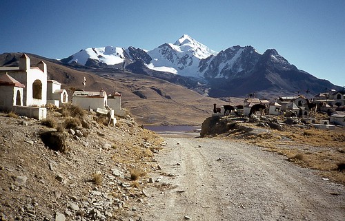
Huayna Potosi by Daniel Biays, Le Huayna Potosí  (6088 m) est une montagne de Bolivie, située à environ 25 km au nord de La Paz dan
Huayna Potosi by Daniel Biays
The Moon Valley (Valle de la Luna) at 3,100 meters (10,170 ft) above sea level, La Paz, Bolivia. by ER's Eyes - Our planet is so beautiful., abnerrovielosantos valedalua themoonvalley lapaz bolivia bolívia thepedrodomingomurilloprovince eros
The Moon Valley (Valle de la Luna) at 3,100 meters (10,170 ft) above sea level, La Paz, Bolivia. by ER's Eyes - Our planet is so beautiful.
The Moon Valley (Valle de la Luna) at 3,100 meters (10,170 ft) above sea level, La Paz, Bolivia. by ER's Eyes - Our planet is so beautiful., valledelaluna valedalua bolívia bolivia lapaz trails trilhas erosão badlands choma sanpedrocactus th
The Moon Valley (Valle de la Luna) at 3,100 meters (10,170 ft) above sea level, La Paz, Bolivia. by ER's Eyes - Our planet is so beautiful.
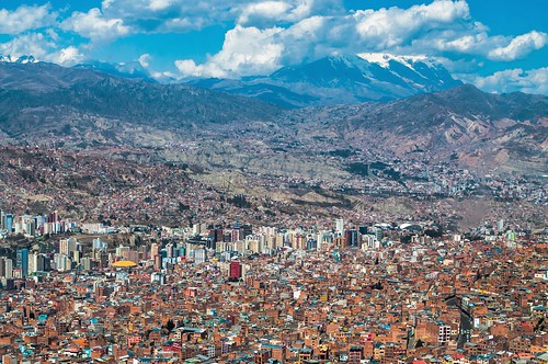
La Paz, Bolivia by David Baggins, Views from the new cable car and its station in El Alto.bolivia cablecar lapaz teleférico
La Paz, Bolivia by David Baggins
The Moon Valley (Valle de la Luna) at 3,100 meters (10,170 ft) above sea level, La Paz, Bolivia. by ER's Eyes - Our planet is so beautiful., valedalua themoonvalley lapaz bolivia bolívia thepedrodomingomurilloprovince erosion mountain montan
The Moon Valley (Valle de la Luna) at 3,100 meters (10,170 ft) above sea level, La Paz, Bolivia. by ER's Eyes - Our planet is so beautiful.
La Paz, Bolivia by David Baggins, Views from the new cable car and its station in El Alto.bolivia cablecar vista lapaz teleférico
La Paz, Bolivia by David Baggins
Within the Canyon Walls 1 La Paz Bolivia South America by In Memoriam Ngaire Hart,  La Paz is built in a canyon created by the Choqueyapu River (now mostly built over), which runs nor
Within the Canyon Walls 1 La Paz Bolivia South America by In Memoriam Ngaire Hart
"Comes a Time" - El Alto - Bolívia by TLMELO, andes bolívia cordillerareal cordilheirareal southamerica américadosul altiplano climb climber mount
"Comes a Time" - El Alto - Bolívia by TLMELO
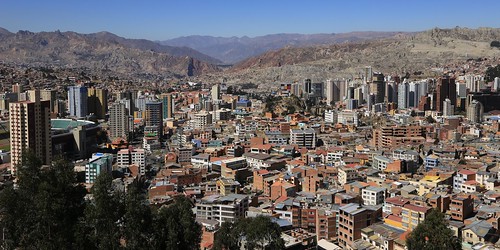
Within the Canyon Walls 2 La Paz Bolivia South America by In Memoriam Ngaire Hart, city travel houses people mountain snow southamerica landscape photography haze community scenery pe
Within the Canyon Walls 2 La Paz Bolivia South America by In Memoriam Ngaire Hart