Elevation of State Highway 96, State Hwy 96, Carthage, MO, USA

Location: United States > Missouri > Jasper County > Marion Township > Carthage >

Longitude: -94.329517

Latitude: 37.1789059

Elevation: 289m / 948feet

Barometric Pressure: 98KPa

Elevation Map:

elevation map of State Highway 96, State Hwy 96, Carthage, MO, USA

Satellite Map:

Satellite map of State Highway 96, State Hwy 96, Carthage, MO, USA

Related Photos:

carterville missouri route66 themotherroad mainstreetusa yesteryear ofdaysgoneby fadingamerica driveintheater driveintheatre theater outdoortheater theatre outdoortheatre 66driveintheatre sigma24105mmf4dgoshsmart
Wide View of Route 66 Drive-In Theatre on Route 66 Between Carterville and Carthage, Missouri
old car sign vintage route66 neon plymouth missouri roadside carthage desoto dealer jaspercounty
DeSoto Plymouth - Route 66, Carthage, Missouri
carthage fuji fuji23mmf14 route66 usa xpro2 blackandwhite bw cafã© street streetphotography travelling urban
Coffee shop, Carthage MO
missouri servicestations us71 abandoned gasstations
Kendricktown Rock Station
preciousmoments equirectangular sambutcher canon815mmfisheye ricohthetas canon500dxtirebel
Canon 500D vs Ricoh Theta S
morning trees sky sun nature sunrise ozarks naturegurl01
golden morning 1
carthage fuji fuji23mmf14 route66 usa xpro2 blackandwhite bw street streetphotography travelling urban
...asses forming, Carthage MO
nikon missouri courthouse carthage d800 jaspercounty jaspercountycourthouse 1424mmf28nikkor ©copyright
Jasper County Courthouse - No. 1
preciousmoments equirectangular carthagemissouri sambutcher ricohtheta ricohthetas canon500dxtirebel
Ricoh Theta S vs Canon 500D
nikon missouri courthouse carthage d800 jaspercounty jaspercountycourthouse 70200mmf28nikkor ©copyright
Jasper County Courthouse - No. 3
nikon missouri courthouse carthage d800 jaspercounty jaspercountycourthouse 1424mmf28nikkor ©copyright
Jasper County Courthouse - No. 2
us166 missouri servicestations abandoned gasstations
Truck Stop- Side View
route66 bridges missouri us66
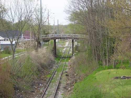
Oak Street Bridge-Side View
route66 bridges missouri us66 us71
BN 66 Bridge-Side View
railroad route66 bridges missouri us66
Carthage Bridge: NB Deck View
railroad route66 bridges missouri us66
Carthage Bridge: Side View
railroad route66 bridges missouri us66
Carthage Bridge: Deck View
scooter missouri moped 50cc joplin gy6 139qmb bigsugard
My 50cc Scooter - Front View
missouri highways roadconstruction
Stack o' Ramps
the main street america” ”the mother road” “la carretera madre” “will rogers highway1 “carretera de will rogers” america calle mayor estados unidos road madre redoakii carthage missouri ruta66 route66 ruta route 66 town usa landscape pano panorama panorámica panoramic
Red Oak II
consolidatedconstructionco ajinomoto windsor joplin missouri mo food processing plant facility
Ajinomoto Windsor - Joplin, MO
the main street america” ”the mother road” “la carretera madre” “will rogers highway1 “carretera de will rogers” america calle mayor estados unidos road madre redoakii carthage missouri ruta66 route66 ruta route 66 town usa landscape pano panorama panorámica panoramic
Red Oak II
the main street america” ”the mother road” “la carretera madre” “will rogers highway1 “carretera de will rogers” america calle mayor estados unidos road madre redoakii carthage missouri ruta66 route66 ruta route 66 town usa landscape pano panorama panorámica panoramic
Red Oak II
square squareformat iphoneography instagramapp uploaded:by=instagram foursquare:venue=4b70598af964a52083142de3
Calm after the storm #iPhoneOnly
the main street america” ”the mother road” “la carretera madre” “will rogers highway1 “carretera de will rogers” america calle mayor estados unidos road madre redoakii carthage missouri ruta66 route66 ruta route 66 town usa landscape pano panorama panorámica panoramic
Red Oak II
the main street america” ”the mother road” “la carretera madre” “will rogers highway1 “carretera de will rogers” america calle mayor estados unidos road madre redoakii carthage missouri ruta66 route66 ruta route 66 town usa landscape pano panorama panorámica panoramic
Red Oak II
the main street america” ”the mother road” “la carretera madre” “will rogers highway1 “carretera de will rogers” america calle mayor estados unidos road madre redoakii carthage missouri ruta66 route66 ruta route 66 town usa landscape pano panorama panorámica panoramic
Red Oak II
the main street america” ”the mother road” “la carretera madre” “will rogers highway1 “carretera de will rogers” america calle mayor estados unidos road madre redoakii carthage missouri ruta66 route66 ruta route 66 town usa landscape pano panorama panorámica panoramic
Red Oak II
the main street america” ”the mother road” “la carretera madre” “will rogers highway1 “carretera de will rogers” america calle mayor estados unidos road madre redoakii carthage missouri ruta66 route66 ruta route 66 town usa landscape pano panorama panorámica panoramic
Red Oak II
auto sunset abandoned car vintage landscape automobile decay country police retro 1940s missouri 1950s kansas abandonment highwaypatrol photographyforrecreation
Forgotten Law
cemeteries cemetery graves missouri tombstones ozarks gravestones 2014 redoak2 redoakii
Red Oak II Cemetery
statue route66 missouri jimsbar jimsplace route66missouri pamschreckcom photographerpamelaschreckengost carthragemissouri ©pamelaschreckengost
Headless Statue
uploaded:by=flickrmobile flickriosapp:filter=nofilter old66driveintheater
Old 66 Drive-in Theater
uploaded:by=flickrmobile flickriosapp:filter=nofilter old66driveintheater
Old 66 Drive-in Theater
cemeteries cemetery graves missouri tombstones ozarks gravestones 2014 redoak2 redoakii
Red Oak II Cemetery
old green classic abandoned truck pickup missouri trucks ozarks pickups redoak2 redoakii missoura redoaktwo
Red Oak II - Missouri
route66 missouri us66
Dead End on 66
travel signs missouri routes roads freeways shields roadscenes expressways 2015okmous400 moroads mohighways
Morgan Heights, MO- MO 96- MO 171 & BL I-49