Elevation of Sprayberry Rd, Monticello, GA, USA
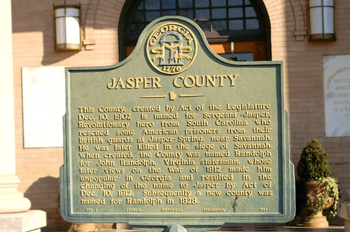
Location: United States > Georgia > Jasper County > Monticello >
Longitude: -83.545630
Latitude: 33.2813381
Elevation: -10000m / -32808feet
Barometric Pressure: 295KPa
Related Photos:
Topographic Map of Sprayberry Rd, Monticello, GA, USA
Find elevation by address:

Places near Sprayberry Rd, Monticello, GA, USA:
1953 Sprayberry Rd
1778 Sprayberry Rd
173 Shady Dale Rd Nw
617 Martin Mill Rd
Linchburg Rd NW, Eatonton, GA, USA
334 Fold S Rd
Goolsby Rd, Monticello, GA, USA
Aikenton Rd, Monticello, GA, USA
Linchburg Rd NW, Eatonton, GA, USA
100 Horton Dr Sw
Cemetery St, Shady Dale, GA, USA
Old Godfrey Hwy, Eatonton, GA, USA
Glades Rd, Eatonton, GA, USA
Eatonton
Eatonton
Eatonton
Eatonton
Eatonton
Eatonton
Eatonton
Recent Searches:
- Elevation of 6 Rue Jules Ferry, Beausoleil, France
- Elevation of Sattva Horizon, 4JC6+G9P, Vinayak Nagar, Kattigenahalli, Bengaluru, Karnataka, India
- Elevation of Great Brook Sports, Gold Star Hwy, Groton, CT, USA
- Elevation of 10 Mountain Laurels Dr, Nashua, NH, USA
- Elevation of 16 Gilboa Ln, Nashua, NH, USA
- Elevation of Laurel Rd, Townsend, TN, USA
- Elevation of 3 Nestling Wood Dr, Long Valley, NJ, USA
- Elevation of Ilungu, Tanzania
- Elevation of Yellow Springs Road, Yellow Springs Rd, Chester Springs, PA, USA
- Elevation of Rēzekne Municipality, Latvia


