Elevation of Slot Canyon Trail, CA-78, Borrego Springs, CA, USA

Location: United States > California > San Diego County > Borrego Springs >

Longitude: -116.21410

Latitude: 33.1819825

Elevation: -10000m / -32808feet

Barometric Pressure: 295KPa

Elevation Map:

elevation map of Slot Canyon Trail, CA-78, Borrego Springs, CA, USA

Satellite Map:

Satellite map of Slot Canyon Trail, CA-78, Borrego Springs, CA, USA

Related Photos:

borregosprings california jupiter lll milkyway galaxy lightpollution stars unitedstatesofamerica
Jupiter, Stars and Ocotillo 9450
anzaborregodesert desert california sunset goldenhour sidelight golden badlands twilight goldenstate gold summer cool
How strange that nature does not knock, and yet does not intrude!
california view unitedstates canyon vista badlands anzaborrego anzaborregodesertstatepark fontspoint
Font's Point with a Dust Storm
borregosprings california unitedstatesofamerica
Snow Capped Mountains In the Background and Desert Landscape In the Foreground.
california unitedstates
Camping under the Milky Way. Fisheye view.
california sunset sky terrain cliff west film sign clouds analog america point landscape high desert kodak large dry bluesky canyon ishootfilm pinkfloyd american vista borrego americana 4x5 sheet format 100 analogue badlands anzaborrego f56 elevation overlook sonoran fonts fujinon arid largeformat rugged sonorandesert saltonsea emulsion promontory anza borregosprings ektar fotoman imperialvalley 150mm learningtofly sheetfilm eyetwist theicon fontspoint 45ps ishootkodak fotoman45ps kodakektar100 epsonv750pro recentlyprocessedfilm filmexif filmtagger fujinonw150mmf56 eyetwistkevinballuff americantypologies
learning to fly. anza-borrego desert, ca. 2015.
borregosprings california unitedstatesofamerica fineart abstractart abstract texture textures fractal fractalpatterns repeatingpatterns nature natural drone dji djiglobal djimavicpro2 mavic mavicpro mavicpro2 aerialview aerialphotography dronephotography dronephoto veins earth texturephotography abstractartist hasselblad
Ice Veins
anzaborrego anzaborregodesertstatepark rocket launch elonmusk spacex colorful sky desert ocotillo
SpaceX Falcon 9 Launch as seen from the Anza-Borrego Desert on October 7, 2018
borregosprings california unitedstatesofamerica ocotillo desert mountains snow weather anzaborrego anzaborregodesertstatepark
Snow Capped Mountains In the Background and Desert Landscape In the Foreground.
california wild color detail macro nature closeup outdoors flora desert native bluesky socal exploration discovery perennial ocotillo brightgreen sandiegocounty desertflora fouquieriaceae anzaborregodesertstatepark fouquieriasplendens desertscape leafingout notacactus outinthewild yaquipass zoniedude1 earthnaturelife desertgreenery canonpowershotg12 pronouncedokoteeo pspx8 desertspring2016 1760ftelevation
Desert Greenery
anzaborrego anzaborregodesertstatepark rocket launch elonmusk spacex colorful sky desert ocotillo
SpaceX Falcon 9 Launch as seen from the Anza-Borrego Desert on October 7, 2018
california statepark pink winter sunset red orange yellow evening colorful desert southern borrego badlands february sandiegocounty anzaborregodesert fontspoint kevinpalmer tamron1750mmf28 pentaxk5
Badlands to Lagunas
california ngc npc anzaborrego southerncalifornia californiadesert phainopepla anzaborregodesertstatepark phainopeplanitens californiabirds desertbirds capulineronegro capulinero photobypeterwendelken peterwendelken tamariskgrovecampground phainopeplaphoto phainopeplamale phainopeplamaleincalifornia machodecapulineronegro
PHAINOPEPLA Male Phainopepla nitens in Thorny Shrub in Anza-Borrego Desert State Park, California. Photo by Peter Wendelken
anzaborrego borrego desert spider camouflage
Desert Harvestmen
horizon fontspoint badlands elevated outlook vista bluesky wideangle eyetwist desert lonely arid landsacape nature sand california californiadesert imperialvalley saltonsea desolate empty nikon n90s kodak tmax 100 tmx scansfromthearchives lonelydesert paradiselost 2000 35mm analog analogue nikonn90s kodaktmax100tmx inland ishootfilm rusty crusty filmtagger nikon4000 filmexif bw blackwhite anzaborregodesert rugged ravine canyons weathered eroded ishootkodak black white landscape american west film
font's point. anza-borrego desert, ca. 2000.
fontspoint font point landscape fonts badlands elevated outlook vista bluesky wideangle eyetwist desert lonely arid landsacape nature sand california californiadesert imperialvalley saltonsea desolate empty inland ishootfilm ishootfuji fujichrome velvia rvp nikon n90s scansfromthearchives 2000 barren horizonline american west film analog 35mm
font's point. anza-borrego desert, ca. 2000.
geotagged desert anzaborrego geo:lat=332567494838709 geo:lon=116233034
View from Font's Point in the Anza-Borrego Desert. Take 3.
geotagged desert anzaborrego geo:lat=332568426666668 geo:lon=116233054466667
View from Font's Point in the Anza-Borrego Desert
geotagged desert anzaborrego geo:lat=33256908 geo:lon=116233038709677
View from Font's Point in the Anza-Borrego Desert. Take 2.
longearedowl longearedowlincalifornia owl buhocornudocaricafé buho asiootus asio strigidae californiaowls californiabirds aves californiadesert anzaborregodesertstatepark california photobypeterwendelken peterwendelken ngc coth coth5
LONG-EARED OWL Asio otus in Early Morning Sun at Anza-Borrego Desert State Park, California. Photo by Peter Wendelken.
california desert californiastateparks fontspoint anzaborrego anzaborregodesertstatepark view badlands vista viewpoint
View of the Badlands From Fonts Point
albertwirtz anzaborregobadlands california kalifornien badlands landscape canyon mountains goldenhour goldenestunde paesaggi paysages usa unitedstates vereinigtestaaten us westernusa southwestusa fontspoint statepark anzaborregostatepark erosion anzaborregodesertstatepark desert desertedlandscape wüstenlandschaft wüste natur nature natura juanbautistadeanza bighornsheep borregosprings paloverdewash borregovalley sandiego
*Anza Borrego Desert State Park*
zajdowicz california usa travel canon eos 5dmarkiii dslr digital availablelight lightroom ef24105mmf4lisusm borregosprings nature color sky clouds palms trees plants flora blue green colour outside outdoors desert landscape
Desert Sky
anzaborrego anzaborregostatepark wildflower wildflowers borregosprings california unitedstates us
Sunrise, Anza-Borrego 2420
california statepark sunset socal anzaborrego fontspoint
Opportunities are like sunrises. If you wait too long, you miss them...
california park morning travel copyright usa canon palms landscape photography golden early photo unitedstates state hour 17 anzaborrego february seventeen borregosprings 2011 5dmarkii caliparks
Seventeen Palms
sony a7ii 35mm zeiss anzaborregodesert borregomountain goldenhour
Old Ocean
mexico desert sandiego badlands southerncalifornia anzaborregodesert fontspoint startepark
We live in a bewildering world…
Green Ocotillos
california unitedstates desert pumpkinpatch thermal milkyway ocotillowells
Test shot of the Milky Way over the Pumpkin Patch
Sky's on Fire
borregosprings california unitedstates us anzaborrego anzaborregodesertstatepark silhouette camper rv trailer camping campsite desert sandiego sunset orange red sky clouds
Sunday sunset silhouette in the Anza-Borrego Desert
california park sunset copyright usa jeff nature canon landscape photography march desert state photos southern borrego sullivan anza borregosprings 2011 5dmarkii caliparks
Blue Hour Meets Sunset in Anza Borrego
california view unitedstates canyon vista badlands anzaborrego fonts anzaborregodesertstatepark fontspoint
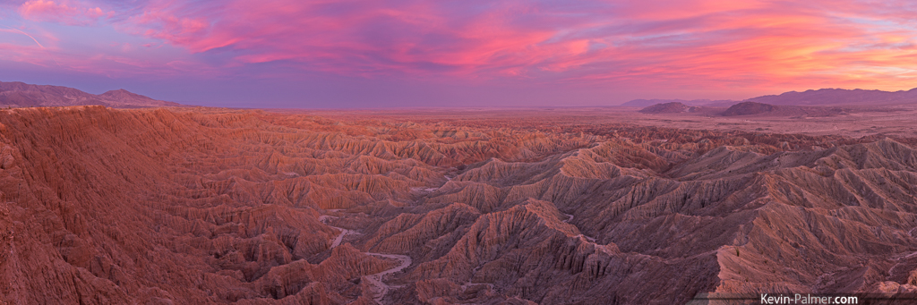
Panorama of the View from Font's Point
california statepark pink winter sunset red panorama orange yellow evening colorful desert southern borrego badlands february sandiegocounty anzaborregodesert fontspoint kevinpalmer tamron1750mmf28 pentaxk5
Borrego Badlands Sunset