Elevation of S Battlefield Blvd, Chesapeake, VA, USA
Location: United States > Virginia > Chesapeake > Pleasant Grove East >
Longitude: -76.202726
Latitude: 36.58986
Elevation: 4m / 13feet
Barometric Pressure: 101KPa
Elevation Map:
Satellite Map:
Related Photos:

Sunset at Munden Point

Orion Nebula

Infinite View

Rite Aid

365/365

Chesapeake Senior Portrait - Katie I.

Not So Living Room

A Sight for Sore Feet

Chesapeake Expressway, Chesapeake, Virginia en route to Outer Banks, North Carolina

Chesapeake Expressway Bridge

Chesapeake Expressway, Chesapeake, Virginia en route to Outer Banks, North Carolina

Chesapeake Expressway, Chesapeake, Virginia en route to Outer Banks, North Carolina
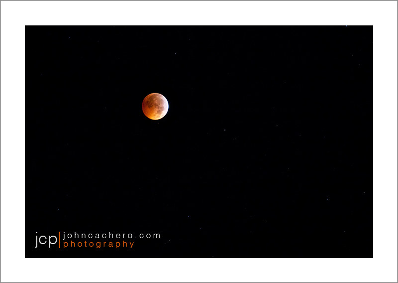
Winter Solstice Lunar Eclipse - Chesapeake, Virginia - December 21, 2010 - 2:55am

Chesapeake Expressway, Chesapeake, Virginia en route to Hampton Roads, Virginia

Infinite View Warp Speed

Chesapeake Expressway, Chesapeake, Virginia en route to Outer Banks, North Carolina

Infinite View Reference Image

Anhinga - Virginia - IMG_4556

Good Hygiene

Master's Bedroom

Mattress City

Stormy Weather - 2/7/2020

51. Crossing A Bridge

46 of 365

Blackwater 025

Pungo Ferry Landing Park

Old barn

McDonald's interior

Virginia Skies

DSC_0041-Edit

Abandoned House on the Dismal Swamp Canal Trail

Swamp in Chesapeake

Last Days of Summer

z2013-09-11 (22) Currituck County NC

HRStock Drone (663 of 776)

Sunset on the baseball field
Topographic Map of S Battlefield Blvd, Chesapeake, VA, USA
Find elevation by address:

Places near S Battlefield Blvd, Chesapeake, VA, USA:
127 Hickory Ridge Rd
Pleasant Grove East
1324 Sanderson Rd
244 Hickory Rd E
1933 Ballahack Rd
1408 Beaver Dam Rd
Hickory High School
700 Beaver Dam Rd
2607 St Brides Rd W
Thistley Lane
Hillcrest Parkway
1344 Benefit Rd
613 Water Oak Ct
Great Bridge East
324 Scone Castle Loop
Balmoral Lane
1508 Balmoral Lane
1824 Land Of Promise Rd
424 Woodards Ford Rd
Cheltingham Ct, Chesapeake, VA, USA
Recent Searches:
- Elevation of AMELIA CT HSE, VA, USA
- Elevation of Abbey Dr, Virginia Beach, VA, USA
- Elevation of Brooks Lp, Spearfish, SD, USA
- Elevation of Panther Dr, Maggie Valley, NC, USA
- Elevation of Jais St - Wadi Shehah - Ras al Khaimah - United Arab Emirates
- Elevation of Shawnee Avenue, Shawnee Ave, Easton, PA, USA
- Elevation of Scenic Shore Dr, Kingwood Area, TX, USA
- Elevation of W Prive Cir, Delray Beach, FL, USA
- Elevation of S Layton Cir W, Layton, UT, USA
- Elevation of F36W+3M, Mussoorie, Uttarakhand, India