Elevation of Redden Rd, Bridgeville, DE, USA
Location: United States > Delaware > Sussex County > Bridgeville >
Longitude: -75.540497
Latitude: 38.7511355
Elevation: 12m / 39feet
Barometric Pressure: 101KPa
Elevation Map:
Satellite Map:
Related Photos:

Mexican Folk Dancers

Abbott's Mill Pond

2017 08-03 0913 DCR MP15N-1563, 1560 SE-1, Seaford, DE

2017 08-03 0955 DCR MP15N-1563 SE-1, Seaford, DE

Building Along the Nanticoke River

2017 08-03 1619 Tug-Capt Johnny, Seaford, DE

Courthouse, Georgetown, Delaware

Georgetown Fire Co., Station 77

No Trespassing

Abbotts Pond - Christmas Eve 2010

Dance of the Old Men

Dance of the Old Men

Abbotts Pond - Christmas Eve 2010

Abandoned Diner in Delaware along US-13

Front view, "Academy and Masonic Hall"

Abandoned DE Diner- rear view

Rear view, "Academy and Masonic Hall"
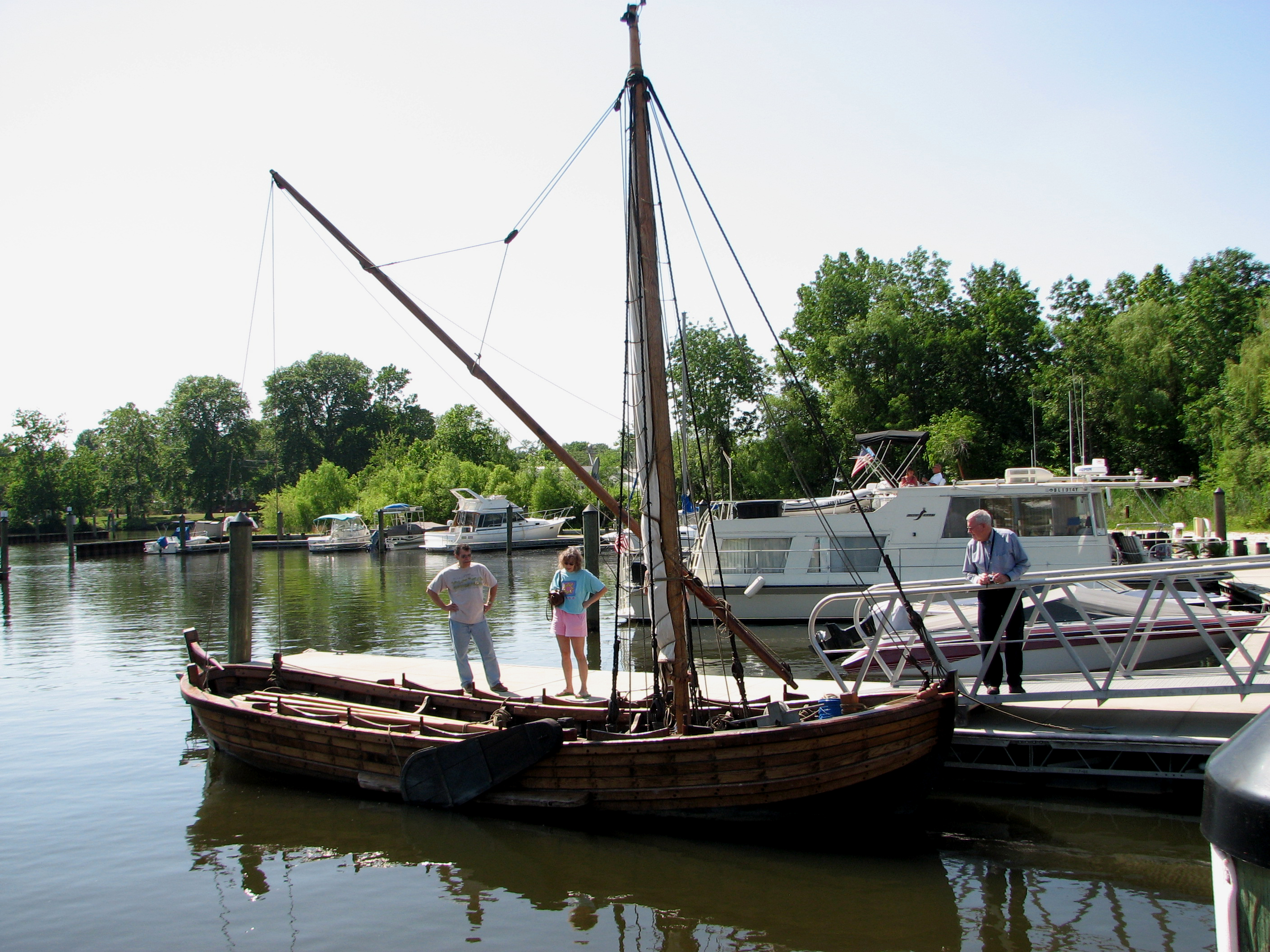
Replica of Captain John Smith's shallop

Tarpaulins partway got blew down by Delmarva fierce windstorm, & now the weird secrets of the little fenced-in area are all out & unenshrouded where people can see.

Captain John Smith's Replica Crew

Ongoing progress of thorny thicket formation.

A view upon "Inland Delmarva" on a mostly cloudy January day.

Good morning Sussex County ???? Day 66/365

Courthouse....
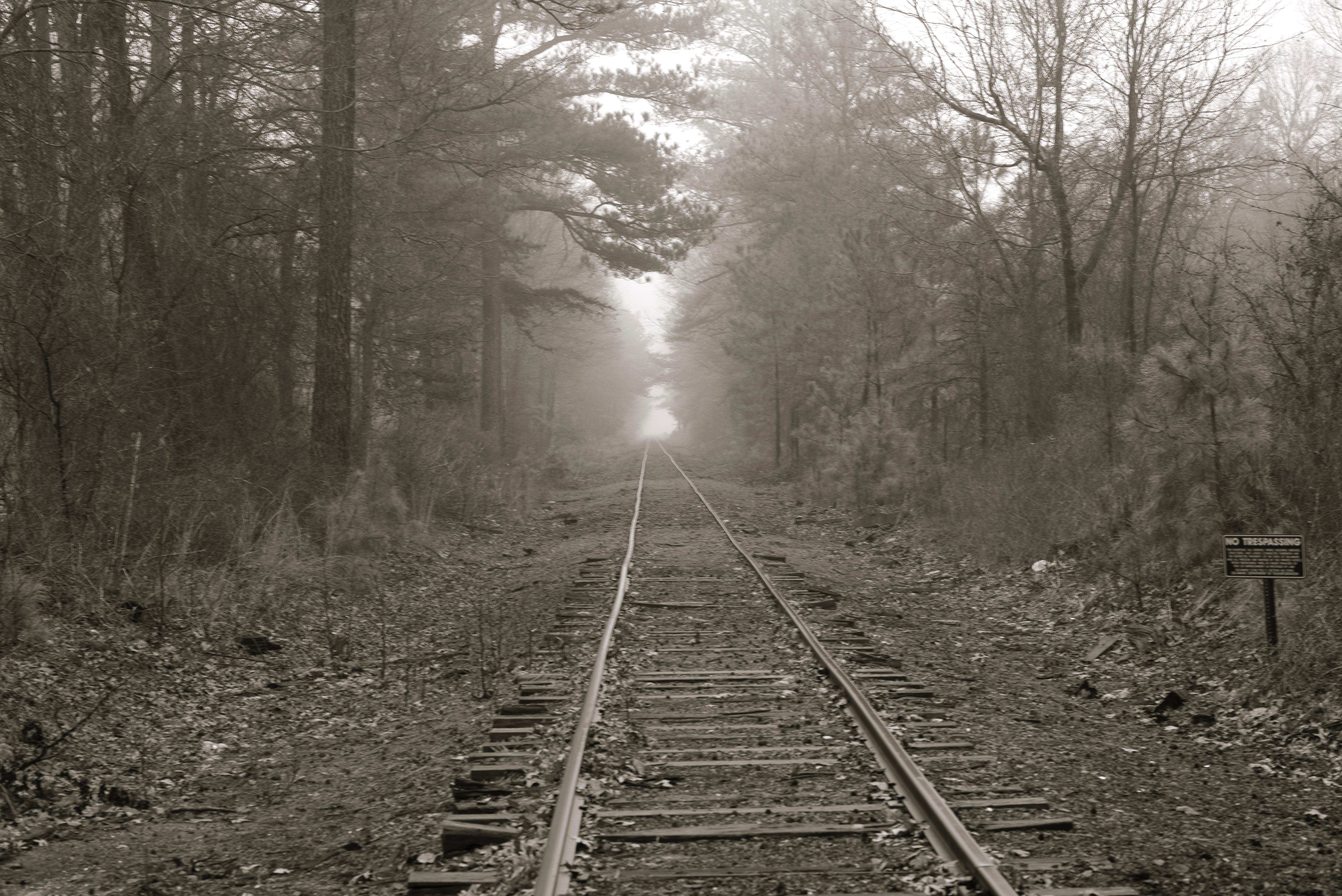
Into the Fog

Field and Buses

Fields, Bridgeville, Delaware

Fields, Bridgeville, Delaware

Fields, U.S. 13, Bridgeville, Delaware

IMG_0782 Dickcissel

Crop Duster 5

Winter Wren

Day 220 Hotel pond

Abbott's Mill- Sussex County DE (7)

Crop Duster 6

rt. 13

dock 2

Wood Thrush

on the borderline
Topographic Map of Redden Rd, Bridgeville, DE, USA
Find elevation by address:

Places near Redden Rd, Bridgeville, DE, USA:
Seashore Hwy, Bridgeville, DE, USA
Collins Pond Rd E, Georgetown, DE, USA
Owens Rd, Greenwood, DE, USA
Mill Park Dr, Bridgeville, DE, USA
11872 Shawnee Rd
Redden Rd, Georgetown, DE, USA
E Robbins Rd, Georgetown, DE, USA
E Redden Rd, Georgetown, DE, USA
Ellendale
Fleatown Rd, Ellendale, DE, USA
21315 Berlin Rd
Reynolds Pond Rd, Ellendale, DE, USA
W North St, Georgetown, DE, USA
310 W Market St
Georgetown
Laurel St Ext, Georgetown, DE, USA
19 Clover Dr
21460 Park Ave
Park Ave, Georgetown, DE, USA
17885 Loblolly Way
Recent Searches:
- Elevation of Bella Terra Blvd, Estero, FL, USA
- Elevation of Estates Loop, Priest River, ID, USA
- Elevation of Woodland Oak Pl, Thousand Oaks, CA, USA
- Elevation of Brownsdale Rd, Renfrew, PA, USA
- Elevation of Corcoran Ln, Suffolk, VA, USA
- Elevation of Mamala II, Sariaya, Quezon, Philippines
- Elevation of Sarangdanda, Nepal
- Elevation of 7 Waterfall Way, Tomball, TX, USA
- Elevation of SW 57th Ave, Portland, OR, USA
- Elevation of Crocker Dr, Vacaville, CA, USA