Elevation of Pearsonville Rd, Pearsonville, NB E5P 1S5, Canada
Location: Canada > New Brunswick > Kings County > Studholm > Pearsonville >
Longitude: -65.712488
Latitude: 45.8074589
Elevation: 178m / 584feet
Barometric Pressure: 99KPa
Elevation Map:
Satellite Map:
Related Photos:

Ant's Eye View
ColesIsland_Panorama_01
WheatField_Panorama5
WheatField_Panorama6
WheatField_Panorama1
WheatField_Panorama7
100_1422
WheatField_Panorama4

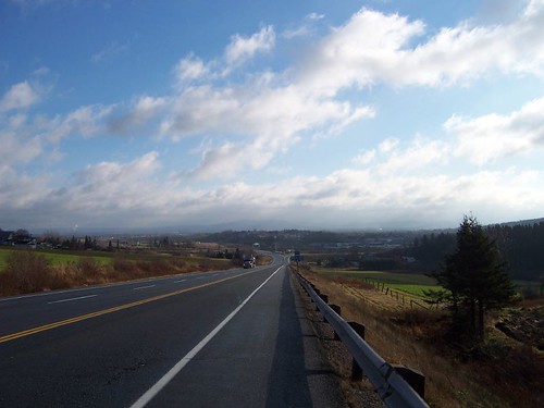
Pretty sky between Sussex and Saint John.

Mary ann

"morning #3"
By the river
Sunlight beauty

Nathan June 21 2009 0059
Almost There
Topographic Map of Pearsonville Rd, Pearsonville, NB E5P 1S5, Canada
Find elevation by address:

Places near Pearsonville Rd, Pearsonville, NB E5P 1S5, Canada:
Pearsonville
Kierstead Mountain
880 Nb-870
New Brunswick 870
156 Chittick Rd
NB-, Belleisle Creek, NB E5P 1G8, Canada
Snider Mountain
Harmer Road
Pleasant Ridge
Pleasant Ridge Rd, Pleasant Ridge, NB E5P 2A8, Canada
Berwick
NB-, Summerfield, NB E4G 2L1, Canada
Summerfield
Studholm
41 McGregor Brook Rd, Roachville, NB E4G 2G1, Canada
91 Queen St
87 Queen St
89 Queen St
83 Queen St
81 Queen St
Recent Searches:
- Elevation of Vista Blvd, Sparks, NV, USA
- Elevation of 15th Ave SE, St. Petersburg, FL, USA
- Elevation of Beall Road, Beall Rd, Florida, USA
- Elevation of Leguwa, Nepal
- Elevation of County Rd, Enterprise, AL, USA
- Elevation of Kolchuginsky District, Vladimir Oblast, Russia
- Elevation of Shustino, Vladimir Oblast, Russia
- Elevation of Lampiasi St, Sarasota, FL, USA
- Elevation of Elwyn Dr, Roanoke Rapids, NC, USA
- Elevation of Congressional Dr, Stevensville, MD, USA