Elevation of Nusatsum Mountain, Central Coast C, BC V0T, Canada
Location: Canada > British Columbia > Central Coast > Central Coast C >
Longitude: -126.37833
Latitude: 52.3983333
Elevation: 2349m / 7707feet
Barometric Pressure: 76KPa
Elevation Map:
Satellite Map:
Related Photos:
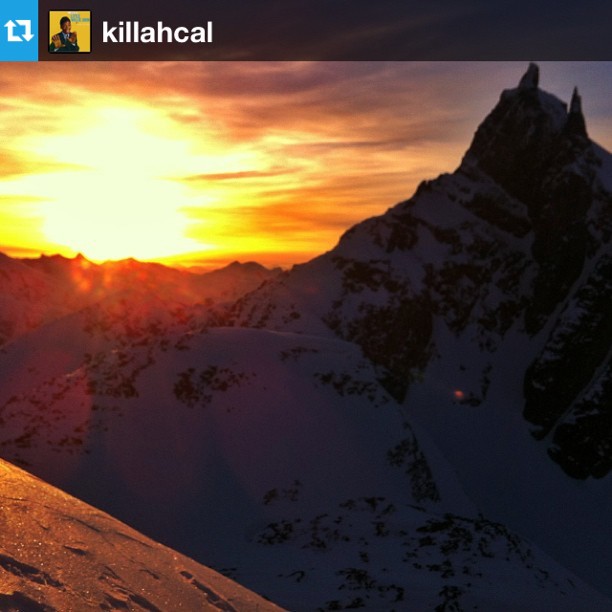
Another view of the Sherpas base camp at sunset from Callum Petit #Repost from @killahcal
Topographic Map of Nusatsum Mountain, Central Coast C, BC V0T, Canada
Find elevation by address:

Places near Nusatsum Mountain, Central Coast C, BC V0T, Canada:
Thunder Mountain
The Horn
Hagensborg
Stupendous Mountain
Afon Talchako
Snowside Mountain
Tweedsmuir Park Lodge
Stuie
Ape Lake
Tweedsmuir South Provincial Park
Talchako Mountain
Central Coast C
Ape Creek
Talchako R
Mount Ada
Recent Searches:
- Elevation of Corso Fratelli Cairoli, 35, Macerata MC, Italy
- Elevation of Tallevast Rd, Sarasota, FL, USA
- Elevation of 4th St E, Sonoma, CA, USA
- Elevation of Black Hollow Rd, Pennsdale, PA, USA
- Elevation of Oakland Ave, Williamsport, PA, USA
- Elevation of Pedrógão Grande, Portugal
- Elevation of Klee Dr, Martinsburg, WV, USA
- Elevation of Via Roma, Pieranica CR, Italy
- Elevation of Tavkvetili Mountain, Georgia
- Elevation of Hartfords Bluff Cir, Mt Pleasant, SC, USA