Elevation of Lime Ridge, Montana, USA
Location: United States > Montana > Augusta >
Longitude: -112.6891666
Latitude: 47.5083333
Elevation: 2234m / 7329feet
Barometric Pressure: 0KPa
Related Photos:
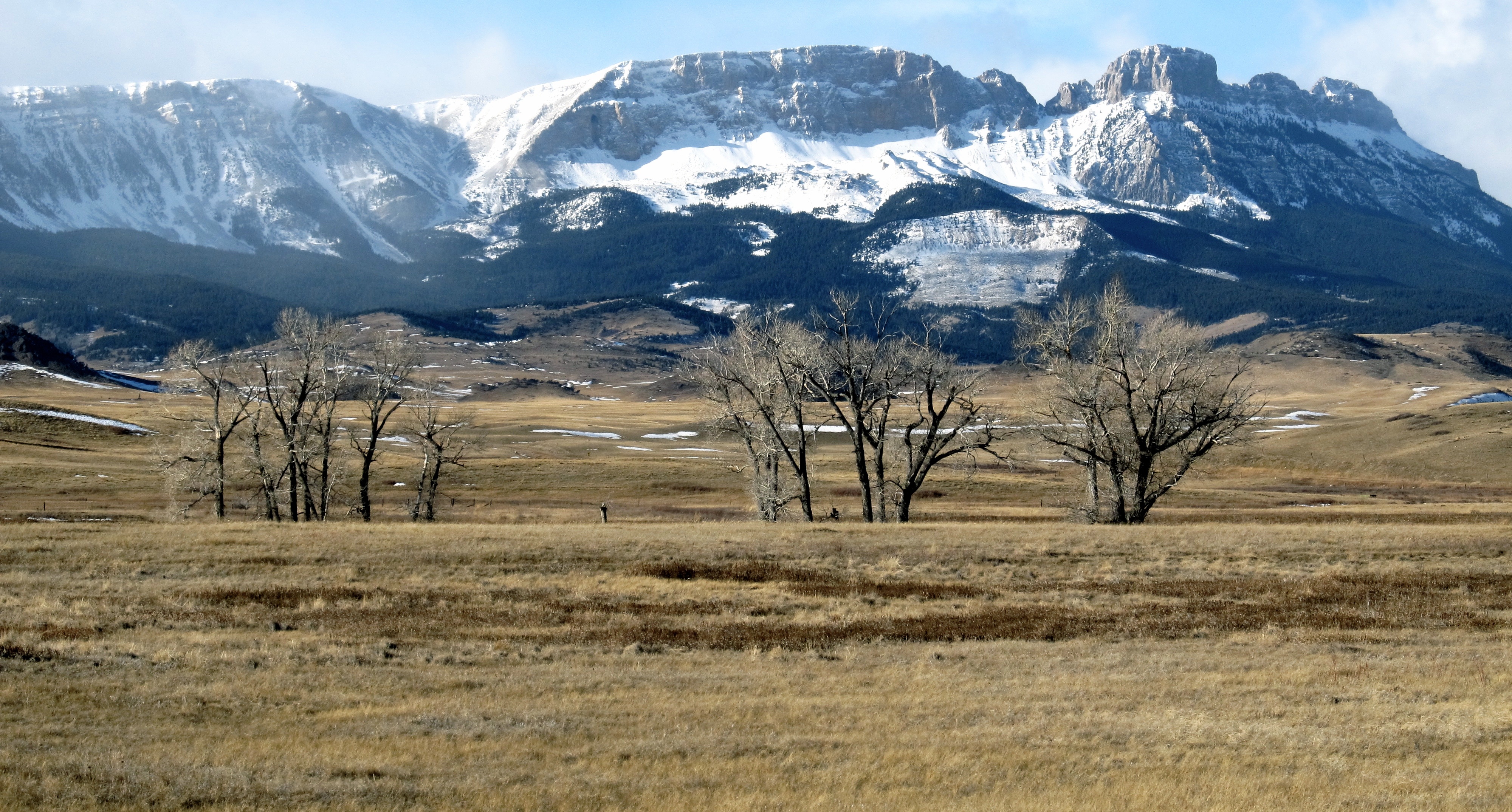
Rocky Mountain Front. Montana
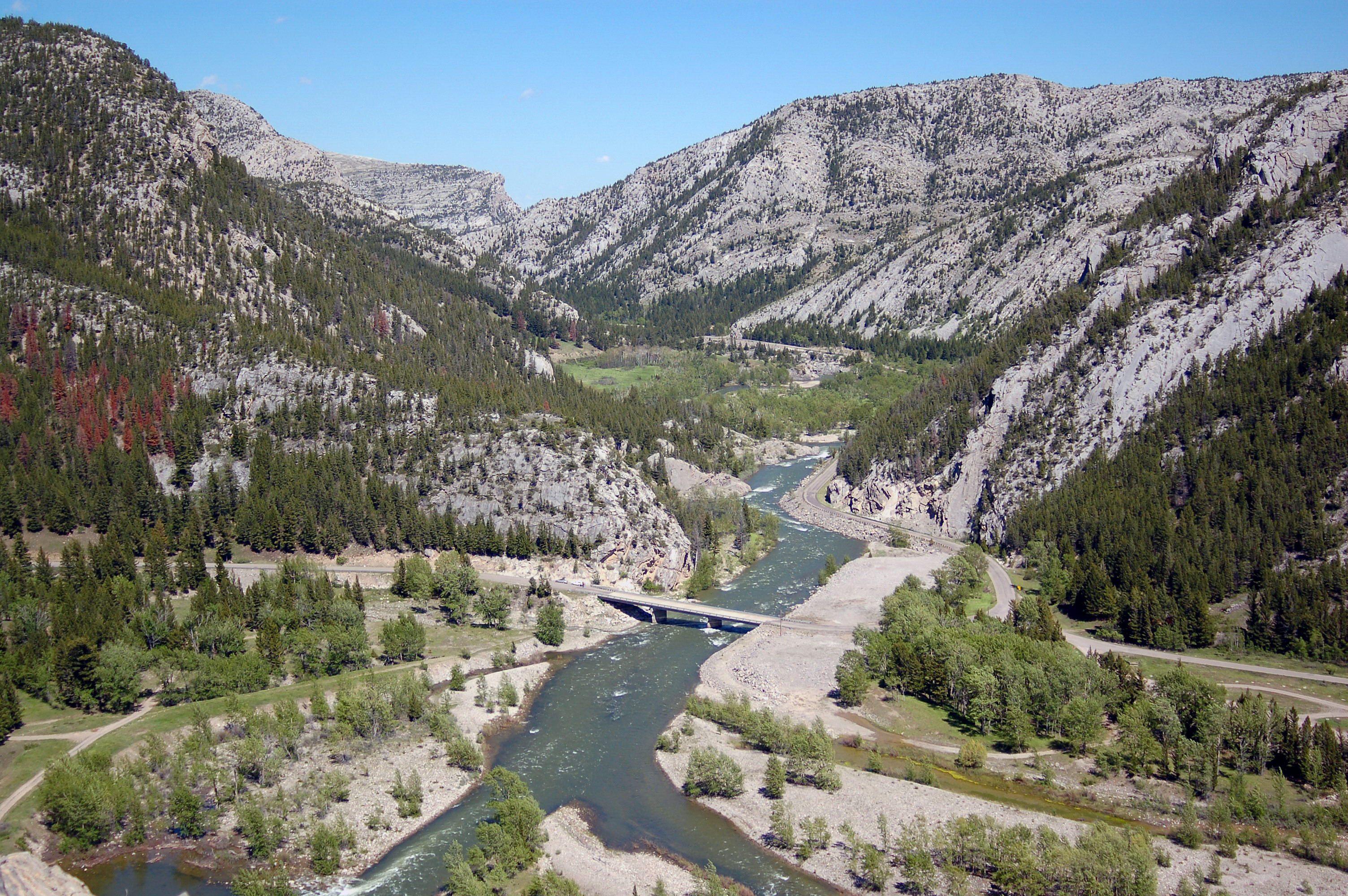
Sun River Canyon
Topographic Map of Lime Ridge, Montana, USA
Find elevation by address:

Places near Lime Ridge, Montana, USA:
Mccarty Hill
Sawtooth Ridge South
Sawtooth Ridge
Fairview Mountain
Cyanide Mountain
Allan Mountain
Renshaw Mountain
Crown Mountain
Gibson Reservoir
Castle Reef
Wood Creek Hogback
Halfmoon Peak
Steamboat Mountain
Grass Hill
Arsenic Mountain
Cigarette Rock
Sheep Reef
Grassy Hills Hp
Steamboat Mountain East
Sugarloaf Mountain
Recent Searches:
- Elevation map of Greenland, Greenland
- Elevation of Sullivan Hill, New York, New York, 10002, USA
- Elevation of Morehead Road, Withrow Downs, Charlotte, Mecklenburg County, North Carolina, 28262, USA
- Elevation of 2800, Morehead Road, Withrow Downs, Charlotte, Mecklenburg County, North Carolina, 28262, USA
- Elevation of Yangbi Yi Autonomous County, Yunnan, China
- Elevation of Pingpo, Yangbi Yi Autonomous County, Yunnan, China
- Elevation of Mount Malong, Pingpo, Yangbi Yi Autonomous County, Yunnan, China
- Elevation map of Yongping County, Yunnan, China
- Elevation of North 8th Street, Palatka, Putnam County, Florida, 32177, USA
- Elevation of 107, Big Apple Road, East Palatka, Putnam County, Florida, 32131, USA
- Elevation of Jiezi, Chongzhou City, Sichuan, China
- Elevation of Chongzhou City, Sichuan, China
- Elevation of Huaiyuan, Chongzhou City, Sichuan, China
- Elevation of Qingxia, Chengdu, Sichuan, China
- Elevation of Corso Fratelli Cairoli, 35, Macerata MC, Italy
- Elevation of Tallevast Rd, Sarasota, FL, USA
- Elevation of 4th St E, Sonoma, CA, USA
- Elevation of Black Hollow Rd, Pennsdale, PA, USA
- Elevation of Oakland Ave, Williamsport, PA, USA
- Elevation of Pedrógão Grande, Portugal