Elevation of Kvinesdal, Norway
Location: Norway > Vest-agder >
Longitude: 6.9785061
Latitude: 58.52508
Elevation: 333m / 1093feet
Barometric Pressure: 97KPa
Elevation Map:
Satellite Map:
Related Photos:

På vei til SIrdal kommune

På vei til SIrdal kommune

Unknown place #212

Tower from Knaben
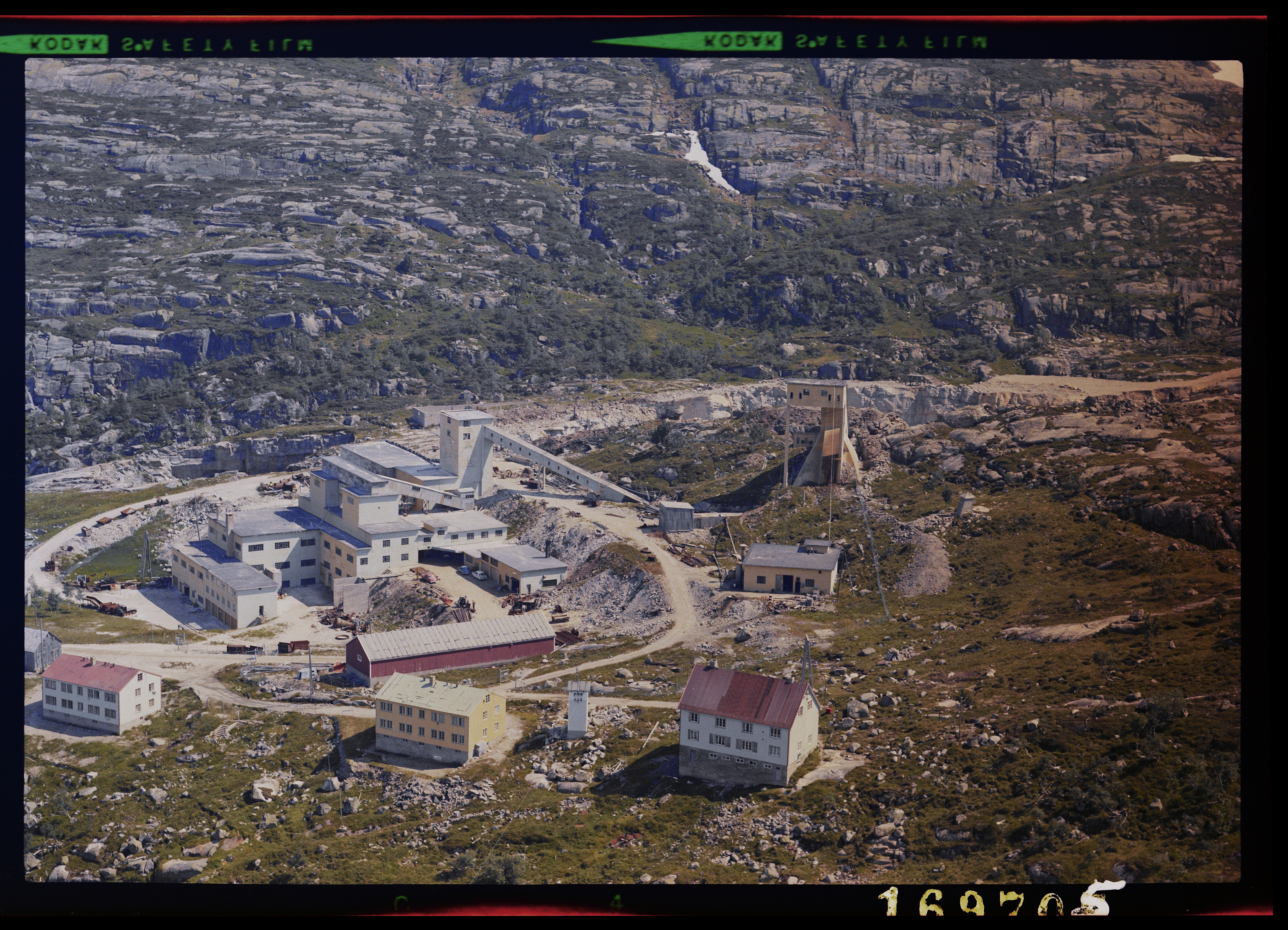
169705 Knaben gruver

Anser anser
Topographic Map of Kvinesdal, Norway
Find elevation by address:

Places in Kvinesdal, Norway:
Places near Kvinesdal, Norway:
Fjotland
Kvinlog
Vest-agder
Tonstad
Fv, Feda, Norway
Fv, Farsund, Norway
Fv 50, Farsund, Norway
Sirdal
Fv, Lyngdal, Norway
Flekkefjord
Grønnes 38, Flekkefjord, Norway
Sinnes
Sinnes
Rv 50, Farsund, Norway
Sæveland Ytre
Fv, Vanse, Norway
Rv 11, Farsund, Norway
Ellenes
Loshavnveien, Farsund, Norway
Broneskogen, Korshamn, Norway
Recent Searches:
- Elevation of Laurel Rd, Townsend, TN, USA
- Elevation of 3 Nestling Wood Dr, Long Valley, NJ, USA
- Elevation of Ilungu, Tanzania
- Elevation of Yellow Springs Road, Yellow Springs Rd, Chester Springs, PA, USA
- Elevation of Rēzekne Municipality, Latvia
- Elevation of Plikpūrmaļi, Vērēmi Parish, Rēzekne Municipality, LV-, Latvia
- Elevation of 2 Henschke Ct, Caboolture QLD, Australia
- Elevation of Redondo Ave, Long Beach, CA, USA
- Elevation of Sadovaya Ulitsa, 20, Rezh, Sverdlovskaya oblast', Russia
- Elevation of Ulitsa Kalinina, 79, Rezh, Sverdlovskaya oblast', Russia