Elevation of Fairview Mountain, New Mexico, USA
Location: United States > New Mexico > Sierra County >
Longitude: -106.52639
Latitude: 33.4650739
Elevation: 1918m / 6293feet
Barometric Pressure: 80KPa
Elevation Map:
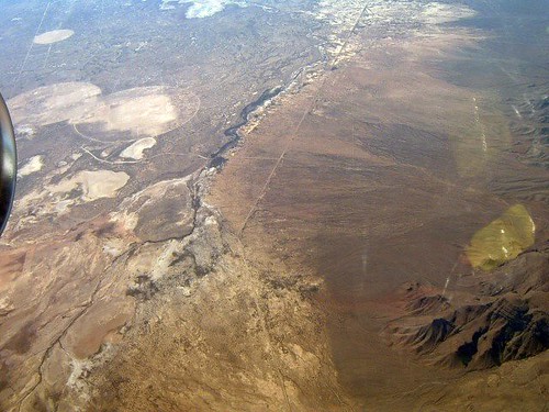
Satellite Map:
Related Photos:
White Sands Missile Testing Court

Pronghorn in NM

stuck out here someplace among the collapsing stars
Topographic Map of Fairview Mountain, New Mexico, USA
Find elevation by address:

Places near Fairview Mountain, New Mexico, USA:
Mockingbird Mountains Hp
Unnamed Road
Capitol Peak
Silver Top Mountain
Sheep Mountain East
Sheep Mountain West
Little Burro Mountains Hp
Salinas Peak
Middle Peak
Ladybug Peak
Mcdonald Ranch House
Trinity Site
Mount Baldy
Oscura Peak
Skillet Knob
Big Gyp Mountain
Granddaddy Peak
Hardscrabble Mountains Hp
Black Top Mountain
Loma Vista
Recent Searches:
- Elevation of Corso Fratelli Cairoli, 35, Macerata MC, Italy
- Elevation of Tallevast Rd, Sarasota, FL, USA
- Elevation of 4th St E, Sonoma, CA, USA
- Elevation of Black Hollow Rd, Pennsdale, PA, USA
- Elevation of Oakland Ave, Williamsport, PA, USA
- Elevation of Pedrógão Grande, Portugal
- Elevation of Klee Dr, Martinsburg, WV, USA
- Elevation of Via Roma, Pieranica CR, Italy
- Elevation of Tavkvetili Mountain, Georgia
- Elevation of Hartfords Bluff Cir, Mt Pleasant, SC, USA