Elevation of Blasdel Dr, Lawrenceburg, IN, USA

Location: United States > Indiana > Dearborn County > Miller Township > Bright >

Longitude: -84.862439

Latitude: 39.2123343

Elevation: -10000m / -32808feet

Barometric Pressure: 295KPa

Elevation Map:

elevation map of Blasdel Dr, Lawrenceburg, IN, USA

Satellite Map:

Satellite map of Blasdel Dr, Lawrenceburg, IN, USA

Related Photos:

reflections pond indiana oldtown lawrenceburgindiana nikond700 oxbowconversancy
Oxbow Nature Conservancy, Lawrenceburg, Indiana
broken accident snowboard bones bone wrist fracture radius ulna
lateral xray of wrist
dearborncounty indiana lawrenceburg oxbow turtle hieroglyphicrivercooterturtle
HIEROGLYPHIC RIVER COOTER TURTLE
panorama indiana oxbow doublecrestedcormorant phalacrocoraxauritus 500mmf4 canoneos1dmarkiii
DOUBLE-CRESTED CORMORANTS - PANORAMA
moon harrison luna fullmoon jupiter harrisonohio frostymoon
Frosty Moon & Jupiter
morning sunlight fog sunrise river nikon hiking kentucky cincinnati ohioriver bmc cincinnatiohio shawneelookout hamiltoncountyparks hamiltoncountyparkdistrict nikond7000 nikkor1024mm
Sunday Morning Sunrise
adult baldeagle indiana haliaeetusleucocephalus lawrenceburg oxbow junopond
BALD EAGLES
prothonotarywarbler oxbow lawrenceburg indiana dearborncounty ias
PROTHONOTARY WARBLER
longexposure water fog river nikon kentucky ohioriver bmc bwnd110 shawneelookout hamiltoncountyparks hamiltoncountyparkdistrict nikond7000 nikkor1024mm
Sunrise on the river
ohio harrison scissortailedflycatcher tyrannusforficatus hamiltoncountyparks kilbyroadponds
SCISSOR-TAILED FLYCATCHER
square squareformat iphoneography instagramapp xproii uploaded:by=instagram foursquare:venue=4b5b3580f964a52051eb28e3
Yeah... So this is now the view of my work computer. Grrrrrrr.. My 2 week old hard drive has to be rebuilt??? Really? And to think I coulda been home doing all kinds of things. Happy Freakin' Monday!
color lines pipe perspective tunnel through circular lightattheend
Light at the end of the tunnel
redneckedphalarope video lostbridge elizabethtown ohio phalaropuslobatus
RED-NECKED PHALAROPE at LOST BRIDGE, SEPTEMBER 1, 2012
powerplant shawneelookout industrialclouds
Industrial Clouds
longexposure sky stars star bluehour startrails northstar manualmode startracking
Early AM Star Trails
ohio church window night festive season harrison stainedglass backlit decorated
Festive church
blackandwhite usa tree stone architecture indiana vernacular ladder lawrenceburg nikond40x
Old Farm Building IV
broken accident snowboard bones bone wrist fracture radius ulna
not so straight
ohio elizabethtown tundraswan cygnuscolumbianus lostbridge southskypool
TUNDRA SWANS at LOST BRIDGE
ohio painting 1850s hamiltoncounty cleves greatmiamiriver ohioartthrough1865 citylevelgeotagging
Fisherman on the Harwinton
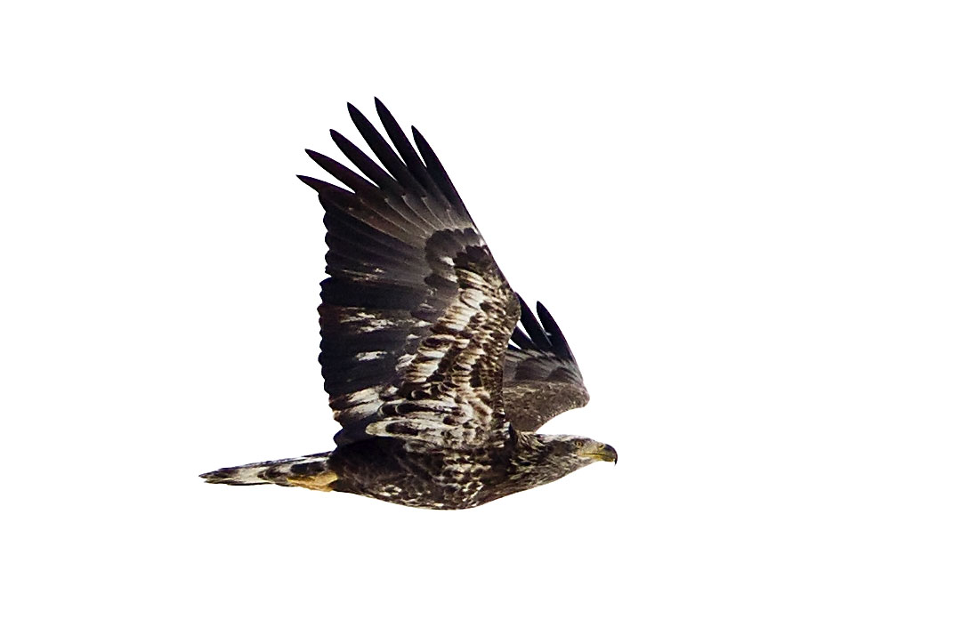
ohio flight baldeagle immature haliaeetusleucocephalus elizabethtown lostbridge greatmiamiriver
IMMATURE BALD EAGLE
oxbowinc southeasternindiana canal reflections pond lake bw pentaxk3
Oxbow Lake
northbend ohio unitedstates us
eagle-6426
riverboat casino pushboats ohioriver lawrenceburgindiana kentucky hollywoodcasino reflections northernkentucky nikond7100
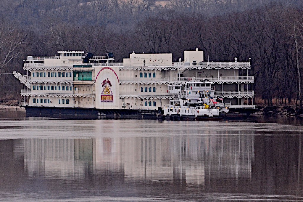
Reflection from Riverboat Casino's late departure
bob schlake okeana ohio
forest green
2010 dslr app iphoneedit snapseed jamiesmed geotagged geotag hdr blue sky skies clouds handyphoto facebook miamiwhitewater landscape hamiltoncounty cincinnati sony alpha a200 may ohio midwest photography spring jamie clermontcounty queencity park sports sport
IMG_4161.JPG
2010 dslr app jamiesmed snapseed iphoneedit geotag geotagged hdr blue skies sky clouds handyphoto facebook miamiwhitewater landscape hamiltoncounty cincinnati sony a200 alpha may ohio midwest photography spring clermontcounty queencity park sports sport
IMG_7744.JPG
bridge ohio lake church river the cleves 45002
The Stream to a far land!
whitewaterriver
Sunday Morning on Whitewater River 3
ohio buckeyes northbend presidentialgraves ohioriversites williamhenryharrisontombstatememorial
Land the Natives Did Not Want Anyway
ohio field cincinnati gumm miamitown gumm238
The Field
indiana lawrenceburg dearborncounty junopondoxbow
JUNO POND, OXBOW
green indiana pollution wetland gumm hardinsburg gumm238
Pollution in the Wetland
greenheron dearborncounty lawrenceburg indiana oxbow unitedstates us
GREEEN HERON-08184269.jpg
morning light ohio sun cold west ice water canon river frozen whitewater harrison cincinnati freezing sigma indiana fisheye 12 rise minus febuary degrees tristate 70d
Frozen River -West
butterfly ohio mitchellmemorialforest cleves greatspangledfritillary
GREAT SPANGLED FRITILLARY BUTTERFLY
sunset woods nikon miamiwhitewater hamiltoncountyparkdistrict nikond7000
Last bit of light from the sun
2010 dslr app jamiesmed snapseed iphoneedit geotag geotagged hdr handyphoto facebook miamiwhitewater landscape hamiltoncounty cincinnati sony a200 alpha may ohio midwest photography spring jamie clermontcounty queencity park sports sport
IMG_8359.JPG
trees lake forest day cloudy indiana lawrenceburg wetland gumm hardinsburg gumm238
Lake in the Wetland
greenheron dearborncounty lawrenceburg indiana oxbow unitedstates us
GREEEN HERON in a DIVE-08184070.jpg
square squareformat iphoneography instagramapp uploaded:by=instagram
Just fixing to start a photo shoot. #woods #forrest #colors #Fall #Autumn #photoshoot
The Hills Roll On