Elevation of Autumn Oak Ln, Harrison, TN, USA
Location: United States > Tennessee > Hamilton County > Harrison >

Longitude: -85.100822

Latitude: 35.175281

Elevation: 259m / 850feet

Barometric Pressure: 98KPa

Elevation Map:

elevation map of Autumn Oak Ln, Harrison, TN, USA
Satellite Map:

Satellite map of Autumn Oak Ln, Harrison, TN, USA
Related Photos:

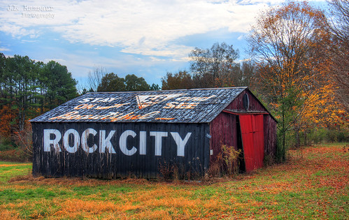
jlrphotography nikond7200 nikon d7200 photography tennessee 2019 engineerswithcameras photographyforgod thesouth southernphotography screamofthephotographer ibeauty jlramsaurphotography georgetown tennesseephotographer georgetowntennessee georgetowntn hamiltoncounty stayontn58andseebeautifulrockcitybarn stayontn58andseebeautifulrockcity sign signage it’sasign signssigns iloveoldsigns oldsignage vintagesign retrosign oldsign vintagesignage retrosignage faded fadedsignage fadedsign iseeasign signcity ghostsign fadedghostsign seerockcitybarn seerockcity oldbarn vintagebarn ruralbarn rockcity ruralsouth rural ruralamerica ruraltennessee ruralview structuresofthesouth smalltownamerica americana
Stay on TN58 and See Beautiful Rock City barn - Georgetown, Tennessee
jlrphotography nikond7200 nikon d7200 photography tennessee 2016 engineerswithcameras thelostcountyoftennessee photographyforgod thesouth southernphotography screamofthephotographer ibeauty jlramsaurphotography ootlewah tennesseephotographer ootlewahtennessee jamescounty ootlewahtn tennesseehdr hdr worldhdr hdraddicted bracketed photomatix hdrphotomatix hdrvillage hdrworlds hdrimaging hdrrighthererightnow bluesky deepbluesky beautifulsky historicalmarker history historic tennesseehistory historyisallaroundus americanrelics fadingamerica it’saretroworldafterall oldandbeautiful vanishingamerica thelostcountyoftennesseehistoricalmarker jamescountyhistoricalmarker sign signage it’sasign signssigns iloveoldsigns oldsignage vintagesign retrosign oldsign vintagesignage retrosignage faded fadedsignage fadedsign iseeasign signcity easttennessee weathered old wondersofoxidation ruralsouth rural ruralamerica ruraltennessee ruralview smalltownamerica americana hamiltoncounty
The Lost County of Tennessee Historical Marker - Ooltewah, Tennessee
morning bridge dam chattanooga river tennessee trail tennesseeriver urbanpark chickamaugadam
Chickamauga Dam (and bridge)
steam locomotive 280 norfolksouthern tennesseevalleyrailroadmuseum 21stcenturysteam southern630 allysonleighphotography
Returning From Cleveland
canon capture chattanooga digital eos harleyownersgroup harleydavidson image impression mjscanlon mjscanlonphotography mojo perspective photo photograph photographer photography picture rally scanlon super tennessee tennesseestatehogrally view wow ©mjscanlon ©mjscanlonphotography
2010 Tennessee State HOG Rally | Chattanooga, Tennessee
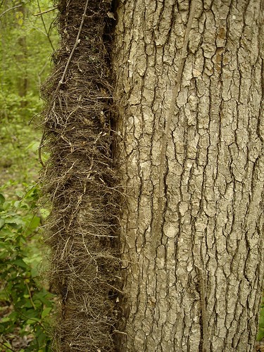
geotagged tennessee poisonivy hamiltoncounty toxicodendron anacardiaceae toxicodendronradicans northchickamaugacreekgreenway geo:lat=35112958 geo:lon=85227900
Toxicodendron radicans (Poison Ivy) Anacardiaceae
trip travel family friends light people usa motion men church chattanooga parish movie season t geotagged fun video movement women worship day catholic purple christ unitedstates tn calendar pentax tennessee faith religion purim ashes latin lamb jew jewish bible esther hd optio priest christianity judaism gps tradition hebrew geotag cha pascha passover deacon sinners repentance forgiveness faithful resurrection lent liturgical pesach humility ststephen metanoia southernbreeze imposition 2013 parishioner wg1
Imposition of Ashes, Ash Wednesday 2013 - m4200
blackandwhite bw usa church chattanooga america tn tennessee columns arches presbyterian fallingwater countrychurch soddydaisy hixson
Falling Water Presbyterian Church
chattanooga museum crane tvrm southernrailroad railroadcrane tennesseevalleyrailroadmuseum
Southern Railroad Crane Car #903008 (Front View)
blue sunset sky fall colors girl leaves sarah hair eyes colorful pretty gorgeous dee serendipity davis sarendipity
The View
geotagged tennessee parasite hamiltoncounty squawroot conopholis conopholisamericana northchickamaugacreekgreenway americancancerroot geo:lat=351173 geo:lon=852242
Conopholis americana (American Cancer-root) Orobanchaceae
red people girl kids outside doll play dress outdoor blond
Red Dress
river dam sluice chattanooga tennessee telephoto tennesseeriver morning trail urbanpark chickamaugadam manualfocus canonfd fotodiox legacylens
Chickamauga sluice
friends sunset chattanooga topf25 water fishing tn tennessee marylee naturesfinest views100 harrisonbaystatepark colorphotoaward 100viewclub maryleemartin platinumheartaward naturessilhouettes damniwishidtakenthat maryleeusa maryleepope
~Sunset Fishing~
jlrphotography nikond7200 nikon d7200 photography photo ooltewahtn easttennessee jamescounty tennessee 2016 engineerswithcameras thelostcountyoftennessee photographyforgod thesouth southernphotography screamofthephotographer ibeauty jlramsaurphotography photograph pic ooltewah tennesseephotographer ooltewahtennessee jamescountytennessee italwa lostcountyoftennessee tennesseehistory historicbuilding history historic historyisallaroundus americanrelics beautifuldecay fadingamerica it’saretroworldafterall oldandbeautiful vanishingamerica uscountycourthouses tennesseecountycourthouses nationalregisterofhistoricplaces engineeringasart ofandbyengineers engineeringisart engineering architecture rural ruralamerica ruraltennessee ruralview oldbuildings structuresofthesouth smalltownamerica americana bluesky deepbluesky beautifulsky whiteclouds clouds sky skyabove allskyandclouds
The Lost County of Tennessee - James County, TN Courthouse
canon capture chattanooga digital eos harleyownersgroup harleydavidson image impression mjscanlon mjscanlonphotography mojo perspective photo photograph photographer photography picture rally scanlon super tennessee tennesseestatehogrally view wow ©mjscanlon ©mjscanlonphotography
2010 Tennessee State HOG Rally | Chattanooga, Tennessee
508 federalsignal federalsignal508 federal508 508siren
Federal Signal 508
chattanooga tn dam tennessee chickamauga whitewingedscoter chickamaugadam
ww scoter male Chickamauga2
NS Train 64Q
chattanooga tennessee unitedstates us
NS Train 143
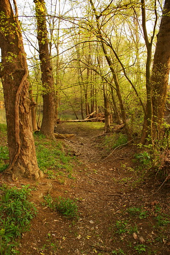
trees green tn trail pathway
Lush pathway
trees sunset summer orange color horizontal landscape spring highway view tennessee south scenic reststop clear hdr photomatix i75s
Scenic View...
tvrm tennesseevalleyrailroad grandjunction wye 80 gp38
GP38 #80 on the wye
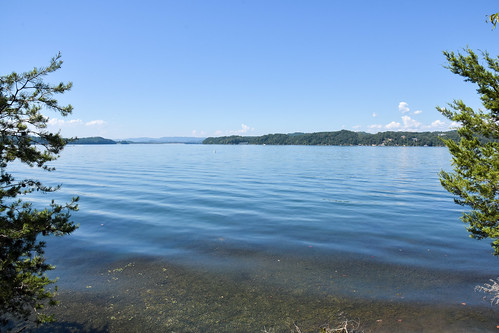
mrieder markusrieder nikon d7200 nikond7200 vacation urlaub fotoreise phototrip usa 2016 usa2016 tennessee bookertwashingtonstatepark statepark nature natur lake
Booker T. Washington State Park
creek memorial flags veterans greenway wolftever
Flags along the creek
trees fall chattanooga colors maple tennessee fallfoliage hixson harley130
Falling Waters Valley Fall Colors
bird heron animal tennessee greatblueheron lovephotography harrisonbaystatepark
Great Blue Heron
NS 123, Chattanooga, TN
geotagged unitedstates hiking tennessee huckleberry soddydaisy cumberlandtrail tennesseestateparks camera:make=canon exif:make=canon exif:focallength=18mm exif:isospeed=125 geo:state=tennessee cumberlandtrailstatepark geo:countrys=unitedstates camera:model=canoneos7d exif:model=canoneos7d exif:lens=18200mm exif:aperture=ƒ90 mimosatrailerpark northchickamaugatrailsegmentofthecumberlandtrail geo:city=soddydaisy geo:lat=3524613800 geo:lon=8523562600 geo:lat=35246138333333 geo:lon=85235626666667 northchickamaugacreeksegment
North Chickamauga Trail Segment of the Cumberland Trail - February 16, 2013
RG5_2802.jpg
geotagged unitedstates hiking tennessee waterfalls huckleberry soddydaisy cumberlandtrail tennesseestateparks camera:make=canon exif:make=canon exif:focallength=18mm geo:state=tennessee cumberlandtrailstatepark exif:isospeed=250 geo:countrys=unitedstates camera:model=canoneos7d exif:model=canoneos7d exif:lens=18200mm exif:aperture=ƒ71 mimosatrailerpark geo:city=soddydaisy stripminefalls geo:lat=3525262267 geo:lon=8524069000 geo:lat=35252623333333 geo:lon=8524069 northchickamaugacreeksegment
Stripmine Falls - North Chickamauga Trail Segment of the Cumberland Trail - February 16, 2013
park cloud lake chattanooga nature canon landscape photographer tennessee chickamauga 30d chesterfrost
Chester Frost Park
geotagged waterfall unitedstates hiking tennessee waterfalls huckleberry soddydaisy cumberlandtrail tennesseestateparks camera:make=canon exif:make=canon exif:focallength=18mm exif:isospeed=125 geo:state=tennessee cumberlandtrailstatepark geo:countrys=unitedstates camera:model=canoneos7d exif:model=canoneos7d exif:lens=18200mm exif:aperture=ƒ90 mimosatrailerpark geo:city=soddydaisy stripminefalls geo:lat=3525267772 geo:lon=8524075439 geo:lon=85240755 geo:lat=35252678333333 northchickamaugacreeksegment
Stripmine Falls - North Chickamauga Trail Segment of the Cumberland Trail - February 16, 2013
geotagged waterfall unitedstates hiking tennessee waterfalls huckleberry soddydaisy cumberlandtrail tennesseestateparks camera:make=canon exif:make=canon exif:focallength=18mm exif:isospeed=125 geo:state=tennessee cumberlandtrailstatepark geo:countrys=unitedstates camera:model=canoneos7d exif:model=canoneos7d exif:lens=18200mm exif:aperture=ƒ71 mimosatrailerpark geo:city=soddydaisy stripminefalls geo:lat=3525268360 geo:lon=8524068660 geo:lat=35252683333333 geo:lon=85240686666667 northchickamaugacreeksegment
Stripmine Falls - North Chickamauga Trail Segment of the Cumberland Trail - February 16, 2013
695nm chattanooga ir695 infrared tennessee unitedstates
Chickamauga Dam
geotagged waterfall unitedstates hiking tennessee waterfalls huckleberry soddydaisy cumberlandtrail tennesseestateparks camera:make=canon exif:make=canon exif:focallength=18mm exif:isospeed=125 geo:state=tennessee cumberlandtrailstatepark geo:countrys=unitedstates camera:model=canoneos7d exif:model=canoneos7d exif:lens=18200mm exif:aperture=ƒ71 mimosatrailerpark geo:city=soddydaisy stripminefalls geo:lat=35252673333333 geo:lat=3525267406 geo:lon=8524068906 geo:lon=85240688333333 northchickamaugacreeksegment
Stripmine Falls - North Chickamauga Trail Segment of the Cumberland Trail - February 16, 2013
geotagged unitedstates hiking tennessee soddydaisy signalmountain cumberlandtrail tennesseestateparks camera:make=canon exif:make=canon exif:isospeed=100 exif:focallength=18mm chickamaugacreek geo:state=tennessee cumberlandtrailstatepark geo:countrys=unitedstates camera:model=canoneos7d exif:model=canoneos7d exif:lens=18200mm exif:aperture=ƒ20 mimosatrailerpark northchickamaugatrailsegmentofthecumberlandtrail geo:city=signalmountain geo:lat=3524176110 geo:lon=8523720381 geo:lon=85237203333333 geo:lat=35241761666667 northchickamaugacreeksegment
Chickamauga Creek - North Chickamauga Trail Segment of the Cumberland Trail - February 16, 2013
geotagged unitedstates hiking tennessee soddydaisy signalmountain cumberlandtrail tennesseestateparks camera:make=canon exif:make=canon exif:isospeed=100 exif:focallength=18mm chickamaugacreek geo:state=tennessee cumberlandtrailstatepark geo:countrys=unitedstates camera:model=canoneos7d exif:model=canoneos7d exif:lens=18200mm exif:aperture=ƒ13 mimosatrailerpark northchickamaugatrailsegmentofthecumberlandtrail geo:city=signalmountain geo:lat=3524175788 geo:lon=8523721629 geo:lon=85237216666667 geo:lat=35241758333333 northchickamaugacreeksegment
Chickamauga Creek - North Chickamauga Trail Segment of the Cumberland Trail - February 16, 2013