Elevation of Wingfield Drive, Wingfield Dr, Virginia, USA
Location: United States > Virginia > Bedford County >
Longitude: -79.410188
Latitude: 37.3421267
Elevation: 255m / 837feet
Barometric Pressure: 98KPa
Elevation Map:
Satellite Map:
Related Photos:

The Aurora Borealis Over the Blue Ridge

Spring Storms in Central Virginia

foggy view down the spur

2019 04-20 1223-2 UP-CNW SD70ACe-1995 E/B 188 Bedford, VA

2019 04-20 1222-1 UP-CNW SD70ACe-1995 E/B 188 Bedford, VA

Grassy Mountain

Ground Assault Tableau, National D-Day Memorial 11/10/2013

view of Blue Ridge Mountains from Forest, Virginia

Bedford County, Virginia view from Bunker Hill area

Forest VA_0753

The Timberlake Tavern
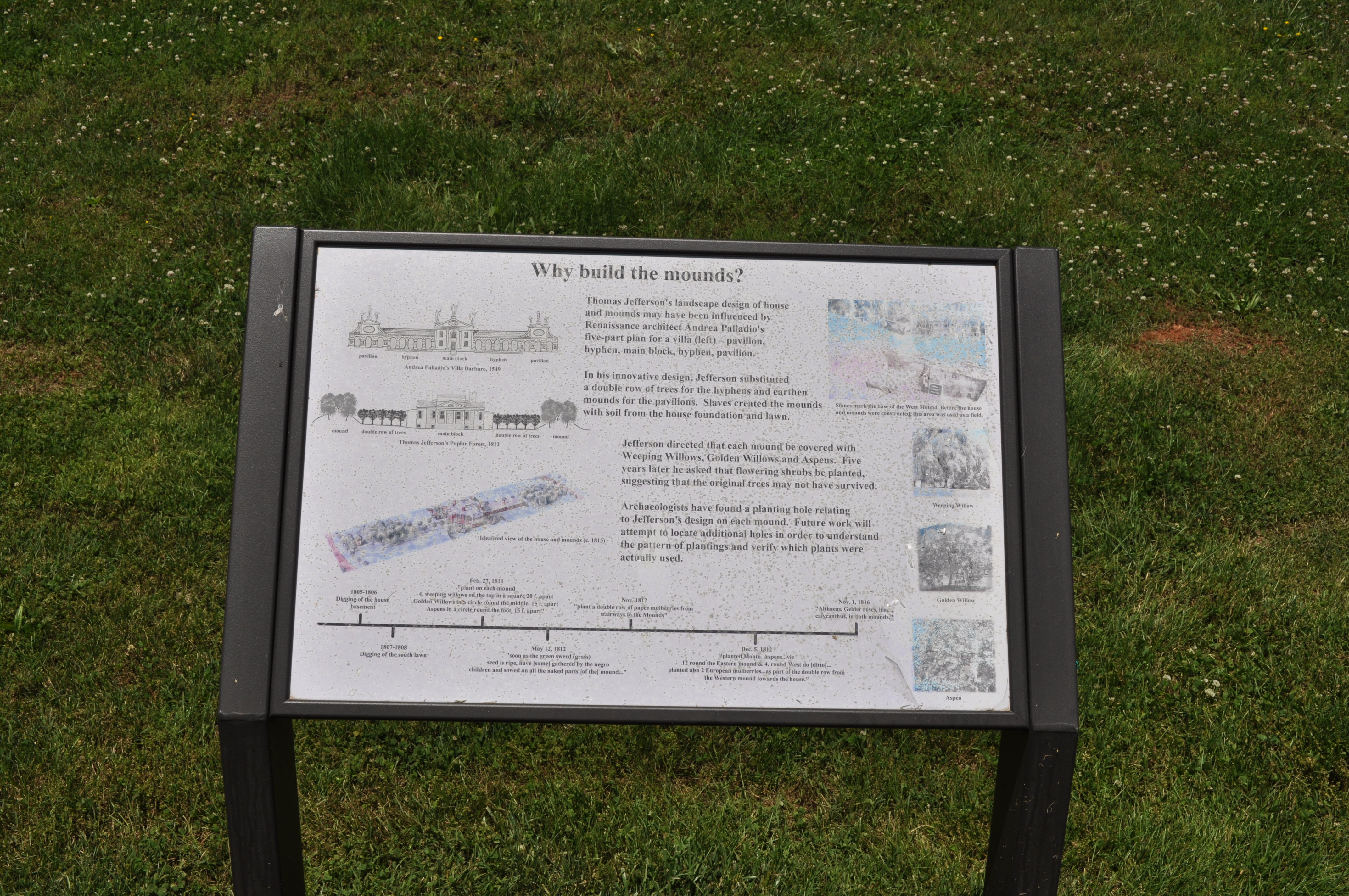
1207 Why build the mounds Img_24074

Poplar Forest 2010

view on Wheatland Road in Bedford County, Virginia

Suburbia as Seen from St Stephens

Poplar Forest 2010

Morning Fog in Forest

Poplar Forest 2010

RAD2013.05.20.19 BPO Elks Home

Poplar Forest 2010

view at Sedalia in Bedford County, Virginia

A Shower of Meteors

Sunset over the Blue Ridge

Peaks of Otter

Awesome "Slippery Rock" North Carolina

Bedford Factory

1218 The Enslaved Community at Jeffersons Poplar Forest 1772-1826 Img_24085

Pisgah National Forest

Freezing Fog

Poplar Forest - Earthen Mound

Another shot of the Peaks

Peaks of Otter, Dusk

Sunrise over Route 122

Blue Ridge Mountains

Little Otter 2

Morning Fog in Forest

Bedford, VA 2005
Topographic Map of Wingfield Drive, Wingfield Dr, Virginia, USA
Find elevation by address:

Places near Wingfield Drive, Wingfield Dr, Virginia, USA:
1255 Happy Ours Ln
Lowry Rd, Lowry, VA, USA
Goode
103 E Otter Ridge Dr
103 E Otter Ridge Dr
6750 Forest Rd
222 Snooty Fox Rd
133 E Otter Ridge Dr
200 Hunting Ln
Center
1039 Menefee Dr
Dogwood Hills Drive
Bethany Church Cir, Forest, VA, USA
Old Cifax Rd, Goode, VA, USA
1660 Lees Mill Ln
Sycamore Drive
2457 Sycamore Dr
Gallahers Store Rd, Forest, VA, USA
3042 Hurricane Dr
3042 Hurricane Dr
Recent Searches:
- Elevation of Corso Fratelli Cairoli, 35, Macerata MC, Italy
- Elevation of Tallevast Rd, Sarasota, FL, USA
- Elevation of 4th St E, Sonoma, CA, USA
- Elevation of Black Hollow Rd, Pennsdale, PA, USA
- Elevation of Oakland Ave, Williamsport, PA, USA
- Elevation of Pedrógão Grande, Portugal
- Elevation of Klee Dr, Martinsburg, WV, USA
- Elevation of Via Roma, Pieranica CR, Italy
- Elevation of Tavkvetili Mountain, Georgia
- Elevation of Hartfords Bluff Cir, Mt Pleasant, SC, USA