Elevation map of Uralla Shire Council, Uralla, NSW, Australia
Location: Australia > New South Wales >
Longitude: 151.2335592
Latitude: -30.4864837
Elevation: 756m / 2480feet
Barometric Pressure: 0KPa
Related Photos:
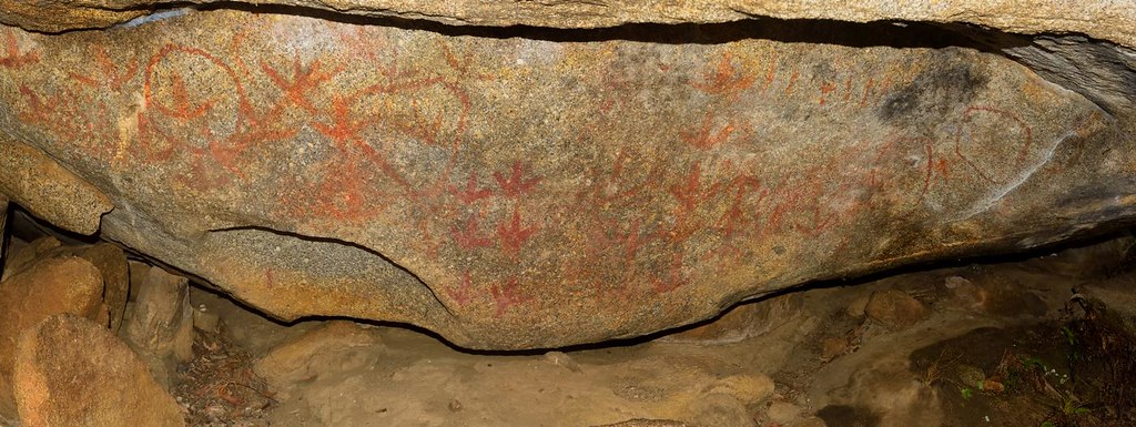
Yarrowyck Rock Art

Mount Yarrowyck

Rocky Smile

180422 NSW LD Saddleback
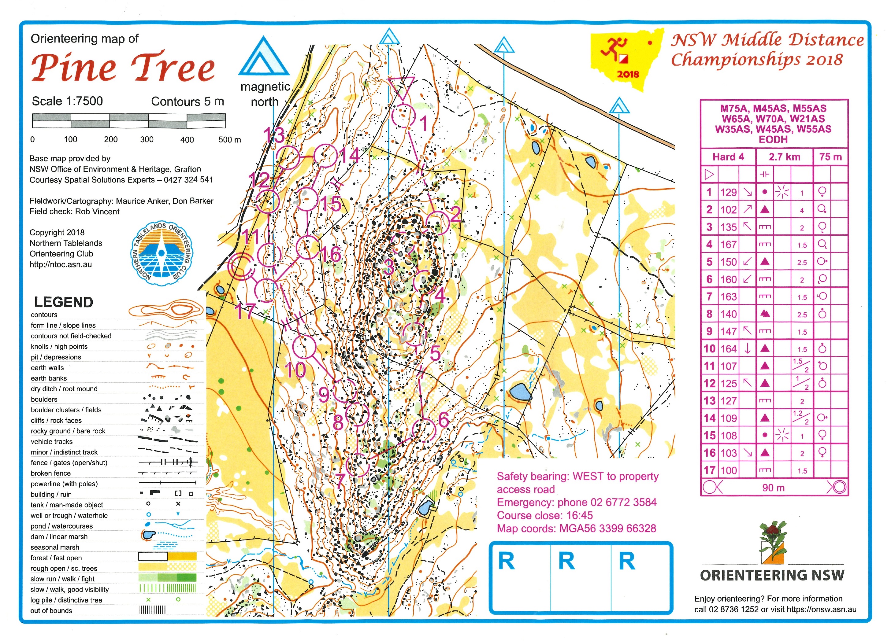
180421 NSW MD Pine Tree

130717_0658MtYarrowyckFromRiedsRoadLx.jpg

Bruce flying

Todd top out

Todd flying

Todd catching

Todd mantling the arete

Bruce's layback

Adidas rulez
Topographic Map of Uralla Shire Council, Uralla, NSW, Australia
Find elevation by address:

Places in Uralla Shire Council, Uralla, NSW, Australia:
Places near Uralla Shire Council, Uralla, NSW, Australia:
70 Kareela Rd
Invergowrie
Uralla
Hosanna Horizons
Briarbrook
540 Ramah Road
Dumaresq
Gunnalong Road
Gunnalong Road
Barraba Road
5 Highlands Rd
565 Eastern Ave
Bendemeer
Bonna
209 Clarks Rd
43 Garibaldi St
1 Back Woolbrook Rd
2 Reginald Ave
Armidale
275 Toms Gully Rd
Recent Searches:
- Elevation map of Greenland, Greenland
- Elevation of Sullivan Hill, New York, New York, 10002, USA
- Elevation of Morehead Road, Withrow Downs, Charlotte, Mecklenburg County, North Carolina, 28262, USA
- Elevation of 2800, Morehead Road, Withrow Downs, Charlotte, Mecklenburg County, North Carolina, 28262, USA
- Elevation of Yangbi Yi Autonomous County, Yunnan, China
- Elevation of Pingpo, Yangbi Yi Autonomous County, Yunnan, China
- Elevation of Mount Malong, Pingpo, Yangbi Yi Autonomous County, Yunnan, China
- Elevation map of Yongping County, Yunnan, China
- Elevation of North 8th Street, Palatka, Putnam County, Florida, 32177, USA
- Elevation of 107, Big Apple Road, East Palatka, Putnam County, Florida, 32131, USA
- Elevation of Jiezi, Chongzhou City, Sichuan, China
- Elevation of Chongzhou City, Sichuan, China
- Elevation of Huaiyuan, Chongzhou City, Sichuan, China
- Elevation of Qingxia, Chengdu, Sichuan, China
- Elevation of Corso Fratelli Cairoli, 35, Macerata MC, Italy
- Elevation of Tallevast Rd, Sarasota, FL, USA
- Elevation of 4th St E, Sonoma, CA, USA
- Elevation of Black Hollow Rd, Pennsdale, PA, USA
- Elevation of Oakland Ave, Williamsport, PA, USA
- Elevation of Pedrógão Grande, Portugal