Elevation of Tlogosari, Bondowoso Regency, East Java, Indonesia
Location: Indonesia > East Java > Bondowoso Regency >
Longitude: 113.965541
Latitude: -8.0344803
Elevation: 843m / 2766feet
Barometric Pressure: 92KPa
Elevation Map:
Satellite Map:
Related Photos:
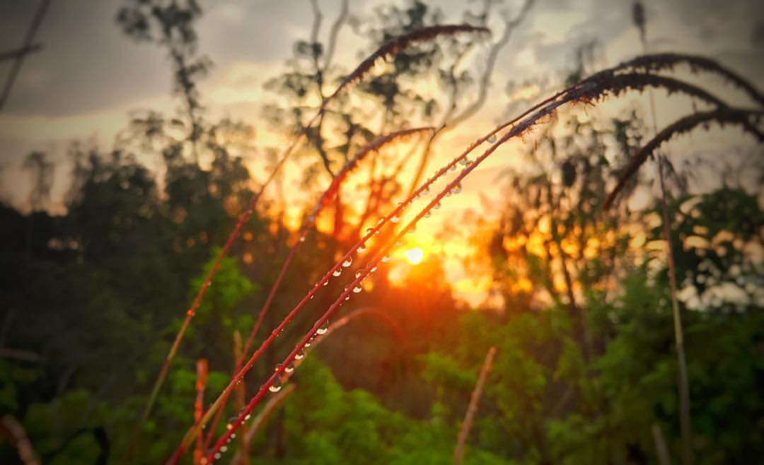
Sunset view from the track of Mt Raung 3.333mdpl #RaungRush 2016 !!! ????⛰ ~~>> Mt Raung (PondokSumur) #Raung #mountain #sunset #forest #panorama #instavsco #indonesia #cold #nature #climber #weekend #instafollow #instalike #iphon
Mountains, according to the angle of view, the season, the time of day, the beholder's frame of mind, or any one thing, can effectively change their appearance. Thus, it is essential to recognize that we can never know more than one side, one small aspect
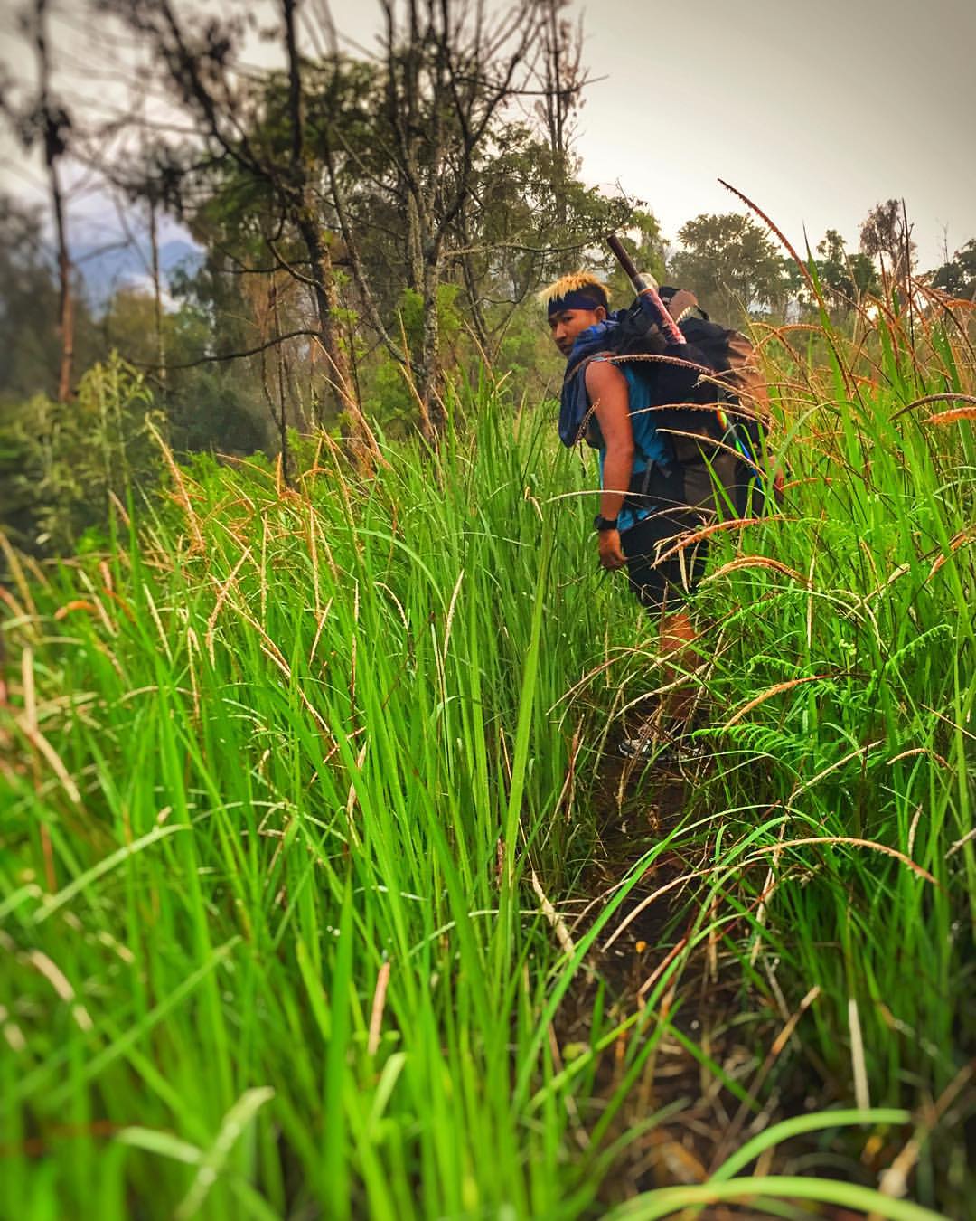
When you walk with your friends and you'll realize what the meaning of friendship is. view from the track of Mt Raung 3.333mdpl #RaungRush 2016 !!! ????⛰ ~~>> Mt Raung (PondokSumur) #Raung #mountain #sunset #forest #panorama #ins
May your dreams be larger than mountains and may you have the courage to scale their summits. Summit of Mt Raung 3.333mdpl #RaungRush 2016 !!! ????⛰ ~~>> Mt Raung #Raung #mountain #sunset #forest #panorama #instavsco #indonesia
_MG_7118.jpg

Uitzicht vanaf een plantage aan de voet van de Ijen-vulkaan, Java

Ijen Volcano
_MG_7103.jpg

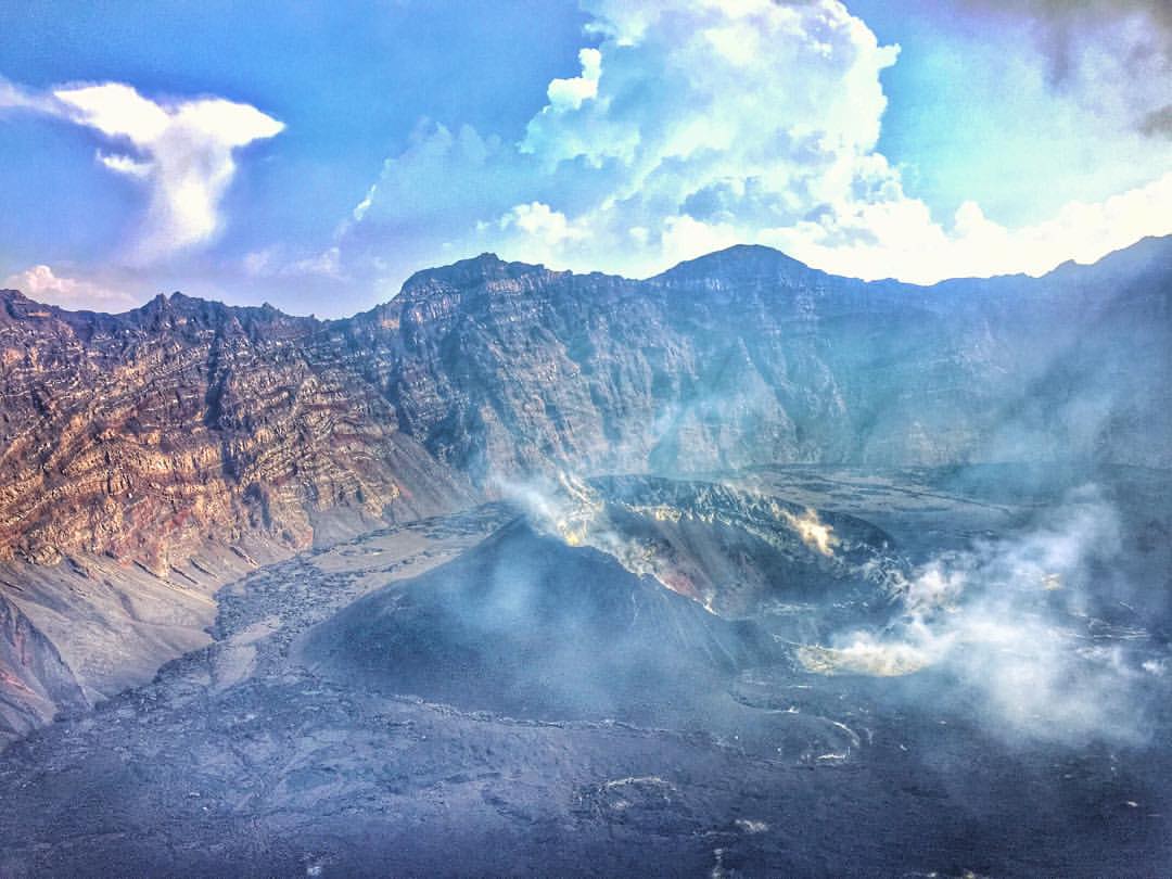
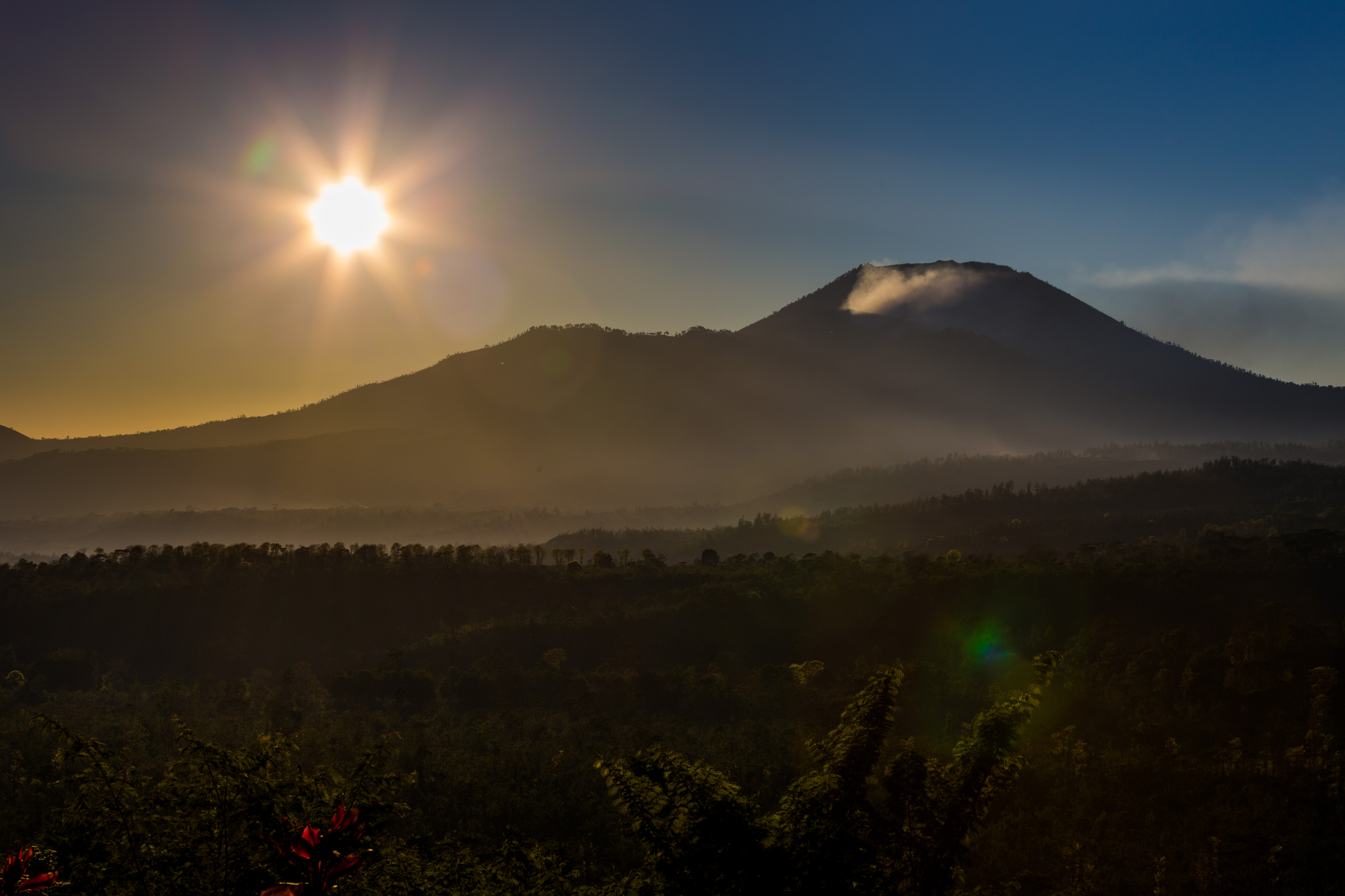
Caldera Raung

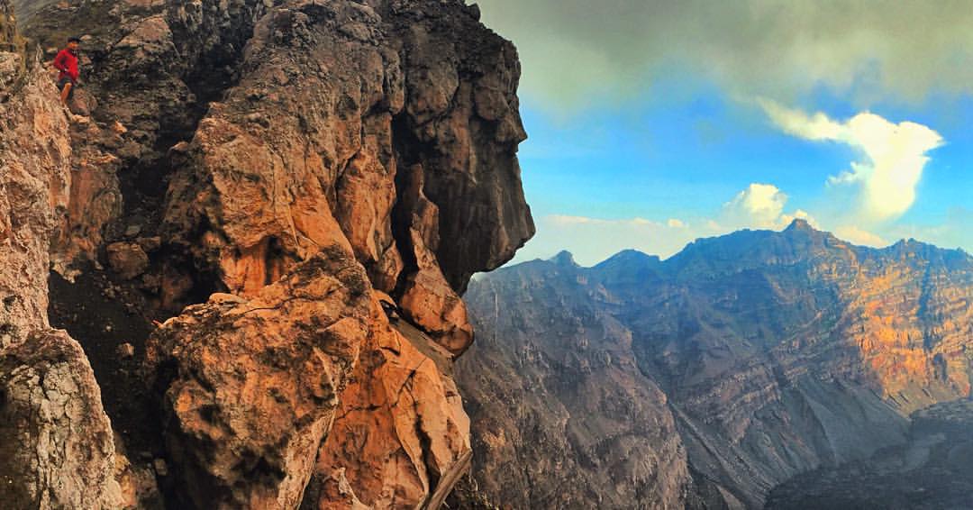
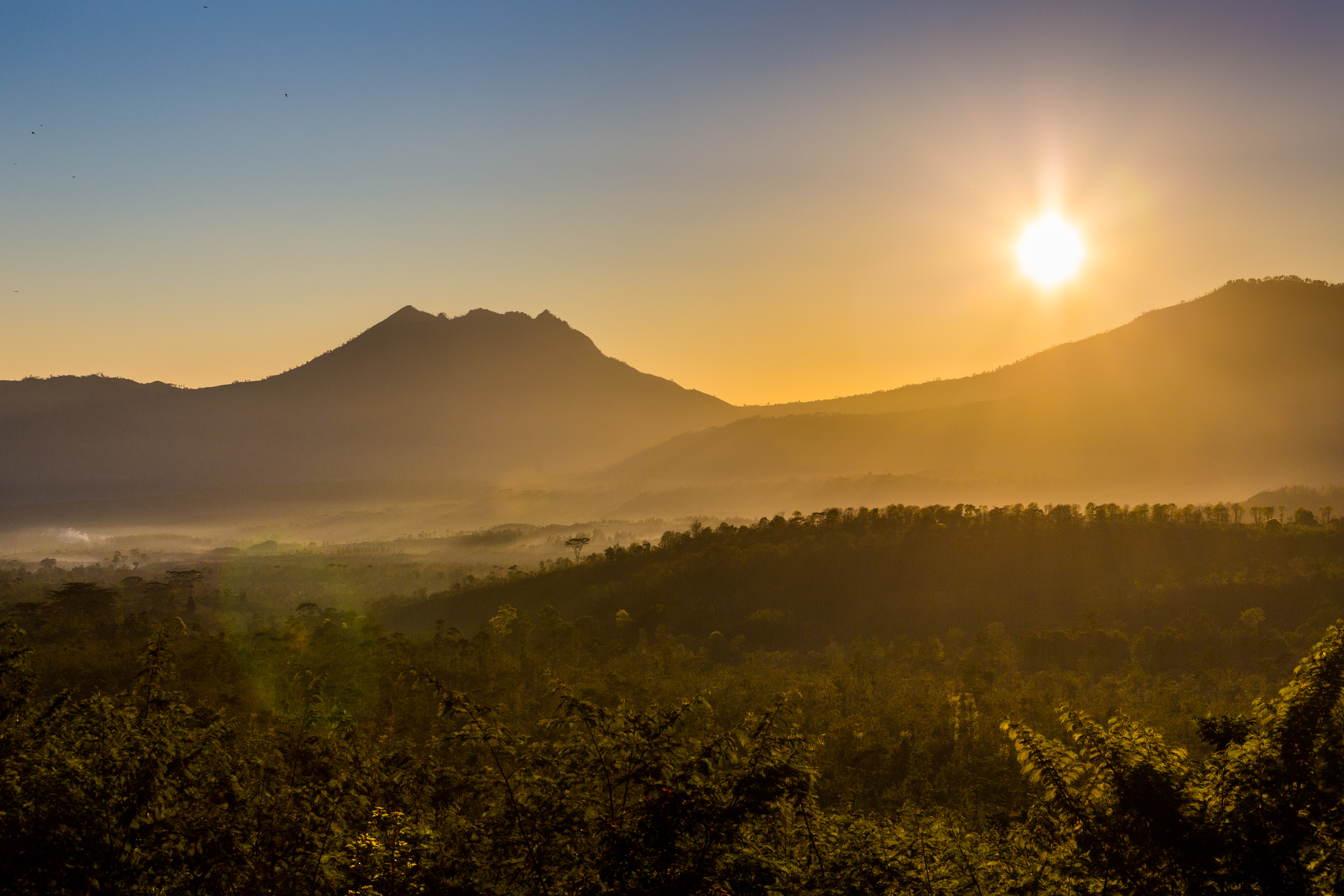
Cliffs around Raung

Cliffs around Raung
Topographic Map of Tlogosari, Bondowoso Regency, East Java, Indonesia
Find elevation by address:

Places in Tlogosari, Bondowoso Regency, East Java, Indonesia:
Places near Tlogosari, Bondowoso Regency, East Java, Indonesia:
Gunosari
Mount Raung
Kalibaru
Paltuding Kawah Ijen Banyuwangi Jatim
Jalan Raya Kalibaru
Ijen
Licin Ijen
Situbondo Regency
Glagah
Banyuwangi Regency
Banyuwangi
Banyuputih
Sumberwaru
Bali Strait
Baluran National Park
Melaya, Jembrana Regency, Bali, Indonesia
Melaya
Seririt
Buleleng Regency
Mayong
Recent Searches:
- Elevation of Corso Fratelli Cairoli, 35, Macerata MC, Italy
- Elevation of Tallevast Rd, Sarasota, FL, USA
- Elevation of 4th St E, Sonoma, CA, USA
- Elevation of Black Hollow Rd, Pennsdale, PA, USA
- Elevation of Oakland Ave, Williamsport, PA, USA
- Elevation of Pedrógão Grande, Portugal
- Elevation of Klee Dr, Martinsburg, WV, USA
- Elevation of Via Roma, Pieranica CR, Italy
- Elevation of Tavkvetili Mountain, Georgia
- Elevation of Hartfords Bluff Cir, Mt Pleasant, SC, USA