Elevation map of Telšiai County, Lithuania
Location: Lithuania >
Longitude: 22.1113915
Latitude: 56.1026616
Elevation: 113m / 371feet
Barometric Pressure: 100KPa
Elevation Map:
Satellite Map:
Related Photos:

Telsiai: A View Of The City

Telsiai: A View From The Window

Telsiai: A View Of The City

Telsiai: A View Of The City

Telsiai: A View Of The City

Telsiai: A View Of The City

domes covering silos at plokštinė missile base, Lithuania

View towards Church of the Assumption of the Blessed Virgin Mary, 27.08.2011.
The view. Zemaitijos #National #park from #ultralight aircraft. Colors are turning, the golden #fall is here! ---- aircraft pilot @tadasmit photos by @vytaspaul

A Summer Day
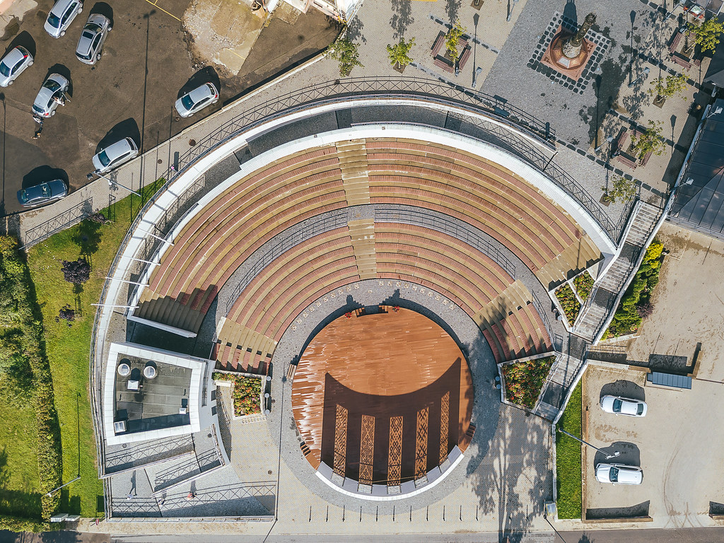
Telšiai amphitheater | Lithuania Aerial #256/365

Telšiai | Lithuania Aerial

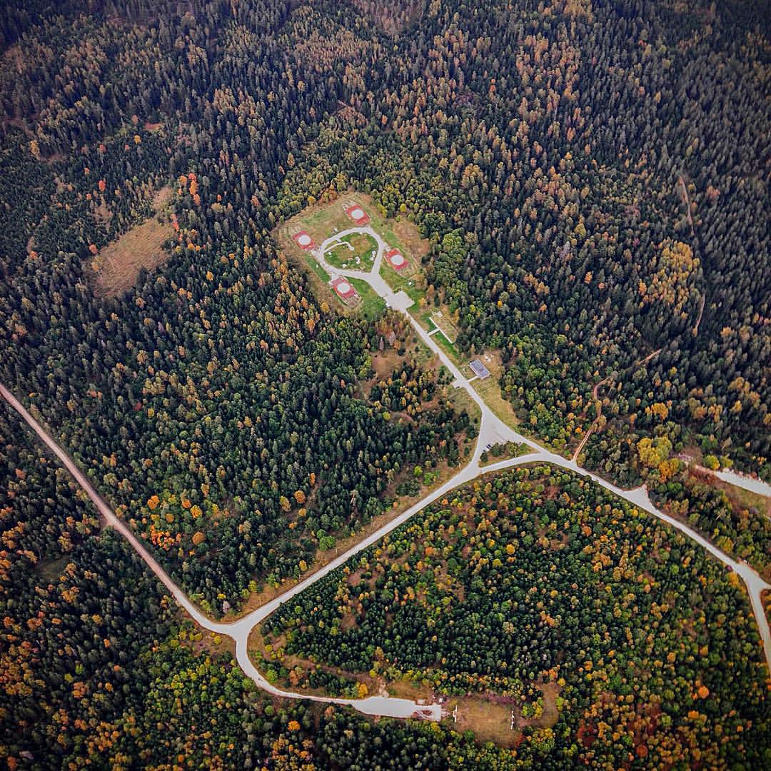
Warhead storage

Telšiai amphitheater | Lithuania Aerial

Netoli Buožėnų

Burnet Companion

Plokstine SS4 Nuclear Missile Silo Complex

Plokstine SS4 Nuclear Missile Silo Complex

Telšiai

Telšiai

Telšiai
Topographic Map of Telšiai County, Lithuania
Find elevation by address:

Places in Telšiai County, Lithuania:
Places near Telšiai County, Lithuania:
Telšiai
Telšiai District Municipality
Plungė District Municipality
Plungė
Skuodas District Municipality
Pavandenė
Šilalė District Municipality
Laukeliai
14, Luknės, Lithuania
Vezaiciai
Vėžaičiai
Klaipėda District Municipality
Kretinga District Municipality
29, Pėžaičiai, Lithuania
Gargždai
Tauragė County
Tauragė District Municipality
Norkaičiai, Lithuania
Gamyklos G. 5
Montresta
Recent Searches:
- Elevation of Corso Fratelli Cairoli, 35, Macerata MC, Italy
- Elevation of Tallevast Rd, Sarasota, FL, USA
- Elevation of 4th St E, Sonoma, CA, USA
- Elevation of Black Hollow Rd, Pennsdale, PA, USA
- Elevation of Oakland Ave, Williamsport, PA, USA
- Elevation of Pedrógão Grande, Portugal
- Elevation of Klee Dr, Martinsburg, WV, USA
- Elevation of Via Roma, Pieranica CR, Italy
- Elevation of Tavkvetili Mountain, Georgia
- Elevation of Hartfords Bluff Cir, Mt Pleasant, SC, USA