Elevation map of Tambacounda Region, Senegal
Location: Senegal >
Longitude: -13.174034
Latitude: 13.5619011
Elevation: 33m / 108feet
Barometric Pressure: 101KPa
Elevation Map:
Satellite Map:
Related Photos:

with the baobabs ...
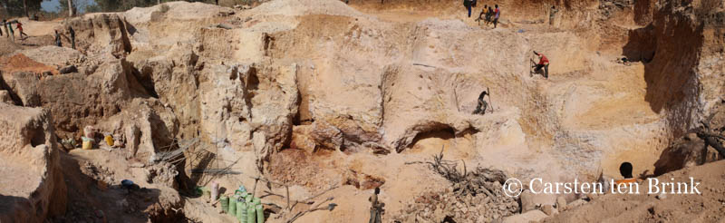
Among the "orpailleurs", the goldminers of the Kédougou region

Among the "orpailleurs", the goldminers of the Kédougou region

Passage House in Kolda, Senegal
Topographic Map of Tambacounda Region, Senegal
Find elevation by address:

Recent Searches:
- Elevation of Corso Fratelli Cairoli, 35, Macerata MC, Italy
- Elevation of Tallevast Rd, Sarasota, FL, USA
- Elevation of 4th St E, Sonoma, CA, USA
- Elevation of Black Hollow Rd, Pennsdale, PA, USA
- Elevation of Oakland Ave, Williamsport, PA, USA
- Elevation of Pedrógão Grande, Portugal
- Elevation of Klee Dr, Martinsburg, WV, USA
- Elevation of Via Roma, Pieranica CR, Italy
- Elevation of Tavkvetili Mountain, Georgia
- Elevation of Hartfords Bluff Cir, Mt Pleasant, SC, USA