Elevation of S W St, Milford, UT, USA
Location: United States > Utah > Beaver County > Milford >
Longitude: -113.01268
Latitude: 38.3958958
Elevation: 1519m / 4984feet
Barometric Pressure: 84KPa
Elevation Map:
Satellite Map:
Related Photos:
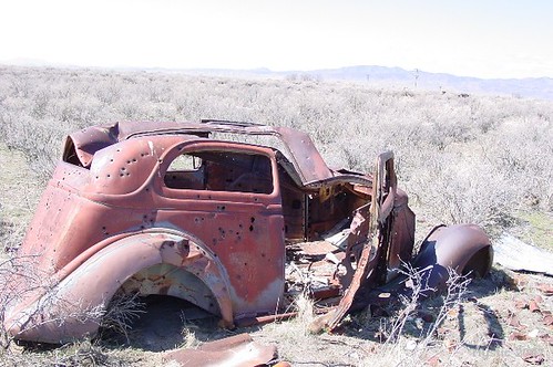
Old Car Outside Milford Ut

1960 International/Coast pumper (rear)

1963 International/American LaFrance 900-Series (rear)

Old Vw

Old mine

Hot Springs

Rock Corral Recreation Area, Utah

Rock Corral Recreation Area, Utah
Fleeting Cloudburst

207-0708_IMG
Topographic Map of S W St, Milford, UT, USA
Find elevation by address:

Places near S W St, Milford, UT, USA:
45 W Center St, Milford, UT, USA
Milford
North 100 West Street & 400 North Street
South 400 West Street & 400 West
South 400 West Street & 400 West
Beaver County
Greenville
S W, Greenville, UT, USA
Beaver
East 300 South Street
2740 Navajo Trail N
2740 Navajo Trail N
N Creek Rd, Beaver, UT, USA
Cove Fort Historic Site
Forest Road 149
Cottonwood Canyon Narrows
Millard County
Notch Peak
S W, Oasis, UT, USA
94 N Main Hinckley, Hinckley, UT, USA
Recent Searches:
- Elevation of Corso Fratelli Cairoli, 35, Macerata MC, Italy
- Elevation of Tallevast Rd, Sarasota, FL, USA
- Elevation of 4th St E, Sonoma, CA, USA
- Elevation of Black Hollow Rd, Pennsdale, PA, USA
- Elevation of Oakland Ave, Williamsport, PA, USA
- Elevation of Pedrógão Grande, Portugal
- Elevation of Klee Dr, Martinsburg, WV, USA
- Elevation of Via Roma, Pieranica CR, Italy
- Elevation of Tavkvetili Mountain, Georgia
- Elevation of Hartfords Bluff Cir, Mt Pleasant, SC, USA