Elevation of Muztagata, Akto, Kizilsu, China
Location: China > Xinjiang > Kizilsu > Akto >
Longitude: 75.1166666
Latitude: 38.2758333
Elevation: 7272m / 23858feet
Barometric Pressure: 39KPa
Elevation Map:
Satellite Map:
Related Photos:

These mountains
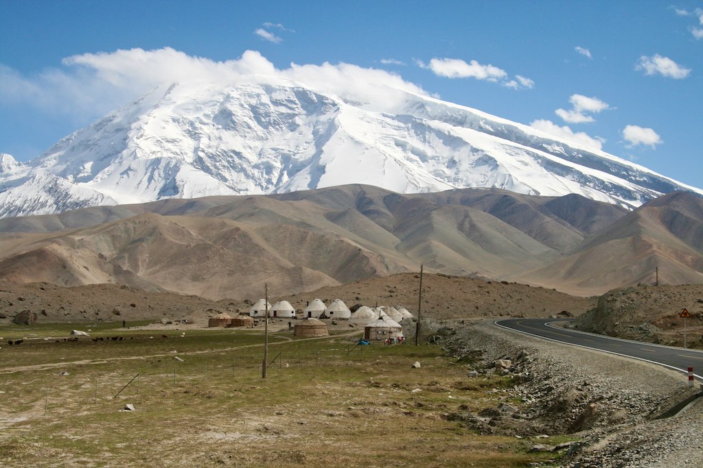
IMG_7128 China Mount Muztag Ata and Yurt Houses
Topographic Map of Muztagata, Akto, Kizilsu, China
Find elevation by address:

Places near Muztagata, Akto, Kizilsu, China:
Recent Searches:
- Elevation of Corso Fratelli Cairoli, 35, Macerata MC, Italy
- Elevation of Tallevast Rd, Sarasota, FL, USA
- Elevation of 4th St E, Sonoma, CA, USA
- Elevation of Black Hollow Rd, Pennsdale, PA, USA
- Elevation of Oakland Ave, Williamsport, PA, USA
- Elevation of Pedrógão Grande, Portugal
- Elevation of Klee Dr, Martinsburg, WV, USA
- Elevation of Via Roma, Pieranica CR, Italy
- Elevation of Tavkvetili Mountain, Georgia
- Elevation of Hartfords Bluff Cir, Mt Pleasant, SC, USA