Elevation of MS-, Leland, MS, USA
Location: United States > Mississippi > Washington County > Leland >
Longitude: -90.806549
Latitude: 33.2703741
Elevation: 32m / 105feet
Barometric Pressure: 101KPa
Elevation Map:
Satellite Map:
Related Photos:


IMAG5350

Loose bolls

Cotton branch

Afternoon pool

Church at Estill, MS
my driveway

my yard

an old pickup

Eddie Cusic and dancer (1)

Eddie Cusic and dancer

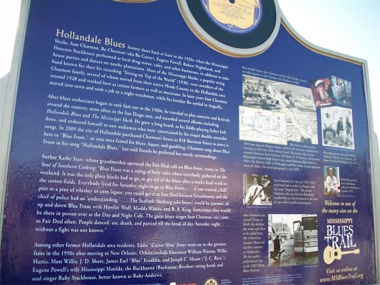
Blue Front

Eddie Cusic (1)

Eddie Cusic
Sam Chatmon (7)

Sam Chatmon (6)

Sam Chatmon (5)

Sam Chatmon (4)

Sam Chatmon (3)
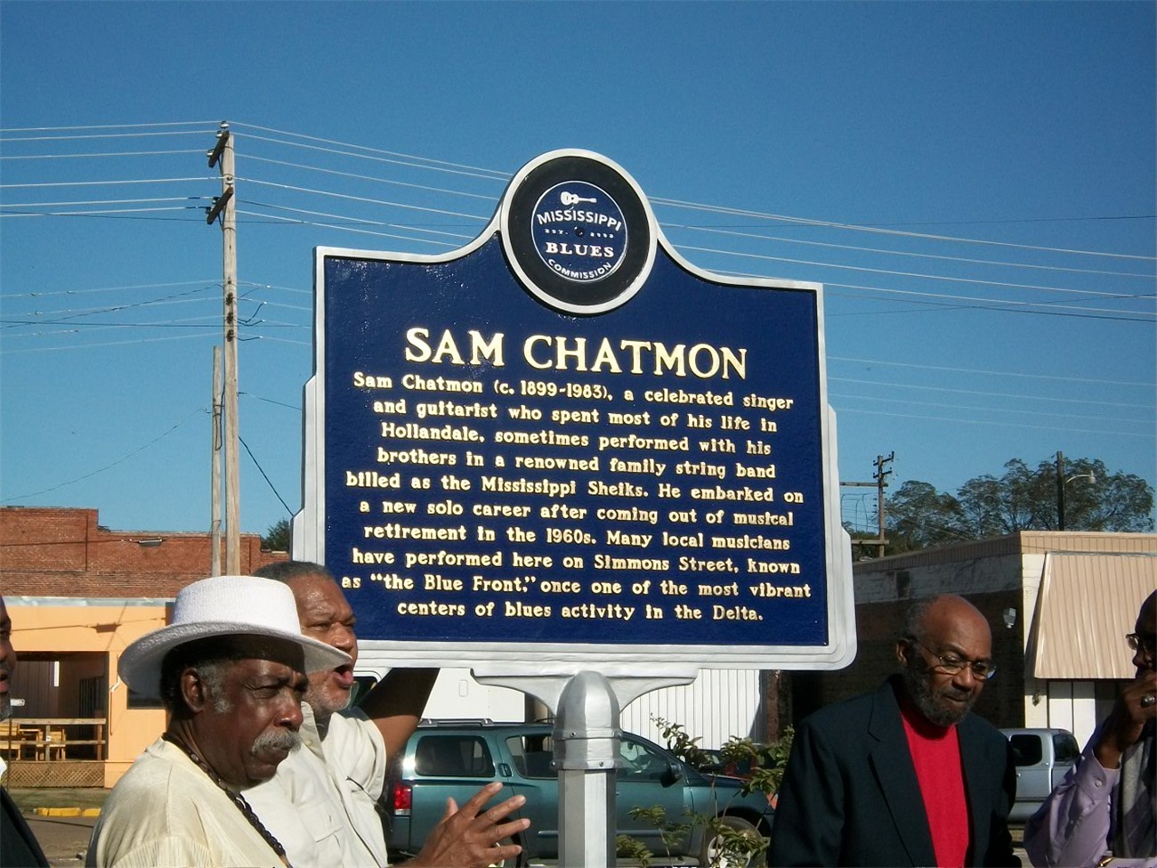
Sam Chatmon (2)
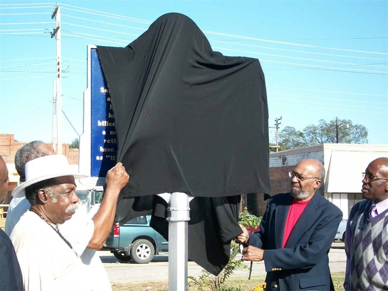
Sam Chatmon (1)
Sam Chatmon

Libby Ray Watson (2)
Topographic Map of MS-, Leland, MS, USA
Find elevation by address:

Places near MS-, Leland, MS, USA:
Avon-Darlove Rd, Hollandale, MS, USA
2045 Old Hwy 61
110 Main St
Sandifer Rd, Hollandale, MS, USA
Hollandale
54 Dunleith Rd, Leland, MS, USA
Washington County
119 Lilac Dr
Leland
243 Rexburg Rd
3864 Us-82
Ritchey Rd, Anguilla, MS, USA
Panther Burn
Panther Burn Rd, Anguilla, MS, USA
221 Woodman Of The World Rd
Lee St, Indianola, MS, USA
Indianola
Gooden Lake Rd, Belzoni, MS, USA
Napanee Rd, Leland, MS, USA
72 Sago Rd, Anguilla, MS, USA
Recent Searches:
- Elevation of Corso Fratelli Cairoli, 35, Macerata MC, Italy
- Elevation of Tallevast Rd, Sarasota, FL, USA
- Elevation of 4th St E, Sonoma, CA, USA
- Elevation of Black Hollow Rd, Pennsdale, PA, USA
- Elevation of Oakland Ave, Williamsport, PA, USA
- Elevation of Pedrógão Grande, Portugal
- Elevation of Klee Dr, Martinsburg, WV, USA
- Elevation of Via Roma, Pieranica CR, Italy
- Elevation of Tavkvetili Mountain, Georgia
- Elevation of Hartfords Bluff Cir, Mt Pleasant, SC, USA