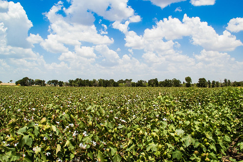
Elevation of Mesquite Ave, Rogers, TX, USA
Location: United States > Texas > Bell County > Rogers >
Longitude: -97.226661
Latitude: 30.9317263
Elevation: 165m / 541feet
Barometric Pressure: 99KPa
Related Photos:
Topographic Map of Mesquite Ave, Rogers, TX, USA
Find elevation by address:

Places near Mesquite Ave, Rogers, TX, USA:
Rogers
Val Verde
Buckholts
Farm To Market Road 1915
19999 Fm 2268
Donahoe Rd, Bartlett, TX, USA
FM, Buckholts, TX, USA
16194 Fm487
Holland
19125 Alligator Rd
FM, Rockdale, TX, USA
Granger Dam Rd, Granger, TX, USA
FM, Thorndale, TX, USA
Bartlett
Co Rd, Taylor, TX, USA
2400 Fm2268
55 Co Rd, Taylor, TX, USA
Granger
Main St, Schwertner, TX, USA
Schwertner
Recent Searches:
- Elevation of Corso Fratelli Cairoli, 35, Macerata MC, Italy
- Elevation of Tallevast Rd, Sarasota, FL, USA
- Elevation of 4th St E, Sonoma, CA, USA
- Elevation of Black Hollow Rd, Pennsdale, PA, USA
- Elevation of Oakland Ave, Williamsport, PA, USA
- Elevation of Pedrógão Grande, Portugal
- Elevation of Klee Dr, Martinsburg, WV, USA
- Elevation of Via Roma, Pieranica CR, Italy
- Elevation of Tavkvetili Mountain, Georgia
- Elevation of Hartfords Bluff Cir, Mt Pleasant, SC, USA


