Elevation of Kokomo, MS, USA
Location: United States > Mississippi >
Longitude: -90.002862
Latitude: 31.1974002
Elevation: 110m / 361feet
Barometric Pressure: 100KPa
Elevation Map:
Satellite Map:
Related Photos:

Red Bluff 4
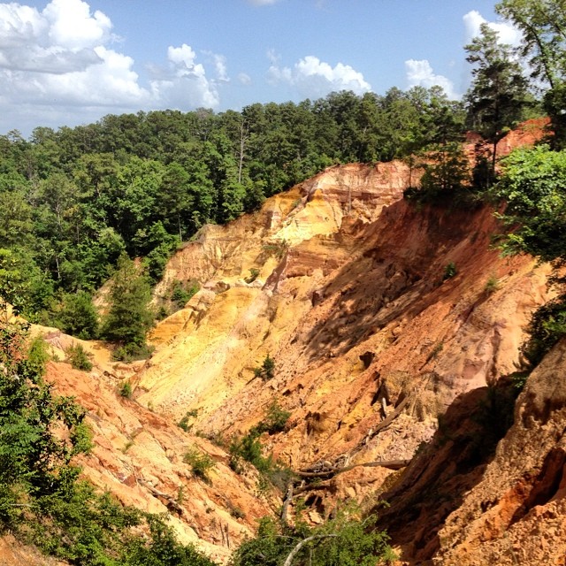
We went to a cool place for Father's Day! #redbluff #redbluffms #mississippisgrandcanyon

Soils at Red Bluff

Red Bluff

Robin Sled

Robin and Rachel sled!

at the bottom

Clear sky

Icy window

At my lil bro practice.
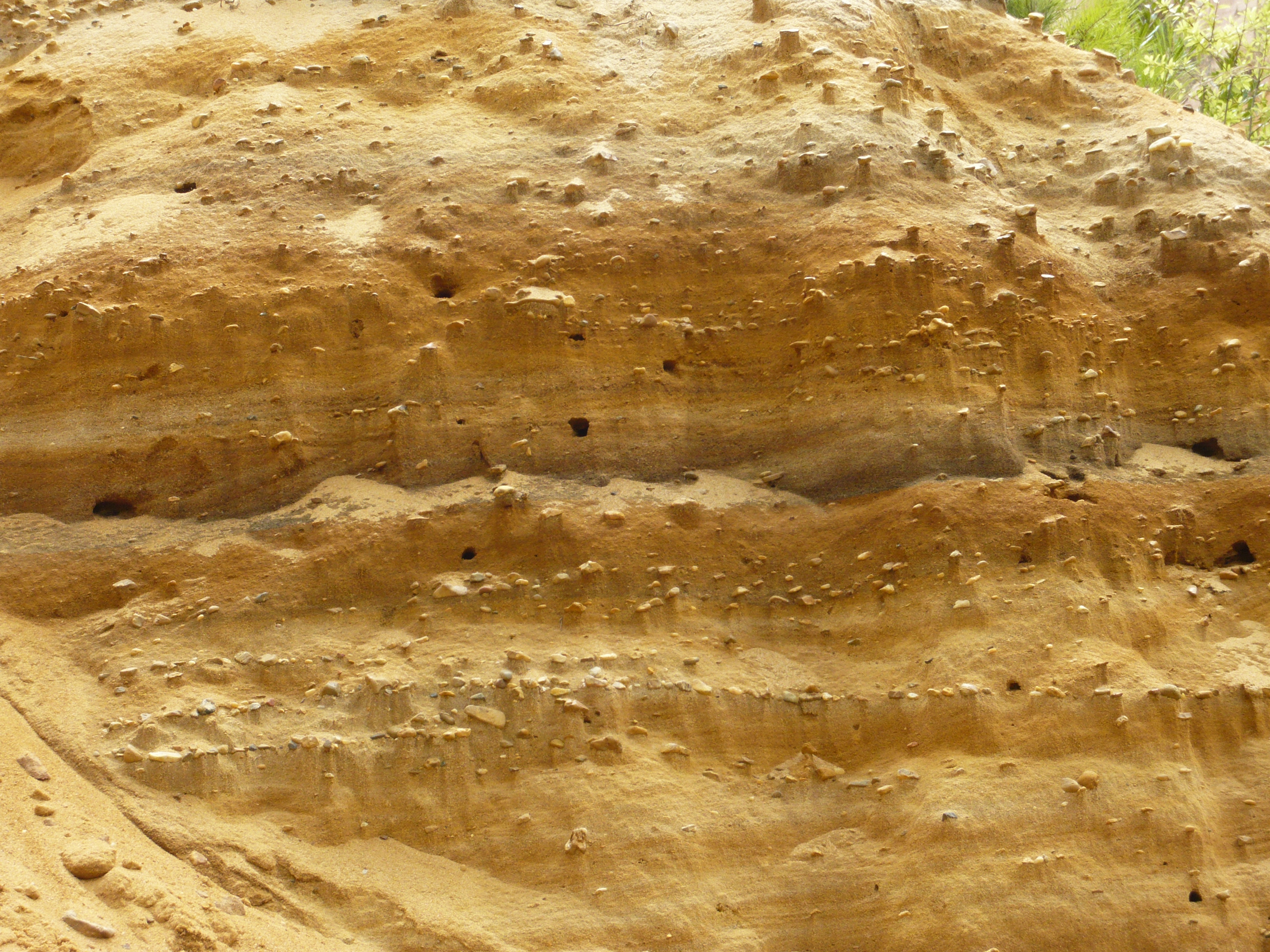
Little houses made of gravel

Red Bluff is 30 meters deep

Mississippi's Little Grand Canyon

better shot with robins camera
Topographic Map of Kokomo, MS, USA
Find elevation by address:

Places in Kokomo, MS, USA:
Places near Kokomo, MS, USA:
Kokomo, MS, USA
Mississippi 585
Knoxo Rd, Tylertown, MS, USA
201 Rushingtown Rd
129 Lowery Loop
MS-48 E, Tylertown, MS, USA
Walthall County
Tylertown
111 New Home Church Rd
Tilton
Tom Sistrunk Road
MS-, Jayess, MS, USA
Jayess
6, LA, USA
J S King Road
Robert Tynes Road
LA-25, Franklinton, LA, USA
325 Beartown Rd
Warren Way Road
Rutland Road
Recent Searches:
- Elevation of Corso Fratelli Cairoli, 35, Macerata MC, Italy
- Elevation of Tallevast Rd, Sarasota, FL, USA
- Elevation of 4th St E, Sonoma, CA, USA
- Elevation of Black Hollow Rd, Pennsdale, PA, USA
- Elevation of Oakland Ave, Williamsport, PA, USA
- Elevation of Pedrógão Grande, Portugal
- Elevation of Klee Dr, Martinsburg, WV, USA
- Elevation of Via Roma, Pieranica CR, Italy
- Elevation of Tavkvetili Mountain, Georgia
- Elevation of Hartfords Bluff Cir, Mt Pleasant, SC, USA