Elevation of Indian Route 40, Indian Rte 40, Sells, AZ, USA
Location: United States > Arizona > Pima County > Sells >
Longitude: -112.07689
Latitude: 32.4393208
Elevation: 574m / 1883feet
Barometric Pressure: 95KPa
Related Photos:

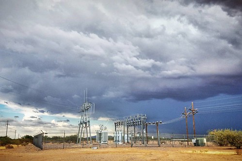
#atwork Santa Rosa #substation #electric #power #tohonooodhamutilityauthority #toua #tohonooodhamnation #landscape #clouds

Cruising in the middle of the desert…driving this nasty ass truck to Phoenix!I got these pumpkin empanadas but I can't eat them because I feel like my hands are tainted LOL (via @shots)
Topographic Map of Indian Route 40, Indian Rte 40, Sells, AZ, USA
Find elevation by address:

Places near Indian Route 40, Indian Rte 40, Sells, AZ, USA:
Indian Rte 34, Ajo, AZ, USA
Tohono St, Casa Grande, AZ, USA
AZ-84, Maricopa, AZ, USA
6870 S Bianco Rd
27534 W Cornman Rd
2724 S Sloane Rd
N Navajo Way, Stanfield, AZ, USA
Stanfield
18346 W Provo Rd
53862 W Barrel Rd
Arizona City, AZ, USA
Arizona City
W Santa Cruz Blvd, Queen Creek, AZ, USA
7815 N White And Parker Rd
12200 S Overfield Rd
8282 W Sandy Ln
E Williams Cir, Marana, AZ, USA
7575 W Battaglia Dr
Casa Grande
Cook E Jar Bakery & Cafe
Recent Searches:
- Elevation of Corso Fratelli Cairoli, 35, Macerata MC, Italy
- Elevation of Tallevast Rd, Sarasota, FL, USA
- Elevation of 4th St E, Sonoma, CA, USA
- Elevation of Black Hollow Rd, Pennsdale, PA, USA
- Elevation of Oakland Ave, Williamsport, PA, USA
- Elevation of Pedrógão Grande, Portugal
- Elevation of Klee Dr, Martinsburg, WV, USA
- Elevation of Via Roma, Pieranica CR, Italy
- Elevation of Tavkvetili Mountain, Georgia
- Elevation of Hartfords Bluff Cir, Mt Pleasant, SC, USA
