Elevation of Indian Institute of Technology, Mandi, Parashar Road, Tehsil Sadar, Near Kataula, Kamand Campus, Kamand, Himachal Pradesh, India
Location: India > Himachal Pradesh > Mandi >
Longitude: 76.9860747
Latitude: 31.7753998
Elevation: 1004m / 3294feet
Barometric Pressure: 90KPa
Elevation Map:
Satellite Map:
Related Photos:

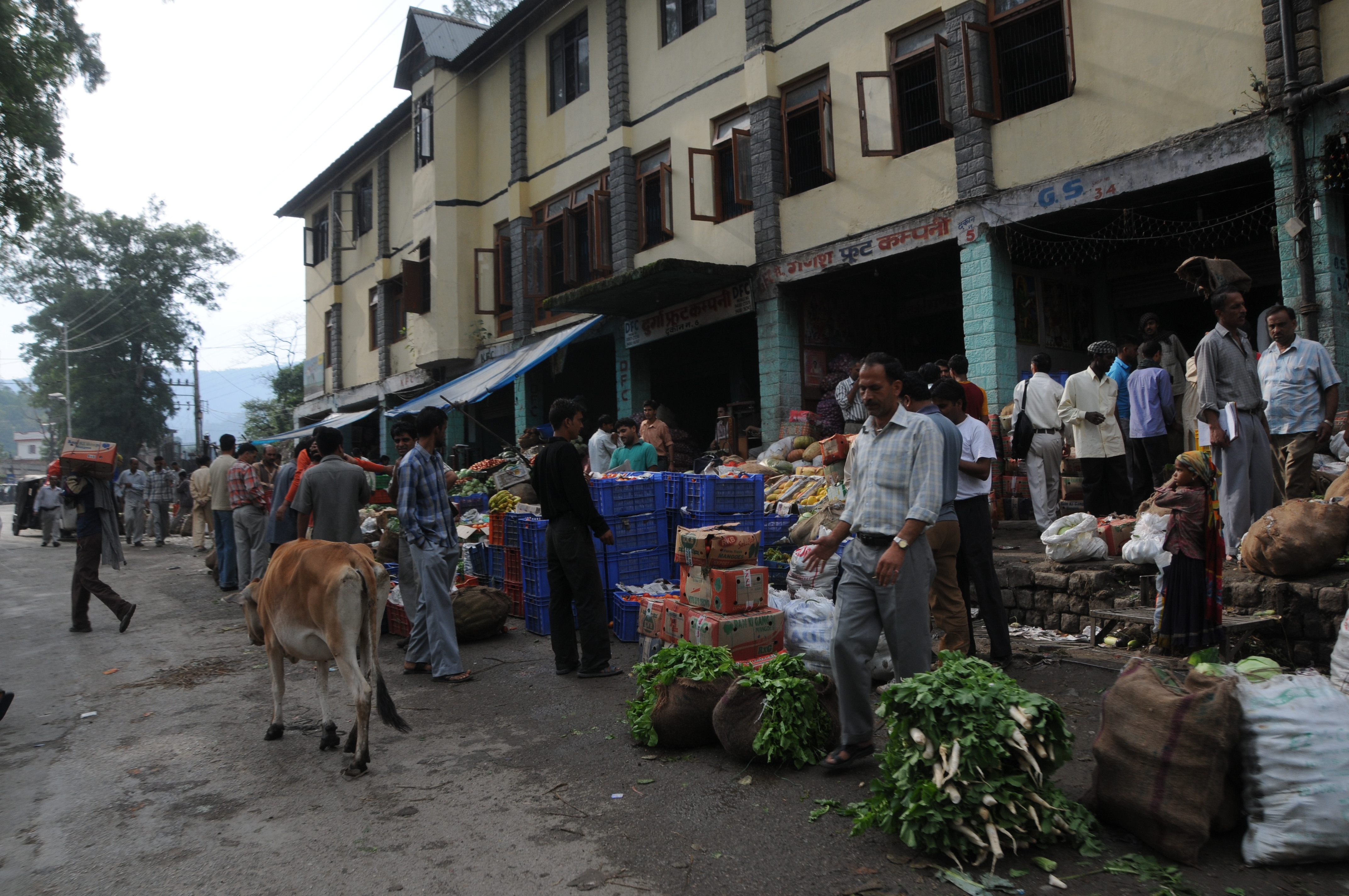
Assessing how Indian farmers manage climate and weather risks in India

Assessing how Indian farmers manage climate and weather risks in India

Assessing how Indian farmers manage climate and weather risks in India

Parashar Forest Dept Rest House at night

A hut with a view

Prime real estate

Prashar Lake first view

Hillock in front of the Prashar Lake

A house with a view

CSP_2190.JPG

City Above Clouds

Beas River Mandi - City view

View from Hanoogi Footbridge

Magnificient view when extra water from surge shaft is plunged down into Sutluj river from Slapper Power house of Pandoh dam! The Pandoh Dam is an embankment #dam on the #Beas River in #Mandi, #HimachalPradesh. © Lokesh Mehta Under the Beas

Parashar Lake - Aerial View

CSP_2193.JPG

CSP_2188.JPG

CSP_2192.JPG
CSP_2194.JPG

CSP_2189.JPG

CSP_2187.JPG

Parashar Lake, Mandi

Prashar Lake

A random temple on the trail

Govt rest houses from the lake

Prashar Lake and all the nearby constructions

The stream in the valley

The road head

Prashar valley
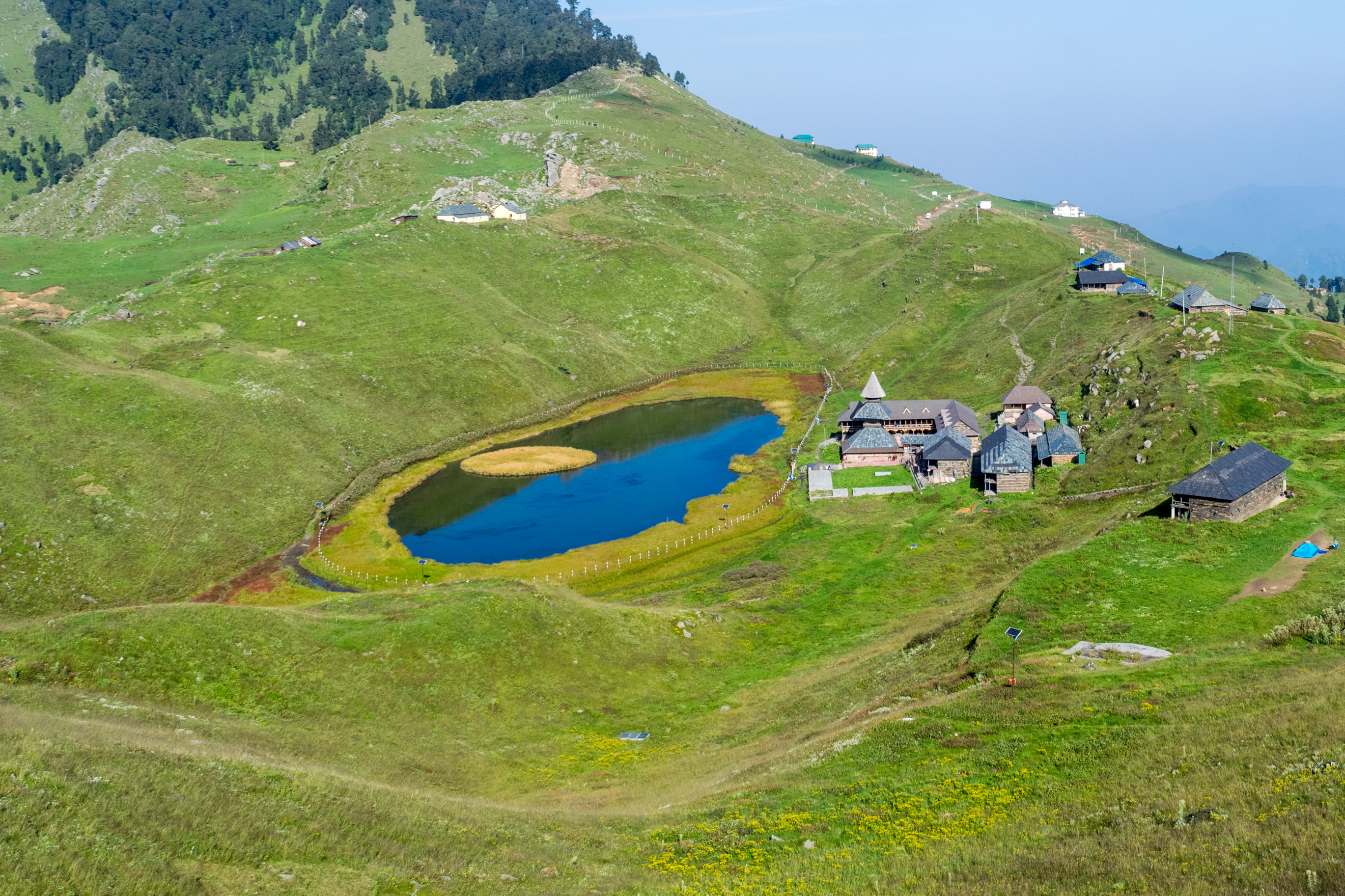
Prashar Lake from the hillock nearby

The stream at Bagi village

Hill slopes in the valley

Mandi: Beas River
Topographic Map of Indian Institute of Technology, Mandi, Parashar Road, Tehsil Sadar, Near Kataula, Kamand Campus, Kamand, Himachal Pradesh, India
Find elevation by address:

Places near Indian Institute of Technology, Mandi, Parashar Road, Tehsil Sadar, Near Kataula, Kamand Campus, Kamand, Himachal Pradesh, India:
Iit Mandi North Campus
Khanahr
Tihri
Mandi
Palace Colony
178/2/3
D.p.f. Parashar Dhar
Parashar Lake
Adi Brahma Temple, Rahla
D.p.f Narainpairu
Mandi
Talogi
Rewalsar
Kullu
Aut
Diyar
Harinagar
Sundernagar
Shiah
Gps Garsa
Recent Searches:
- Elevation of Corso Fratelli Cairoli, 35, Macerata MC, Italy
- Elevation of Tallevast Rd, Sarasota, FL, USA
- Elevation of 4th St E, Sonoma, CA, USA
- Elevation of Black Hollow Rd, Pennsdale, PA, USA
- Elevation of Oakland Ave, Williamsport, PA, USA
- Elevation of Pedrógão Grande, Portugal
- Elevation of Klee Dr, Martinsburg, WV, USA
- Elevation of Via Roma, Pieranica CR, Italy
- Elevation of Tavkvetili Mountain, Georgia
- Elevation of Hartfords Bluff Cir, Mt Pleasant, SC, USA