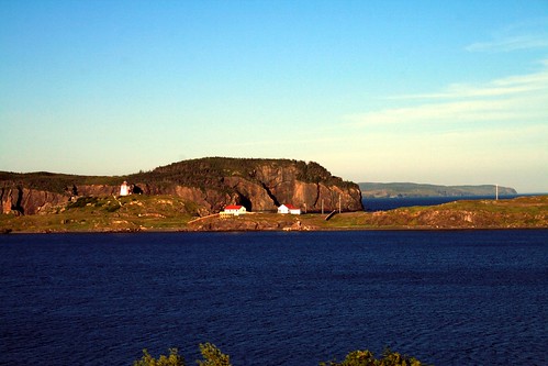
Elevation of Indian Bay, NL A0G, Canada
Location: Canada > Newfoundland And Labrador > Division No. 7 >
Longitude: -53.863604
Latitude: 49.037433
Elevation: 7m / 23feet
Barometric Pressure: 0KPa
Related Photos:
Topographic Map of Indian Bay, NL A0G, Canada
Find elevation by address:

Places near Indian Bay, NL A0G, Canada:
J. W. Pickersgill Blvd, Centreville-Wareham-Trinity, NL A0G 4P0, Canada
Centreville-wareham-trinity
25 Sturges Ln, Badger's Quay, NL A0G 1B0, Canada
Valleyfield
Greenspond
56 Main St, Greenspond, NL A0G 2N0, Canada
New-wes-valley
Wesleyville
Hwy 26, Wesleyville, NL A0G 4R0, Canada
71 NL-, Templeman, NL A0G 4G0, Canada
Templeman
N Side Rd, Saint Chads, NL A0G 3W0, Canada
Barbour Living Heritage Village
Eastport
13 Hwy, Saint Chads, NL A0G 3W0, Canada
79 Sandy Cove Rd, Salvage, NL A0G 3X0, Canada
17 Loop Rd, Eastport, NL A0G 1Z0, Canada
Salvage
Terra Nova National Park
Portland
Recent Searches:
- Elevation map of Greenland, Greenland
- Elevation of Sullivan Hill, New York, New York, 10002, USA
- Elevation of Morehead Road, Withrow Downs, Charlotte, Mecklenburg County, North Carolina, 28262, USA
- Elevation of 2800, Morehead Road, Withrow Downs, Charlotte, Mecklenburg County, North Carolina, 28262, USA
- Elevation of Yangbi Yi Autonomous County, Yunnan, China
- Elevation of Pingpo, Yangbi Yi Autonomous County, Yunnan, China
- Elevation of Mount Malong, Pingpo, Yangbi Yi Autonomous County, Yunnan, China
- Elevation map of Yongping County, Yunnan, China
- Elevation of North 8th Street, Palatka, Putnam County, Florida, 32177, USA
- Elevation of 107, Big Apple Road, East Palatka, Putnam County, Florida, 32131, USA
- Elevation of Jiezi, Chongzhou City, Sichuan, China
- Elevation of Chongzhou City, Sichuan, China
- Elevation of Huaiyuan, Chongzhou City, Sichuan, China
- Elevation of Qingxia, Chengdu, Sichuan, China
- Elevation of Corso Fratelli Cairoli, 35, Macerata MC, Italy
- Elevation of Tallevast Rd, Sarasota, FL, USA
- Elevation of 4th St E, Sonoma, CA, USA
- Elevation of Black Hollow Rd, Pennsdale, PA, USA
- Elevation of Oakland Ave, Williamsport, PA, USA
- Elevation of Pedrógão Grande, Portugal


