Elevation of Ideal St, Belle Rose, LA, USA
Location: United States > Louisiana > Assumption Parish > > Belle Rose >
Longitude: -91.045261
Latitude: 29.9960059
Elevation: 4m / 13feet
Barometric Pressure: 101KPa
Elevation Map:
Satellite Map:
Related Photos:

Houmas House

Looper filming location

lean-flight-11-19-2015-8055

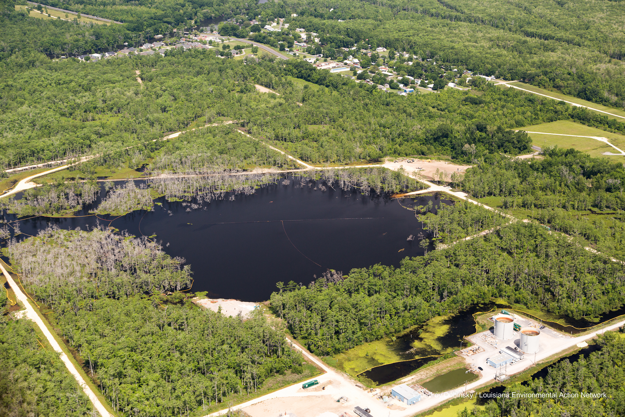
Bayou Corne Sinkhole

Bayou Corne Sinkhole

lean-flight-11-19-2015-8078

New Pad - Bayou Corne Sinkhole

Bayou Corne Sinkhole Aerial Images 6-21-13LEAN045400005506211306212013

St. Amico Chapel, Donaldsonville, LA.

Bayou Corne Sinkhole Aerial Images 6-21-13LEAN052900012806211306212013

Bayou Corne Sinkhole Aerial Images 6-21-13LEAN049500009606211306212013

Bayou Corne Sinkhole Aerial Images 6-21-13LEAN053000012906211306212013

Bayou Corne Sinkhole

Bayou Corne Sinkhole Aerial Images Brine Tanks 6-21-13LEAN043200003306211306212013
lmrk-lean-flight--flickr-5-2-14-0026

lmrk-lean-flight--flickr-5-2-14-0035

lmrk-lean-flight--flickr-5-2-14-0022

lmrk-lean-flight--flickr-5-2-14-0030

Bayou Corne Sinkhole and Community Aerial Images 6-21-13LEAN043400003506211306212013

lmrk-lean-flight--flickr-5-2-14-0039

lmrk-lean-flight--flickr-5-2-14-0021

lmrk-lean-flight--flickr-5-2-14-0037
Topographic Map of Ideal St, Belle Rose, LA, USA
Find elevation by address:

Places near Ideal St, Belle Rose, LA, USA:
5935 La-308
5541 La-1
LA-, Napoleonville, LA, USA
6701 La-1
Louisiana 1
LA-, Napoleonville, LA, USA
Belle Rose
Napoleonville
1, LA, USA
2, LA, USA
5, LA, USA
8103 Mt Calvary St
Communi St, St James, LA, USA
St James Co-Op St, St James, LA, USA
LA-18, St James, LA, USA
Saint James
7650 La-44
Convent
Trudeau Street
St. James Parish
Recent Searches:
- Elevation of Corso Fratelli Cairoli, 35, Macerata MC, Italy
- Elevation of Tallevast Rd, Sarasota, FL, USA
- Elevation of 4th St E, Sonoma, CA, USA
- Elevation of Black Hollow Rd, Pennsdale, PA, USA
- Elevation of Oakland Ave, Williamsport, PA, USA
- Elevation of Pedrógão Grande, Portugal
- Elevation of Klee Dr, Martinsburg, WV, USA
- Elevation of Via Roma, Pieranica CR, Italy
- Elevation of Tavkvetili Mountain, Georgia
- Elevation of Hartfords Bluff Cir, Mt Pleasant, SC, USA