Elevation of HaTamar St 9, קרני שומרון
Longitude: 35.0801057
Latitude: 32.1694599
Elevation: 305m / 1001feet
Barometric Pressure: 98KPa
Elevation Map:
Satellite Map:
Related Photos:

View from old train station

Nablus Panoramic

The old house on the hill III

My view from my desk

Antipatris. The old caravansary possibly from the days of Paul

Ras el-Ain. Source of the Auji showing the old caravansary of Antipatris

Antipatris (Tel Afek)

The old house on the hill II
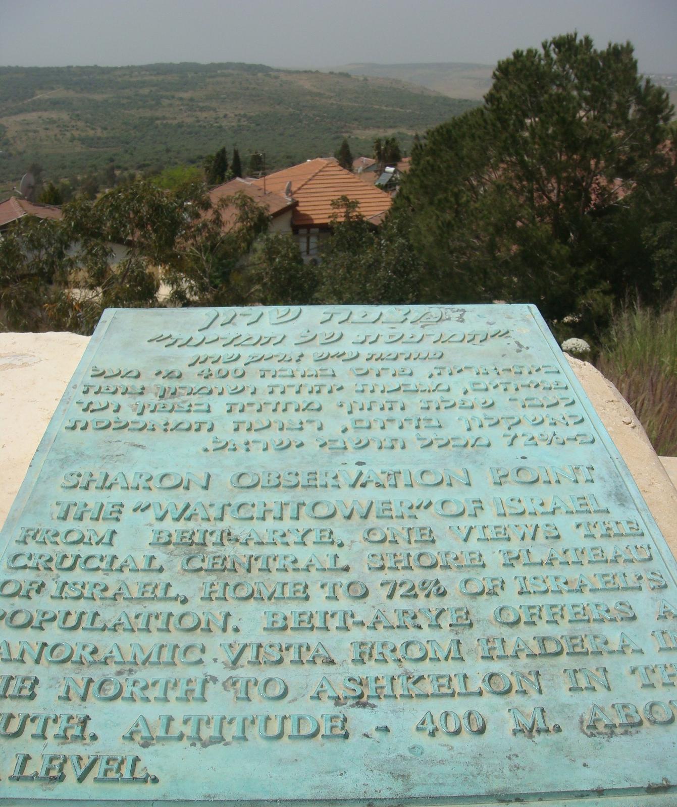
Observation point in Bet Arieh

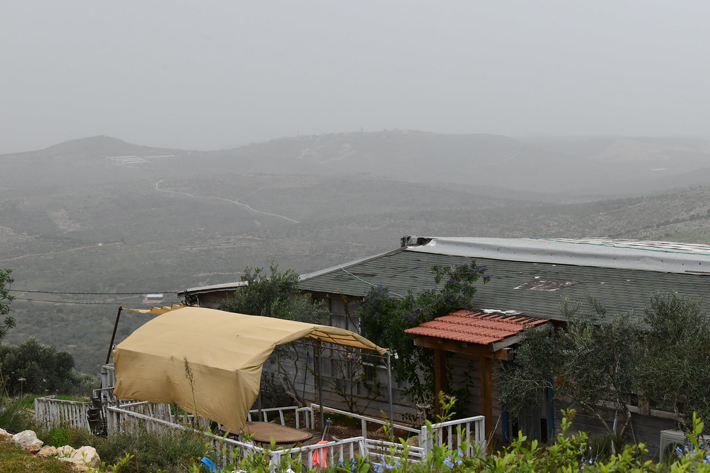
Day 4h - another view of the Israeli settlement
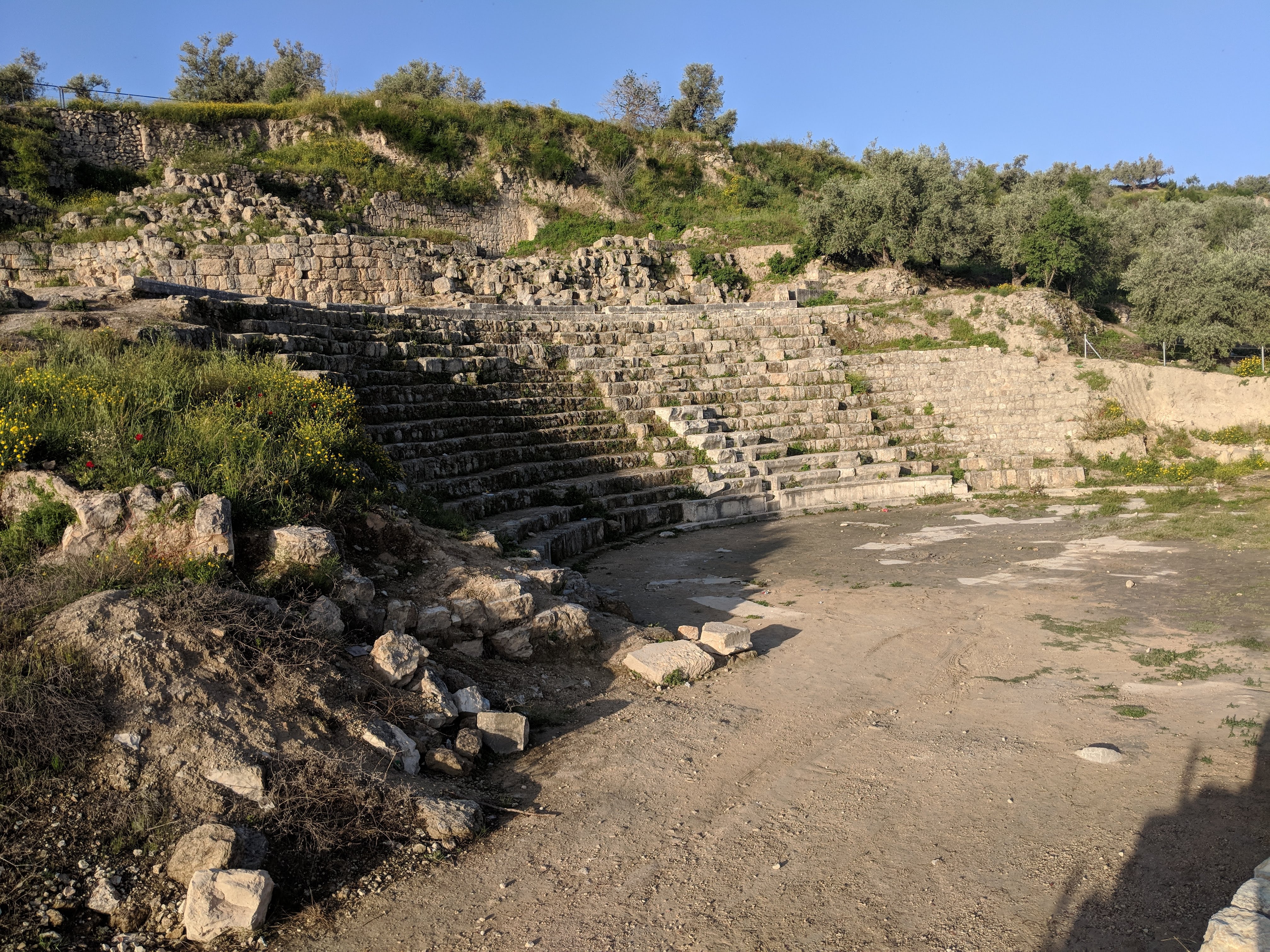
Day 4d - view of Sebastia's amphitheater
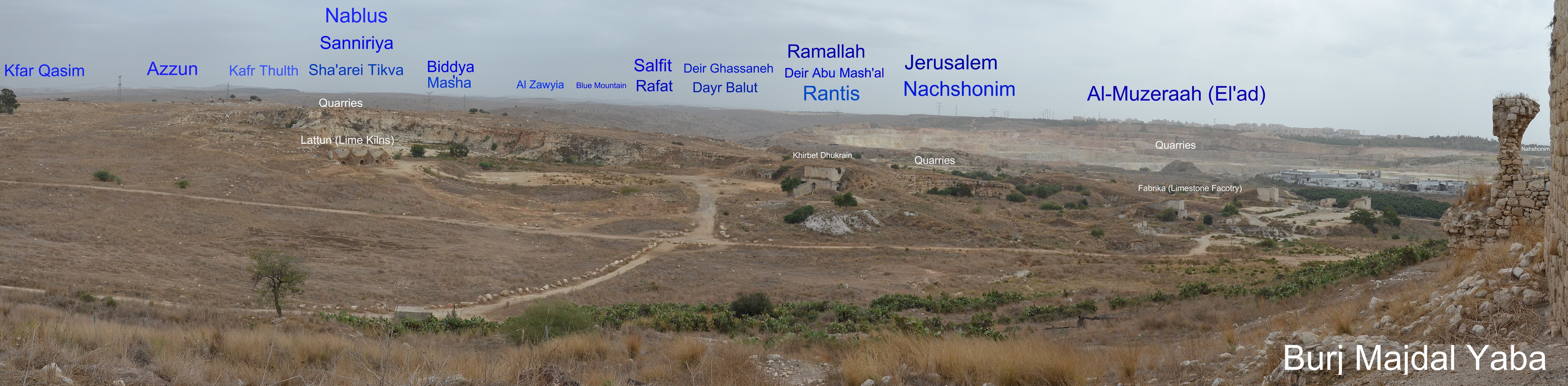
Majdal Yaba South East

Yehonathan lookout in Maalé Hemed
Yehonathan lookout in Maale Hemed

View from Ir David

The old house on the hill

Lonely Tree in Yizhar I ●S95●

130704 Nablus

Sebastia's Green Landscape (PS)

Gal - April 2014

Looking N over Theatre

מבצר אנטיפטרוס

מבצר אנטיפטריס ומקורות הירקון

Sebastiye E4070240_61

Sebastiye E4070230_51

Ruins IV

Ruins I

Ruins VII

Jerusalem, July 2013

@ Kfar Saba, the park.

.

@ Kfar Saba, the park.

Sheikh Musharraf

Land of Honey
Topographic Map of HaTamar St 9, קרני שומרון
Find elevation by address:

Places near HaTamar St 9, קרני שומרון:
Karnei Shomron
Sal'it
Karmel
Kefar Sava
מדרחוב
Tel Mond
Brenner St 5
Ahuza St 88
Tel Khai St 19
Ra'anana
Ehud Manor Street
Hasharon
Pardesiya
Arik Lavi
Jo Amar Street
Hatkuma St 7
Hof Hasharon
Nude Beach
Netanya
Recent Searches:
- Elevation of Corso Fratelli Cairoli, 35, Macerata MC, Italy
- Elevation of Tallevast Rd, Sarasota, FL, USA
- Elevation of 4th St E, Sonoma, CA, USA
- Elevation of Black Hollow Rd, Pennsdale, PA, USA
- Elevation of Oakland Ave, Williamsport, PA, USA
- Elevation of Pedrógão Grande, Portugal
- Elevation of Klee Dr, Martinsburg, WV, USA
- Elevation of Via Roma, Pieranica CR, Italy
- Elevation of Tavkvetili Mountain, Georgia
- Elevation of Hartfords Bluff Cir, Mt Pleasant, SC, USA