Elevation of GA-, Du Pont, GA, USA
Location: United States > Georgia > Echols County >
Longitude: -82.85098
Latitude: 30.8233498
Elevation: 48m / 157feet
Barometric Pressure: 101KPa
Elevation Map:
Satellite Map:
Related Photos:
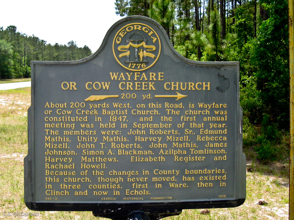
Cow Creek Church
Topographic Map of GA-, Du Pont, GA, USA
Find elevation by address:

Places near GA-, Du Pont, GA, USA:
Haylow Tarver Rd, Du Pont, GA, USA
82 Withers Rd, Du Pont, GA, USA
Echols County
Bird Sand Hill
NE 20th Loop, Jasper, FL, USA
11247 Ne 41st Terrace
11249 Ne 41st Terrace
11249 Ne 41st Terrace
11245 Ne 41st Terrace
11237 Ne 41st Terrace
11237 Ne 41st Terrace
Fargo
County Road 6
Jasper
4466 Us-41
US-41, Jasper, FL, USA
Hamilton County
Co Rd, Jasper, FL, USA
Southeast 69th Boulevard
Northeast Benton Road
Recent Searches:
- Elevation of Corso Fratelli Cairoli, 35, Macerata MC, Italy
- Elevation of Tallevast Rd, Sarasota, FL, USA
- Elevation of 4th St E, Sonoma, CA, USA
- Elevation of Black Hollow Rd, Pennsdale, PA, USA
- Elevation of Oakland Ave, Williamsport, PA, USA
- Elevation of Pedrógão Grande, Portugal
- Elevation of Klee Dr, Martinsburg, WV, USA
- Elevation of Via Roma, Pieranica CR, Italy
- Elevation of Tavkvetili Mountain, Georgia
- Elevation of Hartfords Bluff Cir, Mt Pleasant, SC, USA