Elevation map of French Southern and Antarctic Lands

Longitude: 69.348557

Latitude: -49.280366

Elevation: 284m / 932feet

Barometric Pressure: 98KPa

Elevation Map:

elevation map of French Southern and Antarctic Lands

Satellite Map:

Satellite map of French Southern and Antarctic Lands

Related Photos:

earth is flat oblate spheroid pseudoscientific cosmologies experiments bedford level globus cruciger mappemonde disc cosmography berlin museum island prussian cultural heritage foundation hughes experiment homemade believe believing believed worth endeavor
Flat Earth Society...Hughes would ever lift himself off....World was aid out or made flat...Earth is flat and square, and the sky is a round canopy; they did not succeed in conceiving the possibility of the antipodes.
clouds nasa iss
Wave Clouds Near Île aux Cochons, Southern Indian Ocean
flag australia bandeiras oceania austrália
Australia / Austrália
libraryofcongress loc capitolhill unitedstatesofamerica unitedstates us dc washington usa america book books publication publications architecture building buildings washingtondc capital capitals beauxartsstyle beauxarts landmark landmarks collection collections districtofcolumbia district districts uscongress congress columbia library libraries beauty stunning thomasjefferson thomasjeffersonbuilding jeffersonbuilding northwestpavillion northwest pavillion pavilionofthediscoverers discoverers 1507waldseemüllerworldmap 1507 martinwaldseemüller worldmap world map pauljpelz johnlsmithmeyer edwardpearcecasey dmv
Western Hemisphere of 1507 Waldseemüller World Map
libraryofcongress loc capitolhill unitedstatesofamerica unitedstates us dc washington usa america book books publication publications architecture building buildings washingtondc capital capitals beauxartsstyle beauxarts landmark landmarks collection collections districtofcolumbia district districts uscongress congress columbia library libraries beauty stunning thomasjefferson thomasjeffersonbuilding jeffersonbuilding northwestpavillion northwest pavillion pavilionofthediscoverers discoverers 1507waldseemüllerworldmap 1507 martinwaldseemüller worldmap world map pauljpelz johnlsmithmeyer edwardpearcecasey dmv
Close-Up of South America on 1507 Waldseemüller World Map
africa nasa stratovolcano penguincolony waveclouds kingpenguin internationalspacestation ileauxcochons stationscience crewearthobservation southernindianocean stationresearch isleofpigs crozetarchipelago
Wave Clouds Over Southern Indian Ocean (NASA, International Space Station, 03/25/12)
africa indianocean nasa madagascar mozambique atoll internationalspacestation bassasdaindia stationscience crewearthobservation stationresearch
Bassas da India (NASA, International Space Station, 04/12/11)
peru sirclementsmarkham royalgeographicalsociety richardiii franklinsfootsteps thelandsofsilencecompletedbyfhhguillemard theincasofperu thestoryofminorcaandmajorca richardiiihislifeandcharacter thepaladinsofedwinthegreat majorjamesrennelandtheriseofmodernenglishgeography thehistoryofperu thelifeofchristophercolumbus thelifeofjohndavisthenavigator thefightingveres lifeofrobertfairfaxofsteetonviceadmiral theseafathers thewarbetweenperuandchile anarrativeofthelifeofadmiraljohnmarkham thevoyagesofwilliambaffin1612–1622 peruvianbark amemoiroftheindiansurveys narrativeofthemissionofgeorgebogletotibet thethresholdoftheunknownregions generalsketchofthehistoryofpersia thecountessofchinchonandthecinchonagenus ollantaanancientyncadrama ahistoryoftheabyssinianexpedition alifeofthegreatlordfairfax contributiontowardagrammaranddictionaryofquichua travelsinperuandindia cuzcoandlima hmsalert sirjohnfranklin franklin stillingfleet frankln egypt egyptians
Sir Clements Robert Markham K.C.B., F.R.S., (1830-1916) - Secretary of the Royal Geographical Society by Frederick William Pomeroy R.A. - erected by the Government of Peru on the front of the Society's Headquarters Building in Kensington Gore, London SW7
libraryofcongress loc capitolhill unitedstatesofamerica unitedstates us dc washington usa america book books publication publications architecture building buildings washingtondc capital capitals beauxartsstyle beauxarts landmark landmarks collection collections districtofcolumbia district districts uscongress congress columbia library libraries beauty stunning thomasjefferson thomasjeffersonbuilding jeffersonbuilding northwestpavillion northwest pavillion pavilionofthediscoverers discoverers 1507waldseemüllerworldmap 1507 martinwaldseemüller worldmap world map pauljpelz johnlsmithmeyer edwardpearcecasey dmv
1507 Waldseemüller World Map
bldigital date1899 pubplacelondon publicdomain sysnum000495551 brownrobertmaphd medium vol01 page148 map wp:bookspage=anthropologyandethnology georefphase2 sherlocknet:tag=stream sherlocknet:tag=france sherlocknet:tag=island sherlocknet:tag=land sherlocknet:tag=state sherlocknet:tag=lake sherlocknet:tag=premier sherlocknet:tag=grand sherlocknet:tag=place sherlocknet:tag=geology sherlocknet:tag=interest sherlocknet:tag=upper sherlocknet:tag=stone sherlocknet:tag=certain sherlocknet:tag=pass sherlocknet:category=organism geo:osmscale=12 geo:continent=null geo:country=fr geo:country=franceterresaustralesetantarctiquesfrançaisesîlessaintpauletnouvelleamsterdamîlenouvelleamsterdameauxterritoriales geo:state=frenchsouthernandantarcticlands geo:county=saintpaulandnewamsterdamislands hasgeoref
British Library digitised image from page 148 of "Our Earth and its Story: a popular treatise on physical geography. Edited by R. Brown. With ... coloured plates and maps, etc"
libraryofcongress loc capitolhill unitedstatesofamerica unitedstates us dc washington usa america book books publication publications architecture building buildings washingtondc capital capitals beauxartsstyle beauxarts landmark landmarks collection collections districtofcolumbia district districts uscongress congress columbia library libraries beauty stunning thomasjefferson thomasjeffersonbuilding jeffersonbuilding northwestpavillion northwest pavillion pavilionofthediscoverers discoverers 1507waldseemüllerworldmap 1507 martinwaldseemüller worldmap world map pauljpelz johnlsmithmeyer edwardpearcecasey dmv
View of 1507 Waldseemüller World Map
libraryofcongress loc capitolhill unitedstatesofamerica unitedstates us dc washington usa america book books publication publications architecture building buildings washingtondc capital capitals beauxartsstyle beauxarts landmark landmarks collection collections districtofcolumbia district districts uscongress congress columbia library libraries beauty stunning thomasjefferson thomasjeffersonbuilding jeffersonbuilding northwestpavillion northwest pavillion pavilionofthediscoverers discoverers 1507waldseemüllerworldmap 1507 martinwaldseemüller worldmap world map pauljpelz johnlsmithmeyer edwardpearcecasey dmv
First Mention of America on 1507 Waldseemüller World Map
bldigital date1850 pubplacelondon publicdomain sysnum002683469 nunnjohnofharwich large vol0 page26 mechanicalcurator imagesfrombook002683469 imagesfromvolume0026834690 map wp:bookspage=arctic georefphase2 sherlocknet:tag=france sherlocknet:tag=depart sherlocknet:tag=point sherlocknet:tag=fort sherlocknet:tag=pass sherlocknet:tag=english sherlocknet:tag=coast sherlocknet:tag=product sherlocknet:tag=southern sherlocknet:tag=name sherlocknet:tag=sans sherlocknet:tag=region sherlocknet:tag=period sherlocknet:tag=england sherlocknet:tag=consider sherlocknet:tag=ancient sherlocknet:tag=vent sherlocknet:category=maps hasgeoref geo:osmscale=7 geo:continent=null geo:country=fr geo:country=franceterresaustralesetantarctiquesfrançaisesîleskergueleneauxterritoriales geo:state=frenchsouthernandantarcticlands geo:county=kerguelenarchipelago
British Library digitised image from page 26 of "Narrative of the Wreck of the 'Favourite' on the Island of Desolation: detailing the adventures, sufferings and privations of J. Nunn, an historical account of the Island, and its whale and seal fisheries.
bldigital date1893 pubplacelondon publicdomain sysnum000024943 large vol0 page130 mechanicalcurator imagesfrombook000024943 imagesfromvolume0000249430 map rotated wp:bookspage=navigation georefphase2 hasgeoref geo:osmscale=7 geo:continent=null geo:country=tf geo:country=frenchsouthernlands geo:state=frenchsouthernandantarcticlands sherlocknet:tag=certain sherlocknet:tag=number sherlocknet:tag=whole sherlocknet:tag=point sherlocknet:tag=term sherlocknet:tag=differ sherlocknet:tag=land sherlocknet:tag=complete sherlocknet:tag=side sherlocknet:tag=western sherlocknet:tag=eastern sherlocknet:tag=european sherlocknet:tag=right sherlocknet:tag=district sherlocknet:tag=square sherlocknet:category=maps
British Library digitised image from page 130 of "Sailing Directions for the Southern Coast of Africa, comprised between Table Bay and Delagoa Bay, also for Prince Edward and Crozet Islands"
bldigital date1866 pubplacelondon publicdomain sysnum003165228 rosserwilliamhenryandimrayjamesfrederick large vol0 page591 mechanicalcurator imagesfrombook003165228 imagesfromvolume0031652280 map rotated wp:bookspage=synopticindexthematic georefphase2 hasgeoref geo:osmscale=7 geo:continent=europe geo:country=fr geo:country=france geo:state=frenchsouthernandantarcticlands sherlocknet:tag=island sherlocknet:tag=country sherlocknet:tag=mile sherlocknet:tag=side sherlocknet:tag=year sherlocknet:tag=differ sherlocknet:tag=place sherlocknet:tag=rock sherlocknet:tag=open sherlocknet:tag=house sherlocknet:tag=number sherlocknet:tag=chap sherlocknet:tag=trait sherlocknet:tag=france sherlocknet:tag=english sherlocknet:category=maps
British Library digitised image from page 591 of "Indian Ocean Directory. The Seaman's Guide to the Navigation of the Indian Ocean, including ... sailing directions for the principal ports on the South and East Coasts of Africa, ... together with a full a
bookcentury1900 bookdecade1910 bookyear1918 bookidseventhcontinent00wrig bookauthorwrighthelenshelensaundersb1874 bookpublisherbostonrgbadger bookcontributorthelibraryofcongress bookcollectionamericana booksponsorthelibraryofcongress bookleafnumber6 bookcollectionlibraryofcongress
Image from page 6 of "The seventh continent; a history of the discovery and explorations of Antarctica" (1918)
bldigital date1866 pubplacelondon publicdomain sysnum003165228 rosserwilliamhenryandimrayjamesfrederick large vol0 page604 mechanicalcurator imagesfrombook003165228 imagesfromvolume0031652280 map otherhalf:pair=1107301989511072206104 lefthalf wp:bookspage=synopticindexthematic georefphase2 sherlocknet:tag=asia sherlocknet:tag=import sherlocknet:tag=mountain sherlocknet:tag=western sherlocknet:tag=coast sherlocknet:tag=country sherlocknet:tag=form sherlocknet:tag=mile sherlocknet:tag=christian sherlocknet:tag=history sherlocknet:tag=land sherlocknet:tag=ancient sherlocknet:tag=state sherlocknet:tag=chapter sherlocknet:tag=water sherlocknet:tag=southern sherlocknet:tag=name sherlocknet:tag=district sherlocknet:category=maps hasgeoref geo:osmscale=7 geo:continent=null geo:country=fr geo:country=franceterresaustralesetantarctiquesfrançaisesîleskergueleneauxterritoriales geo:state=frenchsouthernandantarcticlands geo:county=kerguelenarchipelago
British Library digitised image from page 604 of "Indian Ocean Directory. The Seaman's Guide to the Navigation of the Indian Ocean, including ... sailing directions for the principal ports on the South and East Coasts of Africa, ... together with a full a
bldigital date1861 pubplacewien publicdomain sysnum003274864 scherzercarlvon large vol01 page309 mechanicalcurator imagesfrombook003274864 imagesfromvolume00327486401 map wp:bookspage=worldvoyagesandtravel hasgeoref georefphase2 geo:osmscale=13 geo:continent=null geo:country=fr geo:country=franceterresaustralesetantarctiquesfrançaisessaintpauletamsterdameauxterritoriales geo:state=frenchsouthernandantarcticlands geo:county=saintpauletamsterdam sherlocknet:tag=differ sherlocknet:tag=specie sherlocknet:tag=form sherlocknet:tag=origin sherlocknet:tag=period sherlocknet:tag=numeric sherlocknet:tag=water sherlocknet:tag=whole sherlocknet:tag=nature sherlocknet:tag=wild sherlocknet:tag=vegetate sherlocknet:tag=geology sherlocknet:tag=animal sherlocknet:tag=crater sherlocknet:tag=individual sherlocknet:tag=particular sherlocknet:tag=antwerp sherlocknet:category=diagrams
British Library digitised image from page 309 of "Reise der österreichischen Fregatte Novara um die Erde in den Jahren 1857-1859 unter den Befehlen des Commodore B. von Wüllerstorf-Urbair. (Physikalische und geognostische Erinnerungen von A. v. Humboldt.)
bldigital date1868 pubplaceparis publicdomain sysnum003055017 reclusélisée large vol01 page771 mechanicalcurator imagesfrombook003055017 imagesfromvolume00305501701 map wp:bookspage=anthropologyandethnology georefphase2 hasgeoref geo:osmscale=13 geo:continent=null geo:country=fr geo:country=franceterresaustralesetantarctiquesfrançaisessaintpauletamsterdameauxterritoriales geo:state=frenchsouthernandantarcticlands geo:county=saintpauletamsterdam sherlocknet:tag=water sherlocknet:tag=island sherlocknet:tag=western sherlocknet:tag=erupt sherlocknet:tag=european sherlocknet:tag=form sherlocknet:tag=upper sherlocknet:tag=black sherlocknet:tag=nature sherlocknet:tag=rise sherlocknet:tag=metal sherlocknet:tag=coast sherlocknet:tag=cone sherlocknet:tag=right sherlocknet:tag=fort sherlocknet:tag=crater sherlocknet:category=maps
British Library digitised image from page 771 of "La Terre: description des phénomènes de la vie du globe. I. Les Continents. II. L'Ocean, l'Atmosphere, la Vie"
TOPSHOTS-FRANCE-OVERSEAS-DIPLOMACY
bldigital date1878 pubplacelondon publicdomain sysnum003055004 reclusélisée large vol14 page86 mechanicalcurator imagesfrombook003055004 imagesfromvolume00305500414 map wp:bookspage=geography georefphase2 sherlocknet:tag=region sherlocknet:tag=mile sherlocknet:tag=import sherlocknet:tag=chief sherlocknet:tag=place sherlocknet:tag=southern sherlocknet:tag=square sherlocknet:tag=scale sherlocknet:tag=european sherlocknet:tag=water sherlocknet:tag=district sherlocknet:tag=island sherlocknet:tag=town sherlocknet:tag=numeric sherlocknet:tag=populate sherlocknet:tag=land sherlocknet:tag=port sherlocknet:category=maps hasgeoref geo:osmscale=13 geo:continent=null geo:country=fr geo:country=franceterresaustralesetantarctiquesfrançaisesîlessaintpauletnouvelleamsterdamîlenouvelleamsterdameauxterritoriales geo:state=frenchsouthernandantarcticlands geo:county=saintpaulandnewamsterdamislands
British Library digitised image from page 86 of "The Earth and its Inhabitants. The European section of the Universal Geography by E. Reclus. Edited by E. G. Ravenstein. Illustrated by ... engravings and maps"
pictures ocean friends sea summer vacation sky brown mountain lake mountains reflection green beach water pool pine clouds trekking walking asian volcano sand nikon asia stream heaven flood philippines hill surreal pinetrees hdr lanscape lahar mountainrange zambales volcanoeruption seawater tomasito devastating beautifullandscape stunninglandscape nikond90 vacationinphilippines anawangincove zambalesphilippines anawanginbeach jtnoriega besttouristspotphilippines anawanginzambalesphilippines philippinestouristspots itsmorefuninthephilippines bestsummervacationphilippines vacationpackageszambales
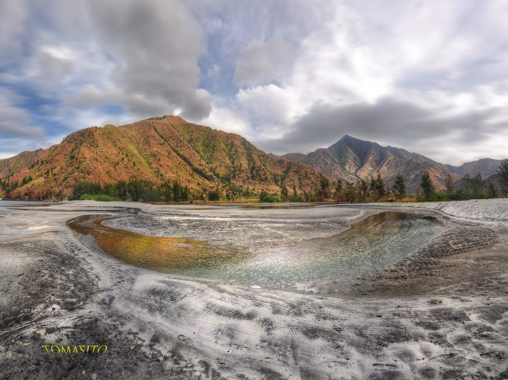
Anawangin Zambales Philippines
longexposure usa sun green art texture love water beautiful rain clouds canon painting landscape photography 1 moss nikon rocks asia stream flickr image cloudy photos hiking unique streetsign fineart tripod philippines picture surreal images explore stop waterfalls getty albumcover movies winds hdr travelers happynewyear hikingtrail waterscape noriega tomasito amercia d90 vacationphotos mostbeautifulplaceonearth beautifulphoto greatphotograph 500px nikond90 manualblending touristspotphilippines mostbeautifulphoto drnoriega jtnoriegathomas touristspotasia
No Entry Into Paradise
mer terre océan océanaustral antarctique embarquement pêche légine palangrier dissostichus sea island archipelago southernocean antarctica subantarcticisland frenchsouthernandantarcticlands îlesubantarctique archipel kerguelen crozet taaf terresaustralesetantarctiquesfrançaises bateau navire boat vessel fishing longliner longline palangre toothfish copec simonfournier australes
Base Alfred Faure, Crozet
mer terre océan océanaustral antarctique embarquement pêche légine palangrier dissostichus sea island archipelago southernocean antarctica subantarcticisland frenchsouthernandantarcticlands îlesubantarctique archipel kerguelen crozet taaf terresaustralesetantarctiquesfrançaises bateau navire boat vessel fishing longliner longline palangre toothfish copec simonfournier australes
Baie du Morbihan
mer terre océan océanaustral antarctique embarquement pêche légine palangrier dissostichus sea island archipelago southernocean antarctica subantarcticisland frenchsouthernandantarcticlands îlesubantarctique archipel kerguelen crozet taaf terresaustralesetantarctiquesfrançaises bateau navire boat vessel fishing longliner longline palangre toothfish copec simonfournier australes
Mont Ross en toile de fond, Kerguelen
mer terre océan océanaustral antarctique embarquement pêche légine palangrier dissostichus sea island archipelago southernocean antarctica subantarcticisland frenchsouthernandantarcticlands îlesubantarctique archipel kerguelen crozet taaf terresaustralesetantarctiquesfrançaises bateau navire boat vessel fishing longliner longline palangre toothfish copec simonfournier australes
Le bonheur est dans le pré
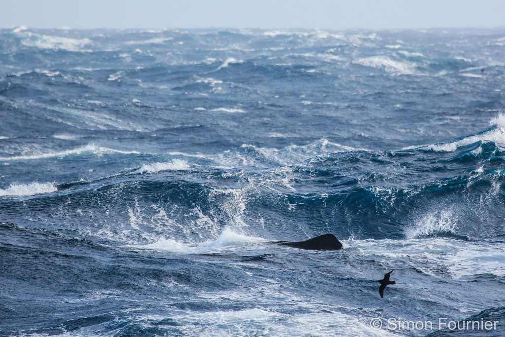
mer terre océan océanaustral antarctique embarquement pêche légine palangrier dissostichus sea island archipelago southernocean antarctica subantarcticisland frenchsouthernandantarcticlands îlesubantarctique archipel kerguelen crozet taaf terresaustralesetantarctiquesfrançaises bateau navire boat vessel fishing longliner longline palangre toothfish copec physetermacrocephalus cachalot cétacé spermwhale déprédation simonfournier australes
Discret cachalot
mer terre océan océanaustral antarctique embarquement pêche légine palangrier dissostichus sea island archipelago southernocean antarctica subantarcticisland frenchsouthernandantarcticlands îlesubantarctique archipel kerguelen crozet taaf terresaustralesetantarctiquesfrançaises bateau navire boat vessel fishing longliner longline palangre toothfish copec aptenodytespatagonicus manchotroyal kingpenguin oiseau bird colonie colony baiedumarin poussin chick îledelapossession spheniscidae miroungaleonina éléphant de australsouthern elephant sealphoquemammifère marin pacha simonfournier australes
Fond de baie
mer terre océan océanaustral antarctique embarquement pêche légine palangrier dissostichus sea island archipelago southernocean antarctica subantarcticisland frenchsouthernandantarcticlands îlesubantarctique archipel kerguelen crozet taaf terresaustralesetantarctiquesfrançaises bateau navire boat vessel fishing longliner longline palangre toothfish copec simonfournier australes
Navires depuis la base Alfred Faure, Crozet
mer terre océan océanaustral antarctique embarquement pêche légine palangrier dissostichus sea island archipelago southernocean antarctica subantarcticisland frenchsouthernandantarcticlands îlesubantarctique archipel kerguelen crozet taaf terresaustralesetantarctiquesfrançaises bateau navire boat vessel fishing longliner longline palangre toothfish copec simonfournier australes
Lumière
mer terre océan océanaustral antarctique embarquement pêche légine palangrier dissostichus sea island archipelago southernocean antarctica subantarcticisland frenchsouthernandantarcticlands îlesubantarctique archipel kerguelen crozet taaf terresaustralesetantarctiquesfrançaises bateau navire boat vessel fishing longliner longline palangre toothfish copec simonfournier australes
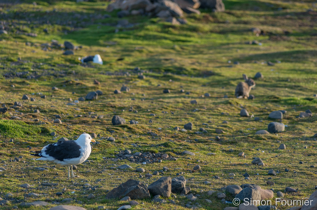
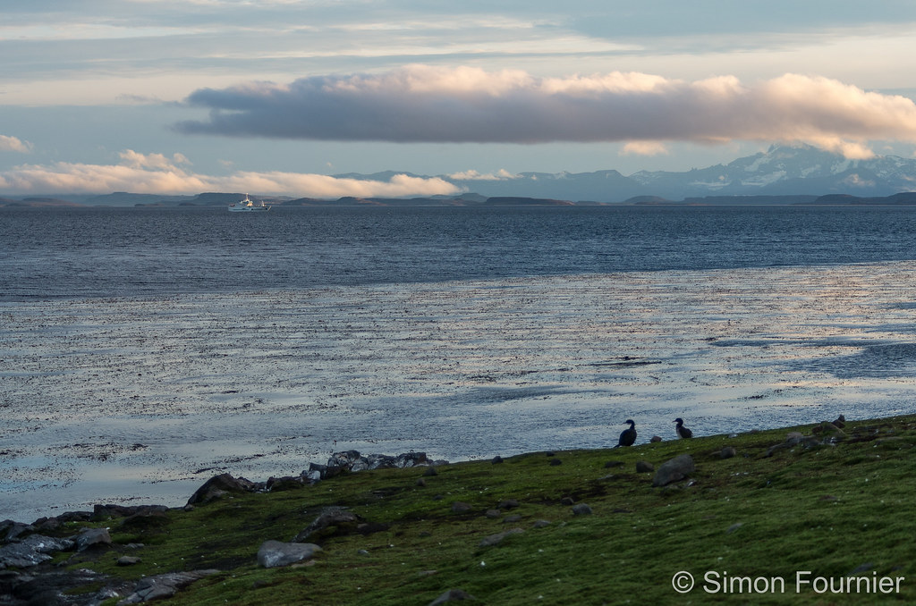
Goélands et Longues-oreilles