Elevation of FM, Pottsville, TX, USA
Location: United States > Texas > Hamilton County >
Longitude: -98.392004
Latitude: 31.6677861
Elevation: 458m / 1503feet
Barometric Pressure: 96KPa
Elevation Map:
Satellite Map:
Related Photos:

Andrea Stewart

Joshua & Pitta ????❤️

Post Office 76870 (Priddy, Texas)

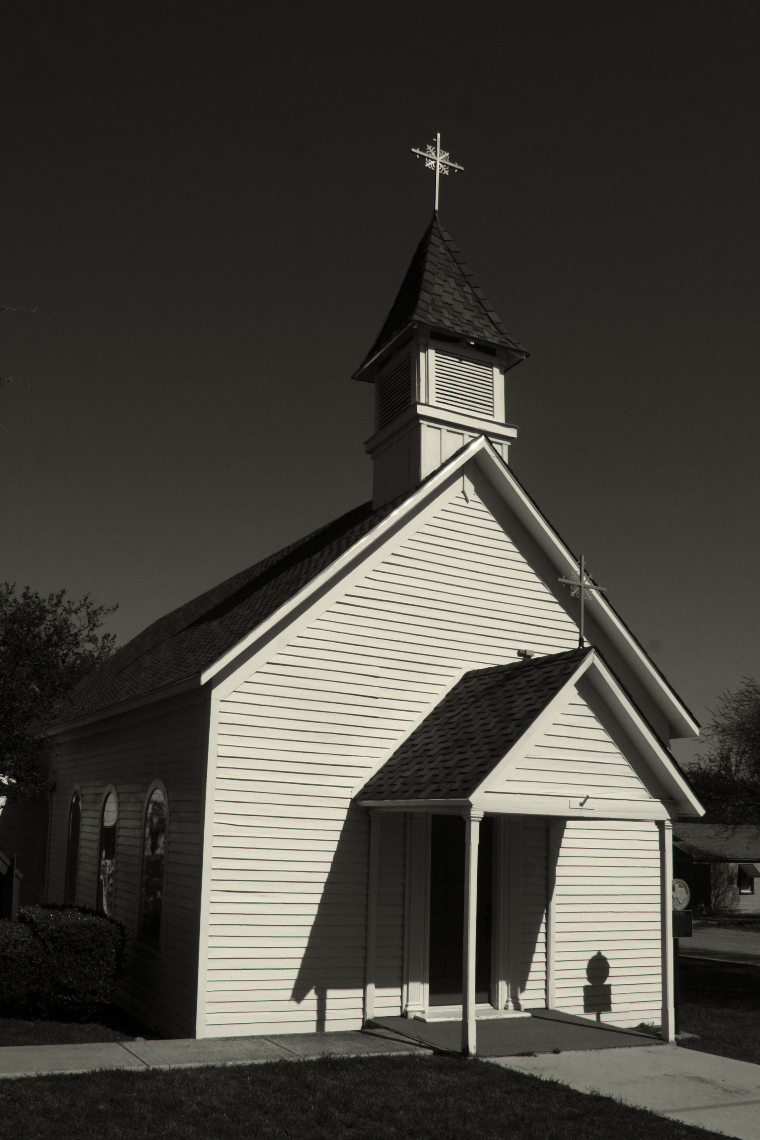
Zion Lutheran Church (Priddy, Texas)

Post Office 76452 (Energy, Texas)
St. Matthews Episcopal
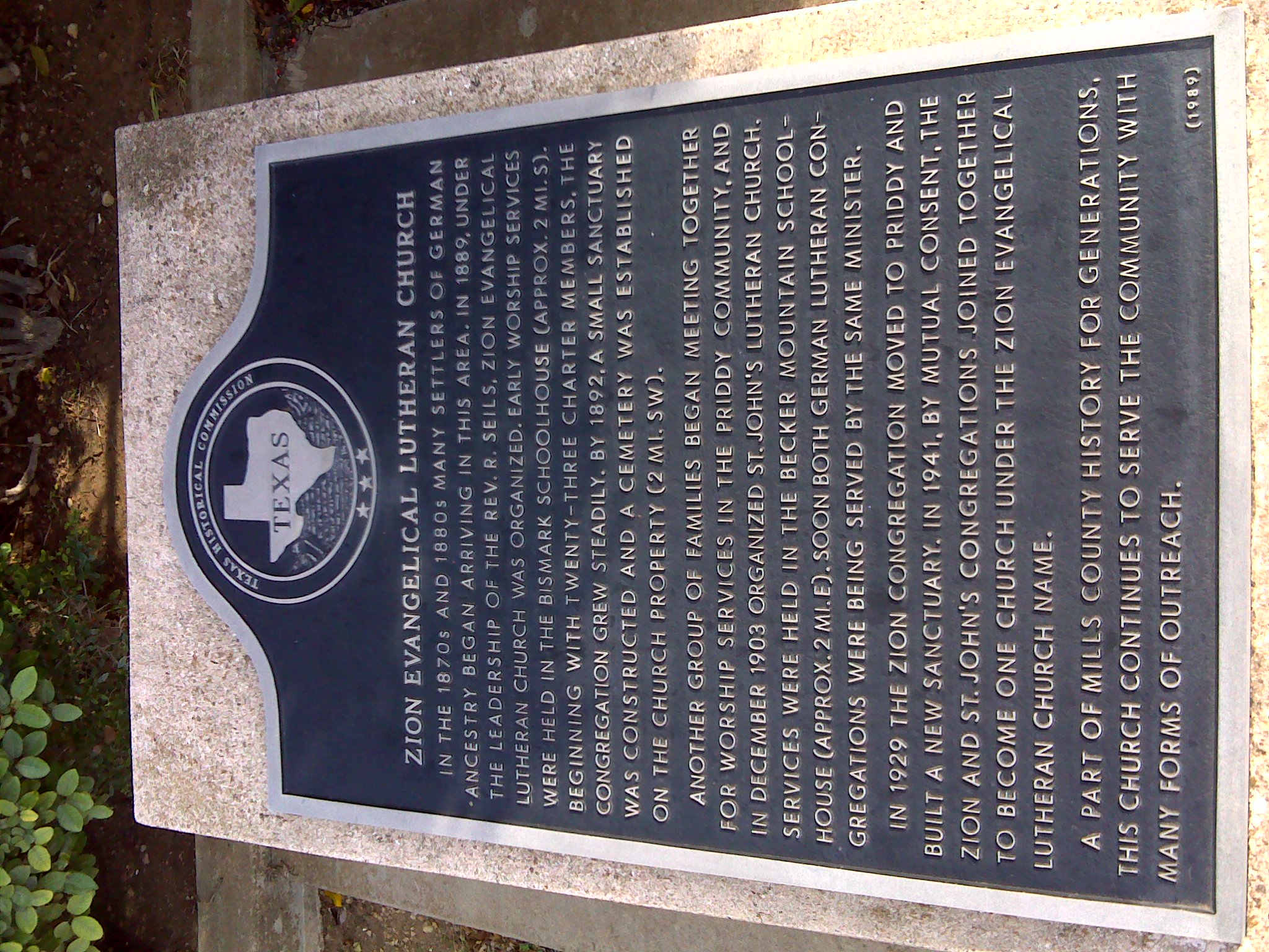
Zion Evangelical Lutheran Church marker
Zion Evangelical Lutheran Church TxHM
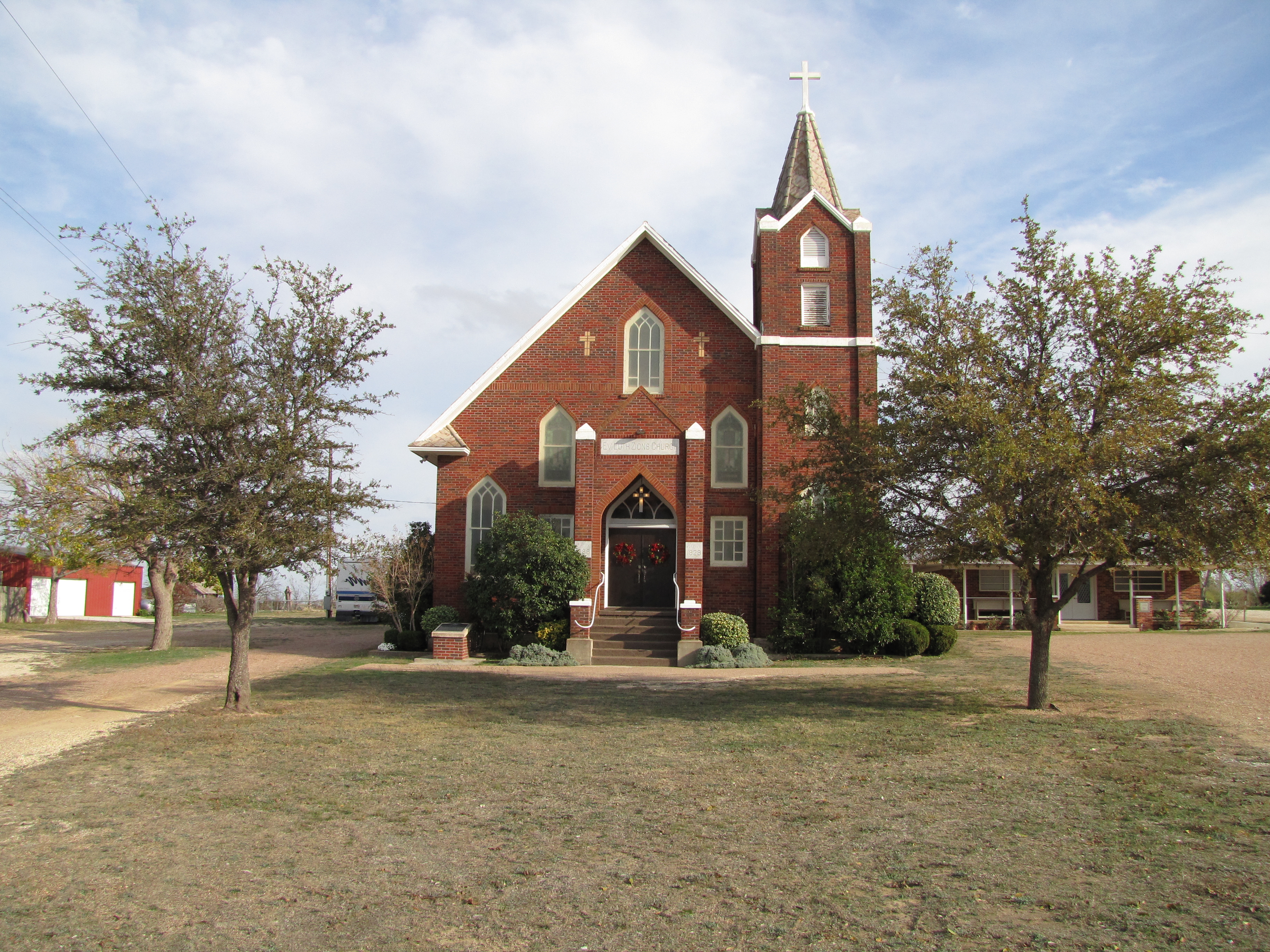
Zion Evangelical Lutheran Church
Topographic Map of FM, Pottsville, TX, USA
Find elevation by address:

Places near FM, Pottsville, TX, USA:
Pottsville
FM, Energy, TX, USA
Energy
1495 Co Rd 614
County Road 512
South Mesquite Creek
Hamilton County
E Main St, Gustine, TX, USA
Gustine
36th Division Memorial Hwy, Gustine, TX, USA
36th Division Memorial Hwy, Hamilton, TX, USA
33 Ranch Rd, Star, TX, USA
Star
FM, Dublin, TX, USA
301 Fm 591
Hamilton
E Main St, Hamilton, TX, USA
Evant
E Brooks Dr, Evant, TX, USA
Co Rd, Dublin, TX, USA
Recent Searches:
- Elevation of Corso Fratelli Cairoli, 35, Macerata MC, Italy
- Elevation of Tallevast Rd, Sarasota, FL, USA
- Elevation of 4th St E, Sonoma, CA, USA
- Elevation of Black Hollow Rd, Pennsdale, PA, USA
- Elevation of Oakland Ave, Williamsport, PA, USA
- Elevation of Pedrógão Grande, Portugal
- Elevation of Klee Dr, Martinsburg, WV, USA
- Elevation of Via Roma, Pieranica CR, Italy
- Elevation of Tavkvetili Mountain, Georgia
- Elevation of Hartfords Bluff Cir, Mt Pleasant, SC, USA