Elevation map of Eastern Province, Zambia

Location: Zambia >

Longitude: 31.9928078

Latitude: -13.805618

Elevation: 845m / 2772feet

Barometric Pressure: 92KPa

Elevation Map:

elevation map of Eastern Province, Zambia

Satellite Map:

Satellite map of Eastern Province, Zambia

Related Photos:

mountains ridges blue layers mist isoprene blueridgemountains brasstownbald georgia morning light landscape canon nature outstandingromanianphotographers ngc npc
Blue mountains sea
casadelarbol viewpoint baños ecuador swings balanços centralhighlands ivagatours mateo jose tungurahua bañosdeaguasanta casadelárbol casadaárvore runtún mountain montanha nature thevillageofruntún treehouse equador ivagatourstouroperator fourwheels southamerica plantasyblanco mostextremeswing theswingattheendoftheworld thetungurahuavolcano volcántungurahua volcano vulcão vulcãotungurahua lacasadelárbol bathsofholywater tungurahuaprovince provínciadetungurahua gatewaytotheamazon lacordilleraorientaldelosandes elpedacitodecielo ciudaddelvolcán ipo thesangaynationalpark elparquenacionalsangay highlands theandes theeasterncordillera thecentralhighlands hostalplantasyblanco hostal albergue hostelinbaños acasadaárvore loscolumpiosdelfindelmundo theswingtoheaven elcolumpioalcielo
La Casa del Árbol at 2,660 meters (8,727 feet) above sea level, Baños, the Central Highlands, Ecuador.
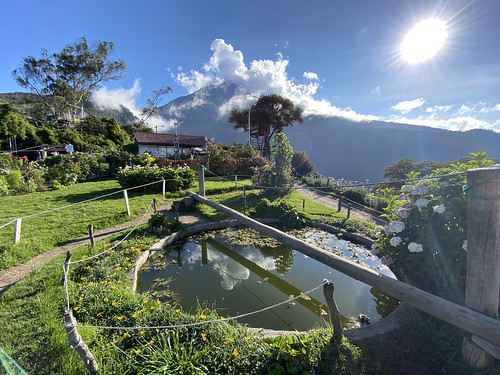
casadelarbol viewpoint baños ecuador swings balanços centralhighlands ivagatours mateo jose tungurahua bañosdeaguasanta casadelárbol casadaárvore runtún mountain montanha nature thevillageofruntún treehouse equador ivagatourstouroperator fourwheels southamerica plantasyblanco mostextremeswing theswingattheendoftheworld reflexo reflection espelho lago lake thetungurahuavolcano volcántungurahua volcano vulcão vulcãotungurahua lacasadelárbol bathsofholywater tungurahuaprovince provínciadetungurahua gatewaytotheamazon lacordilleraorientaldelosandes elpedacitodecielo ciudaddelvolcán ipo thesangaynationalpark elparquenacionalsangay highlands theandes theeasterncordillera thecentralhighlands hostalplantasyblanco hostal albergue hostelinbaños acasadaárvore loscolumpiosdelfindelmundo theswingtoheaven elcolumpioalcielo
La Casa del Árbol at 2,660 meters (8,727 feet) above sea level, Baños, the Central Highlands, Ecuador.
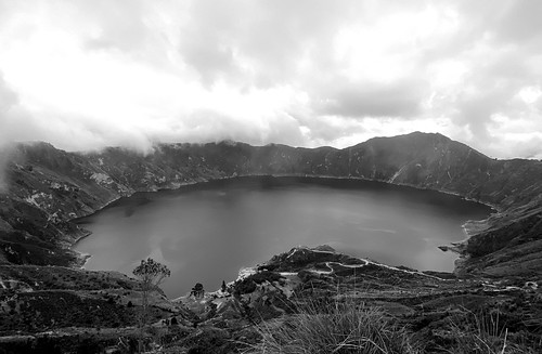
thequilotoaloop hiking thequilotoacrater lagoon acraterlake ecuadoriankichwacommunities caldera viewpoint mirador lagoa thecalderarim pujilí lagunaquilotoa quilotoalagoon lagoaquilotoa quilotoa lakequilotoa water água volcano vulcão crater volcaniccrater cotopaxiprovince equador ecuador quilotoacrater theandesmountainrange theandes centralhighlands highlands altaaltitude montanhas mountains vulcões volcán paisagem landscape casacarpedm carpedmadventures casacarpedmguesthouse danielalirio cordilheiradosandes avenidadosvulcões theavenueofthevolcanoes southamerica estrada highway bw blackandwhite pretoebranco
The Famous Volcanic-Crater Lake of Laguna Quilotoa at 3,870 meters (12,696 ft) MSL, Pujilí, Cotopaxi Province, Ecuador.
bathsofholywater bañosdeaguasanta baños tungurahuaprovince provínciadetungurahua equador ecuador gatewaytotheamazon thetungurahuavolcano lacordilleraorientaldelosandes elpedacitodecielo ciudaddelvolcán ipo thesangaynationalpark elparquenacionalsangay highlands theandes theeasterncordillera thecentralhighlands ivagatourstouroperator ivagatours hostalplantasyblanco hostal albergue hostelinbaños throatoffire theblackgiant mamatungurahua mothertungurahua gargantadefuego gigantenegro laesposadelcercanotaitachimborazo avenidadosvulcões theavenueofthevolcanoes vulcão volcán volcano estratovolcán stratovolcano montanha mountain theandesmountainrange lacordilleraoriental cráter cratera crater sport esporte alpinismo escalada hiking climbing mountaineering caminhada montanhismo mountaineer climber therefugio refúgio refuge thesummit cume lacumbre camping ñatomyguide
Climbing the Summit of the Active and Mighty Stratovolcano 'Tungurahua' ('Throat of Fire' volcano) at 5,023 meters (16,479 feet) above sea level, Baños, the Central Highlands, Ecuador.
cotopaxinationalpark onedaybiketour cotopaxi ecuador theandes equador montanhas mountains volcanos vulcán vulcões cotopaxivolcano vulcãocotopaxi cycling bikingdutchman parquenacionalcotopaxi centralhighlands actvivestratovolcano vulcão volcano volcáncotopaxi thepáramo grassland latacunga theríopita tigua southamerica nature theandesmountains thelatacungacanton cotopaxiprovince lahars madflows casacarpedm downhillmountainbikingoncotopaxivolcano mountainbiking mountainbikingoperator bike
Cotopaxi is an active stratovolcano at 4,620 meters (15,157 ft), Park in Parque Nacional Cotopaxi, Ecuador.
bathsofholywater bañosdeaguasanta baños tungurahuaprovince provínciadetungurahua equador ecuador gatewaytotheamazon thetungurahuavolcano lacordilleraorientaldelosandes elpedacitodecielo ciudaddelvolcán ipo thesangaynationalpark elparquenacionalsangay highlands theandes theeasterncordillera thecentralhighlands ivagatourstouroperator ivagatours hostalplantasyblanco hostal albergue hostelinbaños throatoffire theblackgiant mamatungurahua mothertungurahua gargantadefuego gigantenegro laesposadelcercanotaitachimborazo avenidadosvulcões theavenueofthevolcanoes vulcão volcán volcano estratovolcán stratovolcano montanha mountain theandesmountainrange lacordilleraoriental cráter cratera crater sport esporte alpinismo escalada hiking climbing mountaineering caminhada montanhismo mountaineer climber therefugio refúgio refuge thesummit cume lacumbre camping ñatomyguide
Climbing the Summit of the Active and Mighty Stratovolcano 'Tungurahua' ('Throat of Fire' volcano) at 5,023 meters (16,479 feet) above sea level, Baños, the Central Highlands, Ecuador.
highlands ecuador ipo equador baños hostal albergue theandes bañosdeaguasanta gatewaytotheamazon tungurahuaprovince thecentralhighlands ivagatours ivagatourstouroperator thetungurahuavolcano bathsofholywater provínciadetungurahua lacordilleraorientaldelosandes elpedacitodecielo ciudaddelvolcán thesangaynationalpark elparquenacionalsangay theeasterncordillera hostalplantasyblanco hostelinbaños nature water água landscape natureza falls waterfalls cachoeira catarata cascada pastazariver rotadascachoeiras ríopastaza larutadelascascadas routeofthewaterfalls víaabaños highwayofthewaterfalls thewaterfallsroute waterfallinrutadelascascadas princeofdarkness pailóndeldiablo cascadapailóndeldiablo príncipedelastinieblas príncipedastrevas cascadaderíoverde cascadaderíoverdechico ríoverdewaterfall ríoverdechicowaterfall pailóndeldiablowaterfall devilscauldronwaterfall cachoeiradocaldeirãododiabo
The Devil's Cauldron Waterfall (la Cascada Pailón del Diablo), the Highway of the Waterfalls (la Ruta de las Cascadas), Baños de Agua Santa at 1,800 metros (5,905 ft) above sea level, the Central Highlands, Ecuador.
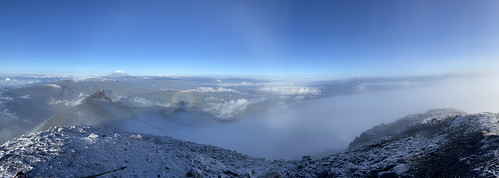
bathsofholywater bañosdeaguasanta baños tungurahuaprovince provínciadetungurahua equador ecuador gatewaytotheamazon thetungurahuavolcano lacordilleraorientaldelosandes elpedacitodecielo ciudaddelvolcán ipo thesangaynationalpark elparquenacionalsangay highlands theandes theeasterncordillera thecentralhighlands ivagatourstouroperator ivagatours hostalplantasyblanco hostal albergue hostelinbaños throatoffire theblackgiant mamatungurahua mothertungurahua gargantadefuego gigantenegro laesposadelcercanotaitachimborazo avenidadosvulcões theavenueofthevolcanoes vulcão volcán volcano estratovolcán stratovolcano montanha mountain theandesmountainrange lacordilleraoriental cráter cratera crater sport esporte alpinismo escalada hiking climbing mountaineering caminhada montanhismo mountaineer climber therefugio refúgio refuge thesummit cume lacumbre camping ñatomyguide agradiseyki
The Summit of the Active and Mighty Stratovolcano 'Tungurahua' ('Throat of Fire' volcano) at 5,023 meters (16,479 feet) above sea level, Baños, the Central Highlands, Ecuador.
ancient angkorthom archaeological architecture asia buddhist cambodia children davidpham davidphamsf documentary fz200 hindu history khmer people prasatsuorprat ruins sandstone shapeshift shapeshiftnet siemreap southeastasia stone streetphotography swimhole temple towers travel unesco unescoworldheritage worldheritag krongsiemreap siemreapprovince
Children at Prasat Suor Prat
ecuador swings jose viewpoint mateo baños centralhighlands balanços casadelarbol ivagatours mountain southamerica nature treehouse montanha equador tungurahua bañosdeaguasanta fourwheels plantasyblanco casadaárvore casadelárbol runtún thevillageofruntún ivagatourstouroperator mostextremeswing theswingattheendoftheworld volcano vulcão volcántungurahua vulcãotungurahua thetungurahuavolcano lacasadelárbol highlands ipo hostal albergue theandes gatewaytotheamazon tungurahuaprovince thecentralhighlands bathsofholywater provínciadetungurahua lacordilleraorientaldelosandes elpedacitodecielo ciudaddelvolcán thesangaynationalpark elparquenacionalsangay theeasterncordillera hostalplantasyblanco hostelinbaños acasadaárvore loscolumpiosdelfindelmundo theswingtoheaven elcolumpioalcielo
La Casa del Árbol at 2,660 meters (8,727 feet) above sea level, Baños, the Central Highlands, Ecuador.
volcano ecuador crater equador vulcão theandes cotopaxiprovince quilotoacrater theandesmountainrange mountains southamerica landscape highlands highway paisagem estrada montanhas cordilheiradosandes volcán centralhighlands vulcões avenidadosvulcões altaaltitude theavenueofthevolcanoes casacarpedm carpedmadventures casacarpedmguesthouse danielalirio lagoa viewpoint mirador e30 ecuadoriankichwacommunities pujulí volcaniccrater ipo baños hostal albergue bañosdeaguasanta gatewaytotheamazon tungurahuaprovince thecentralhighlands ivagatours ivagatourstouroperator thetungurahuavolcano bathsofholywater provínciadetungurahua lacordilleraorientaldelosandes elpedacitodecielo ciudaddelvolcán thesangaynationalpark elparquenacionalsangay theeasterncordillera hostalplantasyblanco hostelinbaños ñatomyguide
E30 at 3,530 meters (11581 ft) MSL, Pujulí, Central Highlands, Ecuador.
italy lombardy bormio provinceofsondrio ortleralps road pass stelvio view landscape mountain nature spectacular hairpinbends tornante europe hill colors clouds scenic beauty adrenaline drive trip travel hike adventure италия стельвио перевал горы пейзаж дорога поворот вид облака красота адреналин высота альпы greatphotographers flickrsbest wow
Where beauty meets adrenaline
reservaecológicalosillinizas sendero trail trilha laplayitaquilotoa thequilotoaloop hiking thequilotoacrater lagoon acraterlake ecuadoriankichwacommunities caldera viewpoint mirador lagoa thecalderarim pujilí lagunaquilotoa quilotoalagoon lagoaquilotoa quilotoa lakequilotoa water água volcano vulcão crater volcaniccrater cotopaxiprovince equador ecuador quilotoacrater theandesmountainrange theandes centralhighlands highlands altaaltitude montanhas mountains vulcões volcán paisagem landscape casacarpedm carpedmadventures casacarpedmguesthouse danielalirio cordilheiradosandes avenidadosvulcões theavenueofthevolcanoes southamerica estrada highway
La Playita Quilotoa (trail), the Volcanic-Crater Lake of Laguna Quilotoa at 3,870 meters (12,696 ft) MSL, Pujilí, Cotopaxi Province, Ecuador.
road city italien blue sky urban italy lake mountains tree castle church nature water architecture canon buildings landscape geotagged boats outdoors see spring wasser europa europe natur may citylife kirche himmel haus tranquility boote berge roofs mai verona stadt architektur recreation blau relaxation ursula hafen landschaft dach idyllic malcesine schiffe burg frühling lakegarda sander häuser habor g11 gardasee veneto dächer frühjahr 2015 strase 100faves 200faves traveldestination castelloscaligero 300faves alpineregion 400faves batikart canonpowershotg11
Malcesine on Lake Garda, Italy
ruinsiningapirca ingapirca lafortalezadeingapirca incaarcheologicalsite incaruins ruinasdeingapirca sunworshippers fortresstemple fortress storehouse valledelcañar aqueductsystem cañar cañarprovince thesunstemple thetempleofthesun eltemplodesol terraces courtyards ruins history história anellipticalplatform theandesmountains cbt cuencabestours herman touroperator ingapircacomplejoarqueológico institutonacionaldepatrimoniocultural murodelinca inkapirka incawall hatuncañar hatunkañar thecañariindigenouspeople theincatúpacyupanqui theincahuaynacápac ellugargrandedeloscañaris thecastlecomplex incásicacañari cañariincaorigin theincaway theincatrail caminodelinca ecuador equador thesouthernhighlands highlands mountain montanhas pepeshouse
The Temple to the Sun God (el Templo del Sol), the Ingapirca Fortress is an Archaeological Complex (authentically Incan-Cañari construction) at 3,180 meters (10,433 ft) above sea level, Cañar Province, the Southern Highlands, Ecuador.
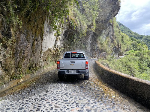
The Green Side of the Carnia Region
hydrocoloeusminutus littlegull lifer bcbird 413 twitch twitcher penticton bc okanagan eurasian eurasia eurasiangull firstwinter 1stwinter immature hoodedgull smallestgullintheworld larusminutus recordshot rare
Record shot of an Immature Little Gull - Penticton, BC
Tortum Lake. Erzurum province, Turkey
chili chile paaseiland rapanui ahutongariki moai addecort landscape nature heads statues paysage isladepascua pukao moyai 15moai guardians panorama 6picscombined history monument ancientart
201912_4477 Easter Island (Rapa Nui), Ahu Tongariki ???????? (15 Moai)
photography fotografie photographer thenetherlands noordzee zeeland northsea middelburg tidalbasin fotograaf neeltjejans deltawerken manmadelandscape deltaworks brouwersdam sociallandscape coastallandscape newtopographics coastalprotection pijlerdam easternscheldt kustversterking bartvandamme werkeilandneeltjejans studiovandamme infostudiovandammecom coastalreinforcements artificialislandneeltjejans
Neeltje Jans Deltaworks
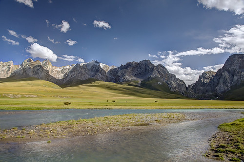
landscape landschaft mountain mountains river sky kelsuu kurumduk atbashi narynprovince kyrgyzstan centralasia asia outdoors alpine scenic epic nature natur beauty lifestock cows grass blue green summer canon canon5d eos hdr travel
Summer pasture along the Kurumduk River
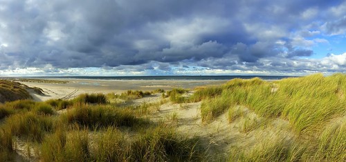
20161105140448 vlieland netherlands nederland northsea duinenvlieland
Stormy weather on Vlieland, the Netherlands
approvato
The castle
netherlands colors clouds canon austria october highway view pass brenner visit italie brennerpass canon1740 2013 5dmark2 hollandfotograaf provincebelluno
View from the Brenner pass
trip travel sea vacation cloud holiday forest turkey pier boat gulf türkiye clear deniz iskele sandal wmp akyaka bulut tatil gokova gökova orman turkei seyahat muğla berrak temiz körfez abigfave theunforgettablepictures vosplusbellesphotos calrity
Still clear ...
The Lighthouse
city morning italien blue light sky urban italy panorama lake mountains tree castle church nature water architecture canon buildings landscape geotagged boats outdoors see spring wasser europa europe day stitch natur may kirche himmel haus tranquility boote berge roofs mai verona stadt architektur recreation geology blau relaxation ursula hafen landschaft dach idyllic malcesine schiffe burg frühling lakegarda sander häuser habor g11 gardasee veneto dächer frühjahr 2015 100faves 200faves traveldestination castelloscaligero 300faves alpineregion 400faves batikart canonpowershotg11
Lake Garda and Malcesine (Italy) in Morning Light
alairelibre cielo city ciudad ciudadimperial clouds cloudscape ctperu cusco cuzco horizonte igersperu incasland landscape mountains naturaleza nature nubes paisaje panorama panoramica peru peruestrella peruvian photo ruteandoperu sacsaywaman sky
CIudad de Cusco
travel vacation sky panorama cloud mountain lake holiday nature water rock stone turkey landscape photography view cloudy türkiye nopeople karadeniz rize 0621 colorimage camlihemsin kackarlar traveldestination beautyofnature kackarmountains horizontalimage kackarmountain çamlihemşin easternblacksearegion 20110712 karadenizdoğu dkaradeniz2011071310 blackseaprovince
Kackar Mountains, Rize, TURKEY
nikon nikond810 nature d810 nikkor70200mm 70200mm yellow mountains mountainside mountaintop clouds blue bluesky landscape light sky serene wow white awesome asia holiday hills hiking huangshan
I wanna see you again
tibetབོད བོད་ལྗོངས། 2018 ༢༠༡༨ ©janreurink tibetanplateauབོད་མཐོ་སྒང་bötogang amdoཨ༌མདོ khamཁམས་བོད easterntibet machenརྨ་ཆེན།county tibetanlandscapepicture landscapeཡུལ་ལྗོངས།yulljongsyünjong landscapesceneryརི་ཆུ་ཡུལ་ལྗོངསrichuyulljongsrichuyünjong landscapepictureཡུལ་ལྗོངས་རི་མོyulljongsrimoyünjongrimo natureརང་བྱུང་ཁམས་rangbyungrangjung natureofphenomenaཆོས་ཀྱི་དབྱིངས་choskyidbyings earthandwaternaturalenvironmentས་ཆུ་sachu
Landscape of Machen county, Tibet 2018
tibetབོད བོད་ལྗོངས། 2018 ༢༠༡༨ ©janreurink tibetanplateauབོད་མཐོ་སྒང་bötogang amdoཨ༌མདོ khamཁམས་བོད easterntibet matöརྨ་སྟོད།county machukhaམ་ཆུ་ཁ་ snowmountainགངས་རི།gangsri snowmountainས་འཛིན་དཀར་པོ་sadzindkarposandzinkarpo tibetanlandscapepicture landscapeཡུལ་ལྗོངས།yulljongsyünjong landscapesceneryརི་ཆུ་ཡུལ་ལྗོངསrichuyulljongsrichuyünjong landscapepictureཡུལ་ལྗོངས་རི་མོyulljongsrimoyünjongrimo natureརང་བྱུང་ཁམས་rangbyungrangjung natureofphenomenaཆོས་ཀྱི་དབྱིངས་choskyidbyings earthandwaternaturalenvironmentས་ཆུ་sachu
Landscape of Mato county, Tibet 2018
oregon columbia river winter clouds hills plains brush plateau
Columbia River on the eastern side of Oregon
blyderivercanyon canyon panoramaroute southafrica za threerondavels mountains landscape scenery mountainlandscape mountainscenery iphone peterch51 panorama blyderiver mpumalanga
Blyde River Canyon
bathsofholywater bañosdeaguasanta baños tungurahuaprovince provínciadetungurahua equador ecuador gatewaytotheamazon thetungurahuavolcano lacordilleraorientaldelosandes elpedacitodecielo ciudaddelvolcán ipo thesangaynationalpark elparquenacionalsangay highlands theandes theeasterncordillera thecentralhighlands ivagatourstouroperator ivagatours hostalplantasyblanco hostal albergue hostelinbaños larutadelascascadas thewaterfallsroute routeofthewaterfalls rotadascachoeiras waterfallinrutadelascascadas víaabaños ríopastaza pastazariver cascada cachoeira catarata falls waterfalls water água nature natureza landscape highwayofthewaterfalls
The Highway of the Waterfalls (la Ruta de las Cascadas), Baños de Agua Santa at 1,800 metros (5,905 ft) above sea level, the Central Highlands, Ecuador.