Elevation of Eagles Nest Farm Ln, Still Pond, MD, USA

Location: United States > Maryland > Kent County > 3, Worton (betterton) >

Longitude: -76.041831

Latitude: 39.3669776

Elevation: 17m / 56feet

Barometric Pressure: 101KPa

Elevation Map:

elevation map of Eagles Nest Farm Ln, Still Pond, MD, USA

Satellite Map:

Satellite map of Eagles Nest Farm Ln, Still Pond, MD, USA

Related Photos:

insect bee hoverfly wings details strips gold yellow red green brown black orange texture wingveins veins gossamer sunny summer flowers tropicalmilkweed milkweed cellphone phonephoto iphone iphone5s externallens olloclip macro closeup dof bokeh phoneography iphoneography ipad ipaddarkroom apps snapseed nature naturelovers artofnature earthnature abstractnature galena maryland marylandnature iphonenature patterns 365
Bees Wings - Color
100400mm 7d arachnida arthropods elknecksp md animals backlit spiders web arachnid arachnids spider arthropod arthropoda img8029 bug bugs animal animalia chelicerate chelicerates chelicerata araneae araneomorphae entelegynes longjawedorbweaver longjawedorbweavers tetragnathidae tetragnathid leucauge leucaugevenusta orchardorbweaver taxonomy:binomial=leucaugevenusta
Happy Web Wednesday!
history museum geotagged technology unitedstates military maryland places worldwarii armor artillery groundforces
BI732 SU-76
moth caterpillar
Wavy-lined Heterocampa Moth caterpillar (Heterocampa biundata)
15fav md betterton
View from Mary Roe Walkup Pavilion
White Banks Beach View (south)
White Banks Beach View (west)
olympusm8mmf18 em10markii raw microfourthirds mft m43 mirrorless unitedstates photoborder photoedge photoframe chesapeakebay maryland lighthouse lightstation oilhouse sign sky clouds grass walkway sidewalk tower f71 1500sec 200iso on1photoraw2018 elkneckstatepark usa tree
Lighthouse and Oil House
unitedstates photoborder photoedge photoframe chesapeakebay sign sky clouds grass olympusem10markii olympusm8mmf18 f71 1500sec 200iso on1photoraw2018 maryland water tree wood leaves rocks raw elkneckstatepark usa
Turkey Point Shoreline
chesapeakebay maryland lighthouse lightstation oilhouse people visitors sign sky clouds grass walkway sidewalk tower olympusm8mmf18 f71 1800sec 200iso on1photoraw2018 unitedstates m43 mft microfourthirds mirrorless photoborder photoedge photoframe raw elkneckstatepark usa olympusem10markii
On the Lighter Side
andelotfarmbioblitz sx30 flash raynox dcr250 cute eyes bug bugs spider spiders animal animals animalia arthropod arthropods arthropoda chelicerate chelicerates chelicerata arachnid arachnids arachnida araneae araneomorphae entelegynes jumpingspider jumpingspiders salticidae salticid img9804 arachtober arachtober2016
Cute.
theroadtobrandywine revolutionarywarreenactment chesapeakebay mountharmonplantation battlefield british redcoats american patriots rebels rifles bayonets canon 20191013134337
Behind American lines
kodachrome v500
Scan with Epson V500 at 6400 PPI using Color Restore
trees lighthouse landscape ir iso100 infrared 1320 f8 chesapeakebay qqq turkeypoint elkneckstatepark olympusepl1 silverefex2 panasonic14mmf25
Turkey Point Lighthouse (Infrared)
inflight still md unitedstates maryland aerial drone dji kennedyville quadcopter multirotor djiphantom3professional phantom3professional turnerscreeklanding
Aerial View of Field - DJI Phantom 3 Pro
museum aberdeen armor grounds proving tanks
Another view of Leopold rail gun
museum aberdeen armor grounds proving tanks
Another view
museum aberdeen armor grounds proving tanks
US Nike Hercules missile another view
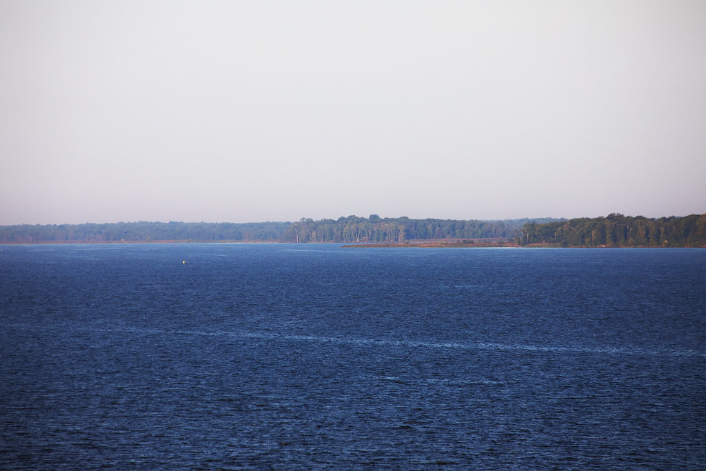
bay maryland chesapeake elkneckstatepark
Chesapeake Bay
bay maryland chesapeake elkneckstatepark
Chesapeake Bay
park light house river neck md day view state 1st first maryland hike erosion event vista elk susquehanna
View from Turkey Point Lighthouse
maryland chesapeakebay elkneckstatepark
Elk Neck State Park
northeast maryland unitedstates turkey point lighthouse elk neck state park tamron 70300mm canon 5d mark iv eos 5dmarkiv 5dm4 5dmk4 5d4 tamronsp70300mmf456divcusd di vc usd f456 outdoors us
Turkey Point Lighthouse - Tamron 70-300mm - Canon 5D Mark IV
northeast maryland unitedstates turkey point lighthouse elk neck state park tamron 70300mm canon 5d mark iv eos 5dmarkiv 5dm4 5dmk4 5d4 tamronsp70300mmf456divcusd di vc usd f456 outdoors water bay us
Elk Neck State Park - Tamron 70-300mm - Canon 5D Mark IV
cecilcounty fieldguide habitats kentcounty liliopsida md magnoliophyta maryland monocots monocotyledons plantae sav sassafrasriver vallisneriaamericana waterbodies angiosperms baygrasses environment nature plants plantsgallery submergedaquaticvegetationsav underwatergrasses wildcelery wildlife unitedstates exif:focallength=24mm geocity camera:make=nikon exif:make=nikon exif:aperture=ƒ50 geo:country=unitedstates exif:model=nikond60 camera:model=nikond60 geostate exif:lens=180550mmf3556 exif:isospeed=800
Invasive Plant Removal on Maryland's Sassafras River
cecilcounty kentcounty liliopsida md magnoliophyta maryland monocots monocotyledons plantae sav angiosperms environment nature plants submergedaquaticvegetationsav underwatergrasses wildlife unitedstates geocity camera:make=nikon geo:country=unitedstates exif:focallength=55mm exif:isospeed=800 geostate exif:model=nikond60 camera:model=nikond60 exif:make=nikon exif:lens=180550mmf3556 exif:aperture=ƒ56
Invasive Plant Removal on Maryland's Sassafras River
cecilcounty kentcounty liliopsida md magnoliophyta maryland monocots monocotyledons plantae sav angiosperms environment nature plants submergedaquaticvegetationsav underwatergrasses wildlife unitedstates exif:focallength=28mm geocity camera:make=nikon exif:make=nikon exif:isospeed=800 geo:country=unitedstates exif:model=nikond60 camera:model=nikond60 geostate exif:lens=180550mmf3556 exif:aperture=ƒ50
Invasive Plant Removal on Maryland's Sassafras River
japan gun tank wwi wwii maryland korean aberdeen german cannon russian tanks japaneese artillary howitzer aberdeenprovingground ordinancemuseum
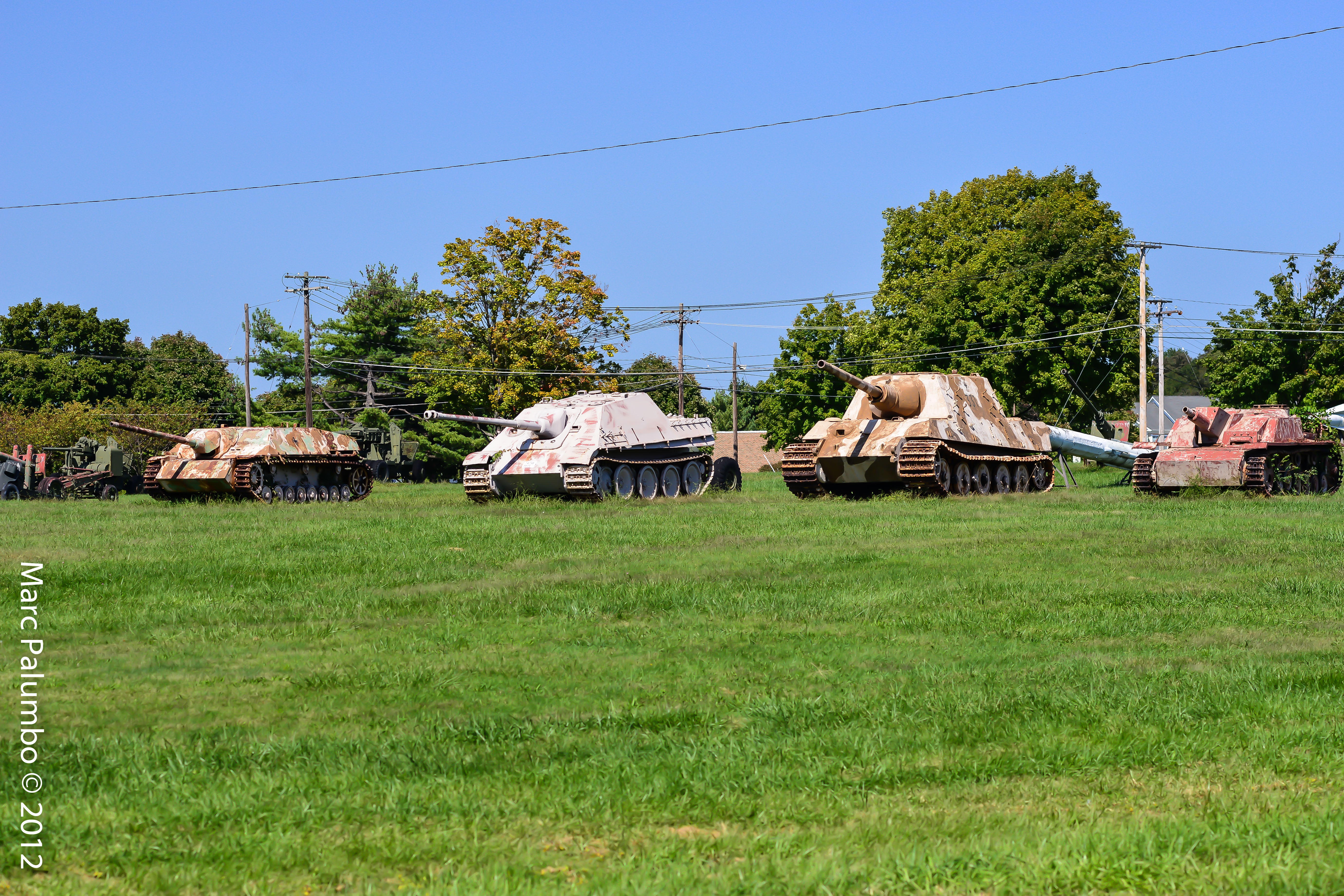
Group of German Tanks
transportation aerial environment stateofconservationrelease unitedstates camera:model=canoneos5dmarkii camera:make=canon geocity geostate exif:model=canoneos5dmarkii exif:aperture=ƒ56 exif:lens=ef24105mmf4lisusm geo:country=unitedstates exif:focallength=35mm exif:isospeed=800 exif:make=canon
Pond Creek in Cecil County, Md.
unitedstates aerial transportation environment geocity geo:country=unitedstates camera:make=canon exif:make=canon exif:isospeed=800 camera:model=canoneos5dmarkii geostate exif:model=canoneos5dmarkii exif:lens=ef24105mmf4lisusm exif:aperture=ƒ50 exif:focallength=58mm
Wetlands near the Elk River in Cecil County, Md.
county winter beach river kent kayak maryland shore february eastern sassafras
February kayaking
mgm5 corporal
MGM-5 Corporal Nuclear Missile
northeast maryland unitedstates turkey point lighthouse elk neck state park tamron 70300mm canon 5d mark iv eos 5dmarkiv 5dm4 5dmk4 5d4 tamronsp70300mmf456divcusd di vc usd f456 outdoors water bay us
Elk Neck State Park - Tamron 70-300mm - Canon 5D Mark IV
cecilcounty kentcounty liliopsida md magnoliophyta maryland monocots monocotyledons plantae sav angiosperms environment nature plants submergedaquaticvegetationsav underwatergrasses wildlife unitedstates exif:focallength=50mm geocity camera:make=nikon exif:make=nikon exif:aperture=ƒ56 geo:country=unitedstates exif:model=nikond60 camera:model=nikond60 geostate exif:lens=180550mmf3556 exif:isospeed=800
Invasive Plant Removal on Maryland's Sassafras River
cecilcounty kentcounty md maryland environment unitedstates exif:aperture=ƒ90 geocity camera:make=nikon exif:focallength=48mm exif:make=nikon exif:isospeed=800 exif:model=nikond60 camera:model=nikond60 geo:country=unitedstates exif:lens=180550mmf3556 geostate
Invasive Plant Removal on Maryland's Sassafras River
maryland betterton
Evergreen Knoll
environment unitedstates exif:isospeed=400 geocity camera:make=nikon exif:focallength=160mm geo:country=unitedstates geostate exif:model=nikond60 camera:model=nikond60 exif:make=nikon exif:aperture=ƒ53 exif:lens=5502000mmf4056
Mount Harmon Historic Home in Cecil County, Md.
environment unitedstates exif:isospeed=400 exif:aperture=ƒ40 camera:make=nikon exif:focallength=55mm geo:country=unitedstates geostate exif:model=nikond60 camera:model=nikond60 geocity exif:make=nikon exif:lens=5502000mmf4056
Mount Harmon Historic Home in Cecil County, Md.
Chesapeake Bay
mountharmon plantation maryland easternshore md dirt road street path trees tree lined leading lines spooky blackandwhite bnw bw
Plantation Drive