Elevation of Coonabarabran NSW, Australia

Location: Australia > New South Wales > Warrumbungle Shire Council >

Longitude: 149.277234

Latitude: -31.273419

Elevation: 510m / 1673feet

Barometric Pressure: 95KPa

Elevation Map:

elevation map of Coonabarabran NSW, Australia

Satellite Map:

Satellite map of Coonabarabran NSW, Australia

Related Photos:

moon space telescope astronomy outerspace seaoftranquility warrumbungleobservatory
Fly Me To...
coonabarabran uploaded:by=flickrmobile flickriosapp:filter=nofilter
More views of Coonabarabran fires
coonabarabran uploaded:by=flickrmobile flickriosapp:filter=nofilter
More views of Coonabarabran fires
square squareformat amaro iphoneography instagramapp uploaded:by=instagram
Iris's view #dinosaur #mademecry
australia new south wales warrumbungle mountain landscape view nature forest creek road outdoor newell highway
Shawns Creek Picnic Area
coonabarabran sidingspringobservatory telescope nsw australia bushfire k7 sigma1020mmf456 wideangle
Siding Spring Observatory
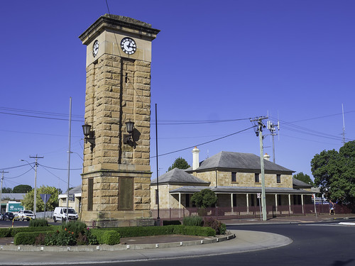
clock clocktower heritagelisted warmemorial newsouthwales australia nsw coonabarabran country olympus olympusem10 paulleader memorial lestweforget streetphotography streetscape architecture oldbuilding building heritagebuilding
Coonabarabran Soldiers' Memorial Clock Tower - see below
coonabarabran uploaded:by=flickrmobile flickriosapp:filter=nofilter
More views of Coonabarabran fires
coonabarabran uploaded:by=flickrmobile flickriosapp:filter=nofilter
More views of Coonabarabran fires
uploaded:by=flickrmobile flickriosapp:filter=nofilter
Lachie's birthday parties 2013
australia new south wales warrumbungle mountain landscape view nature forest creek road outdoor newell highway
Shawns Creek Picnic Area
australia new south wales warrumbungle mountain landscape view nature forest creek road outdoor newell highway
The Newell Highway
australia new south wales warrumbungle mountain landscape view nature forest creek road outdoor newell highway
Shawns Creek Picnic Area
australia new south wales warrumbungle mountain landscape view nature forest creek road outdoor newell highway
Along the Timor Road
australia new south wales warrumbungle mountain landscape view nature forest creek road outdoor newell highway
Along the Timor Road
australia new south wales warrumbungle mountain landscape view nature forest creek road outdoor newell highway
Timor Road
australia new south wales warrumbungle mountain landscape view nature forest creek road outdoor newell highway
Shawns Creek Picnic Area
australia newsouthwales nsw coonabarabran warrumbungles mountain hill volcanic geology
Warrumbungles 20170402_53_Vib_s
valencia square squareformat iphoneography instagramapp uploaded:by=instagram
shit... empty petrol tank (light's on) and 30km to nearest town ???? AC is off... sorry kids in the back (it's hot)... wish us luck!! #familyroadtrip #campingholiday #ontheroad #badjudgement #runningoutofgas #kidsareoblivious
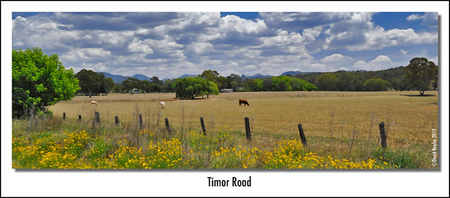
nikon stock australia pasture warrumbungles warrumbunglenationalpark d700 davidnaylor sidingspringsobservatory timorroad
Timor Road
film nature landscape scanner australia slide scan nsw geology aus volcanic filmscan coonabarabran warrumbunglenp 35mmfilmcamera yashicaj3 35mmslrcamera yashinon50mmf2lens canonpixmamg8150 hanimexcs50
Timor Rock
farm volcanicplug coonabarabran newsouthwales australia
In the shadow of a volcano
1Coonabarabran Planes in river park at