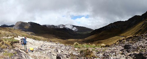
Elevation of Cañar, Ecuador
Location: Ecuador > Cañar Province >
Longitude: -79.154853
Latitude: -2.6112213
Elevation: 3246m / 10650feet
Barometric Pressure: 68KPa
Related Photos:
Topographic Map of Cañar, Ecuador
Find elevation by address:

Places in Cañar, Ecuador:
Places near Cañar, Ecuador:
Buquiar
Chirin
Santuario De La Vírgen Del Cajas
Dos Chorreras Restaurant
Laguna Toreadora
Mirador Tres Cruces
Zhud
Cañar Province
Cuenca
E582
Ingapirca
Posada Ingapirca
Iglesia Católica De San Alfonso - Cojitambo
Cojitambo
Chunchi
Cumanda
Paute
Sibambe
Naranjal
Alausi
Recent Searches:
- Elevation of Corso Fratelli Cairoli, 35, Macerata MC, Italy
- Elevation of Tallevast Rd, Sarasota, FL, USA
- Elevation of 4th St E, Sonoma, CA, USA
- Elevation of Black Hollow Rd, Pennsdale, PA, USA
- Elevation of Oakland Ave, Williamsport, PA, USA
- Elevation of Pedrógão Grande, Portugal
- Elevation of Klee Dr, Martinsburg, WV, USA
- Elevation of Via Roma, Pieranica CR, Italy
- Elevation of Tavkvetili Mountain, Georgia
- Elevation of Hartfords Bluff Cir, Mt Pleasant, SC, USA


