Elevation of Bobonon, Alangalang, Leyte, Philippines

Location: Philippines > Eastern Visayas > Leyte > Alangalang >

Longitude: 124.899656

Latitude: 11.1889207

Elevation: 22m / 72feet

Barometric Pressure: 101KPa

Elevation Map:

elevation map of Bobonon, Alangalang, Leyte, Philippines

Satellite Map:

Satellite map of Bobonon, Alangalang, Leyte, Philippines

Related Photos:

philipines الفلبين 菲律宾 pilipinas फिलीपींस フィリピン 필리핀 филиппины republikangpilipinas republicofthephilippines asia southeast southeastasia pacific island canon t6i canont6i history culture province samar leyte panphilippine hwy highway transport vehicle bridge sanjuanico tulayngsanjuanico strait longest marcos picturesque tree water sea ocean skyline view outlook
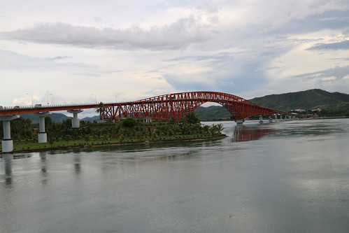
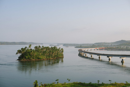
San Juanico Bridge
santa bridge san philippines rita tac samar sta visayas leyte tacloban juanico rwy18 rpva
San Juanico Bridge
philipines الفلبين 菲律宾 pilipinas फिलीपींस フィリピン 필리핀 филиппины republikangpilipinas republicofthephilippines asia southeast southeastasia pacific island canon t6i canont6i history culture province samar leyte panphilippine hwy highway transport vehicle bridge sanjuanico tulayngsanjuanico strait longest marcos picturesque tree water sea ocean skyline view outlook
San Juanico Bridge
philippines disaster typhoon haiyan tacloban
Coastal view
philipines الفلبين 菲律宾 pilipinas फिलीपींस フィリピン 필리핀 филиппины republikangpilipinas republicofthephilippines asia southeast southeastasia pacific island canon t6i canont6i history culture province samar leyte panphilippine hwy highway transport vehicle bridge sanjuanico tulayngsanjuanico strait longest marcos picturesque tree water sea ocean skyline view outlook
San Juanico Bridge
philippines typhoon haiyan tacloban barangay68
The view from Mavill's house
philippines typhoon haiyan tacloban barangay68
The view from Mavill's house
philippines disaster typhoon haiyan
San Juanico Bridge
philipines الفلبين 菲律宾 pilipinas फिलीपींस フィリピン 필리핀 филиппины republikangpilipinas republicofthephilippines asia southeast southeastasia pacific island canon t6i canont6i history culture province samar leyte panphilippine hwy highway transport vehicle bridge sanjuanico tulayngsanjuanico strait longest marcos picturesque tree water sea ocean skyline view outlook mountain sky cloud
San Juanico Strait
philippines disaster typhoon haiyan ngo response tacloban taclobancity easternvisayas cashforwork worldrenew barangay89
Coastal view
square squareformat iphoneography instagramapp uploaded:by=instagram
Panoramic view of the beautiful Leyte Provincial Capitol Building. (Thanks to Chris for the panorama trick in the iPhone camera)
philippines 2008 tacloban
Mom and Mellie
square squareformat iphoneography instagramapp uploaded:by=instagram
Mountain view from where I stay... #tacloban #leyte #philippines
Tuláy ng San Juanico
square squareformat iphoneography instagramapp uploaded:by=instagram
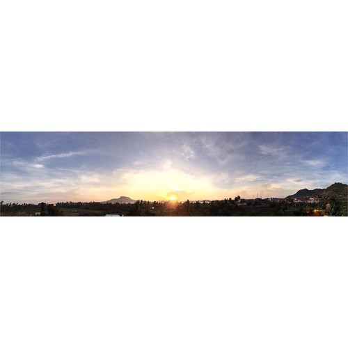
Sunrise panoramic view from our house. Good morning.
travel bridge nature photoshop island photography steel philippines structure tropical samar islets thebridge naturescape travelphotography phillippines tropicalcountry tacloban sanjuanicobridge photomatix steelstructure taclobancity easternvisayas naturscape viveza taclobanleyte visayaz vivezaphotoshop itsmorefuninthephilippines thetropicalphilippines mariáconcepcíonphotography™|2011© mariáconcepcíonphotography sanjuanicobridgeakamarcos marcosregime bridgingtheislandsofsamarandleyte trussesoverthearchofthebridge taclobansamar
Islets near the bridge
travel bridge sky tourism nature clouds photoshop landscape photography nikon steel philippines structure tropical nik 1855mm nikkor midday hdr mothernature cloudscape samar thebridge 1855mmkitlens naturescape phillippines tropicalcountry tacloban sanjuanicobridge photomatix steelstructure hdrphotography taclobancity easternvisayas nikonphotography nikonphilippines naturscape viveza sanjuanicostrait taclobanleyte visayaz d3100 nikond3100 nikond3100philippines itsmorefuninthephilippines thetropicalphilippines mariáconcepcíonphotography™|2011© mariáconcepcíonphotography thesanjuanicobridgeispartofthepanphilippinehighwayalsoknownasthemaharlikahighway bridgingtheislandsofsamarandleyte leytesideofthebridge
Approaching San Juanico Bridge
sunrise airport tacloban
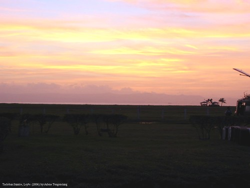
Tacloban Sunrise
yolanda
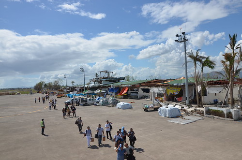
Daniel Z. Romualdez Airport - Tacloban
road bridge blue sea sky panorama storm water sunshine weather clouds landscape island bay construction highway empty philippines transportation infrastructure tropical tropic strait connection samar layte
Welcome to Samar
philippines disaster typhoon haiyan
Temporary camps
philippines disaster typhoon haiyan ngo response tacloban taclobancity easternvisayas cashforwork worldrenew barangay89
Back to the sea
philippines disaster typhoon haiyan
San Juanico Bridge
philippines disaster typhoon haiyan ngo response tacloban taclobancity easternvisayas cashforwork worldrenew barangay89
Out to sea
philippines disaster typhoon haiyan ngo response tacloban taclobancity easternvisayas cashforwork worldrenew barangay89
Restoring the road
square squareformat iphoneography instagramapp uploaded:by=instagram
This beach resort area in Baybay San Jose, Tacloban was destroyed by 3 waves of Tsunami. Most residents live in the biggest tent city community in this side of town.
instagramapp square squareformat iphoneography uploaded:by=instagram
flow with intention, sit on the edge! ????????????????????✅???? #goproph #jackwatsera #gopole #testedtough #lifewelltravelled #happinesseverywhere #Philippines
philippines 2008 tacloban
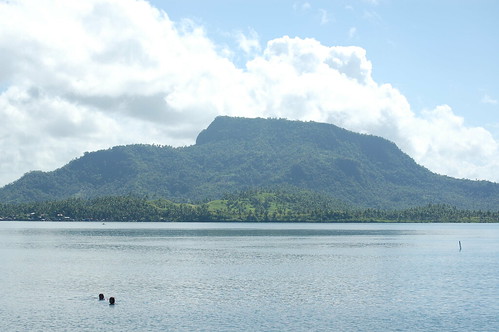
Mount Sumbulu
uploaded:by=flickrmobile flickriosapp:filter=nofilter leyteparkresorthotel
Leyte Park Hotel
square squareformat iphoneography instagramapp uploaded:by=instagram foursquare:venue=4db399de316a3bec5255e2e1
another landscape photo #landscape #places #sky #skyporn #sanjuanicobridge #philippines
San Juanico Bridge, Tacloban Leyte
square squareformat iphoneography instagramapp xproii uploaded:by=instagram foursquare:venue=4ce63f9ad99f721e77cda273
#skyporn #sky #landscape #instalike #instalove #instawhatever
Sunrise at Tacloban