Elevation of Beeston Regis, UK
Location: United Kingdom > Norfolk >
Longitude: 1.2276469
Latitude: 52.9348574
Elevation: 41m / 135feet
Barometric Pressure: 101KPa
Elevation Map:
Satellite Map:
Related Photos:

Stody Lodge Garden 15-05-2019 (12)

Poppies?

A clear view,

Felbrigg lake

Cliff fall at Trimingham caravan park - aerial image

I see the sea !
A camera's eye view.

Stormy clouds over the sea.

Just because I liked the blades.
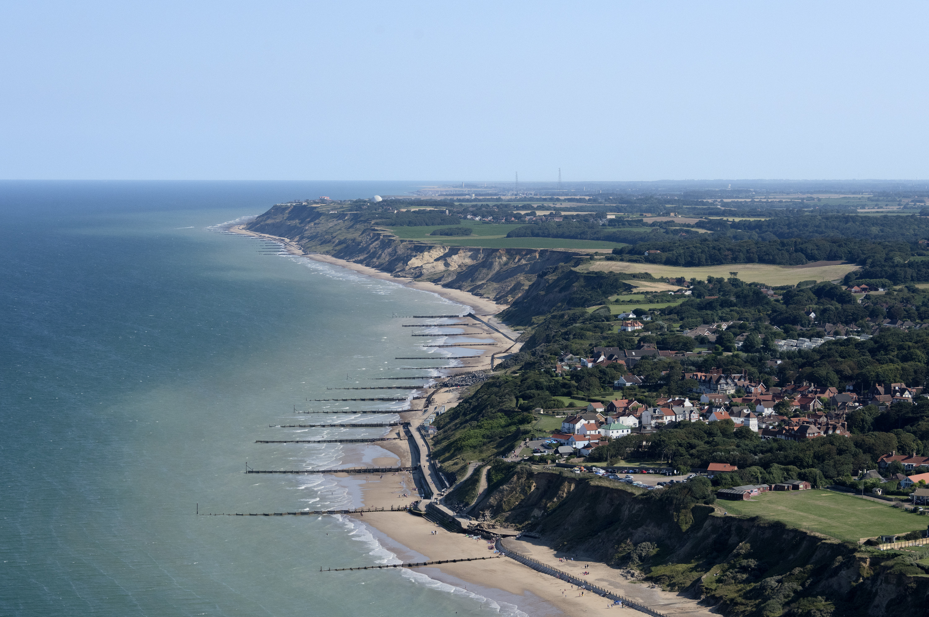
Off the coast at Overstrand - Norfolk aerial

There's always something,
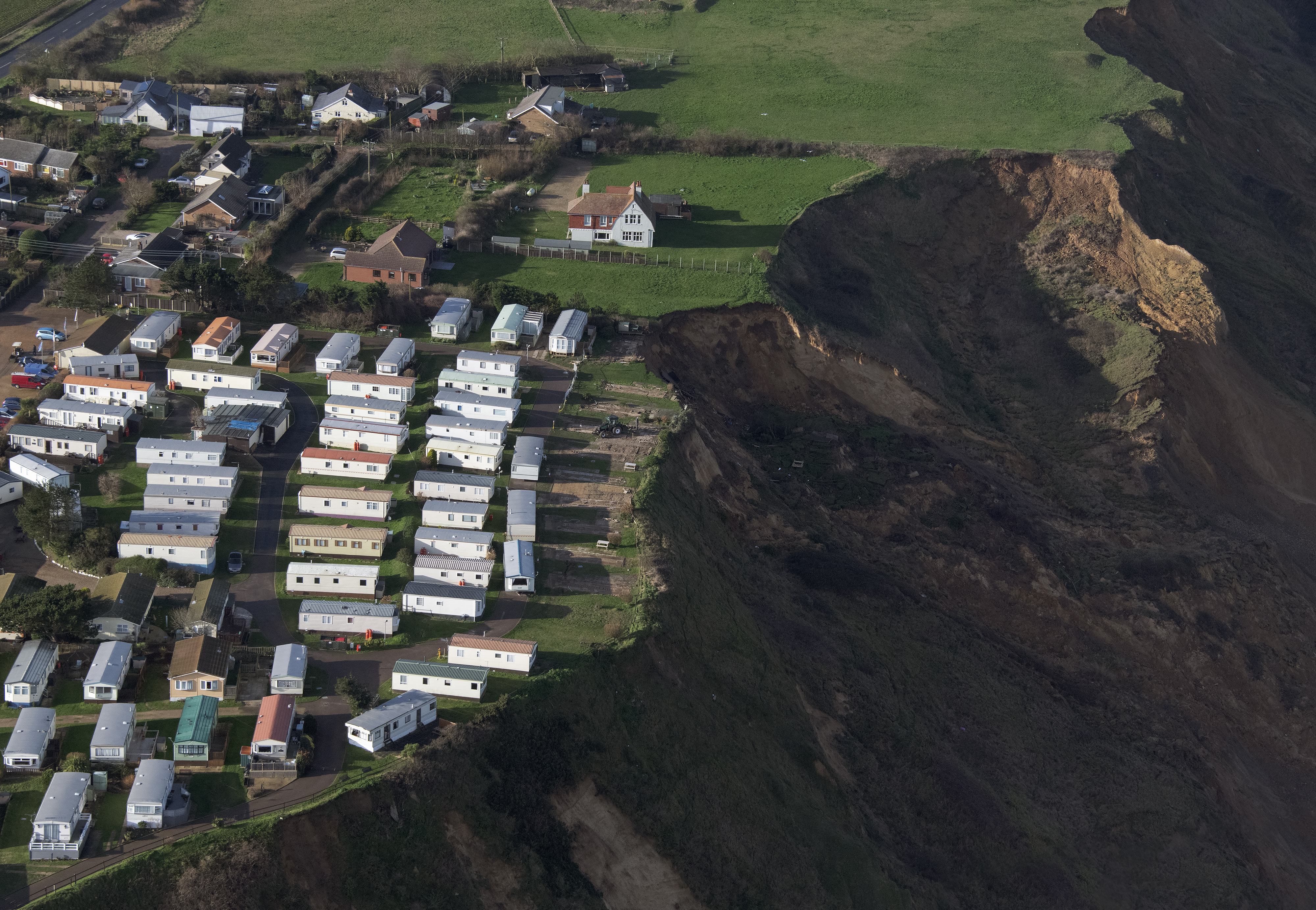
Cliff fall at Trimingham caravan park - aerial image

Wiveton Hall Maize Maze aerial 01

A view of Felbrigg Hall

Felbrigg Hall in Norfolk - UK aerial

Red, White, and Blue.

A Friday Fence with a view.
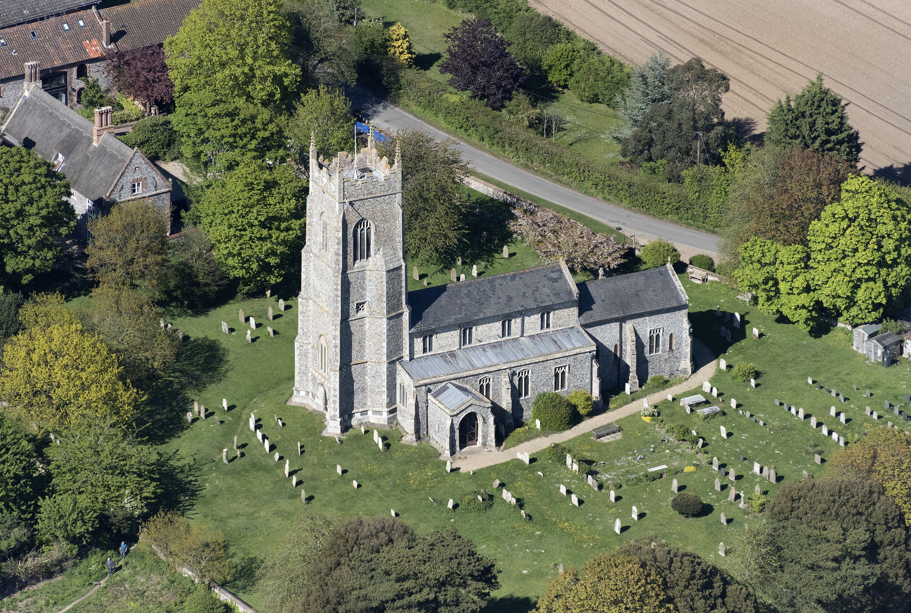
St Mary The Virgin Church in Northrepps - Norfolk UK aerial image

Cliff fall at Trimingham caravan park - aerial image

Hawthorne Shield Bug /3

9F 2-10-0 92203 Black Prince on the Poppy Line run by the North Norfolk Railway

Weybourne Sunset

Overstrand Beach [Project 365 2015 - 305/365]
Coastal Erosion_DSC0774

Sheringham _DSC0749

Cliff face_DSC0761

A thatched roofed cottage, Blickling Estate, Norfolk

Cromer Pier

Cromer Beach

What lies beyond..

Taste of Summer in the Landscape_DSC0747

steve 2

West Runton Coastal Path [233/365 2017]

Sheringham Beach [Project 365 2015 - 362/365]

Blakeney Boat

Beach stroll.
HDR Panorama sunset at Sheringham
Cromer Pier [235/365 2017]

Aerial view of Edgefield Old Church - St Peter & St Paul - Norfolk UK

Cromer Pier and Beach.
Topographic Map of Beeston Regis, UK
Find elevation by address:

Places near Beeston Regis, UK:
Church Lane
Beeston Common
Beeston Common
Beeston Common
Beeston Common
The Links Country Park Hotel
Sheringham
Nr11 8rq
West Beckham
Sheringham Park
West Beckham
10 The Green, Felbrigg, Norwich NR11 8PN, UK
Felbrigg
Metton
Briar Cottage
4 Cromer Rd
Nr25 6qg
Bodham
Cromer
Brownshill
Recent Searches:
- Elevation of Corso Fratelli Cairoli, 35, Macerata MC, Italy
- Elevation of Tallevast Rd, Sarasota, FL, USA
- Elevation of 4th St E, Sonoma, CA, USA
- Elevation of Black Hollow Rd, Pennsdale, PA, USA
- Elevation of Oakland Ave, Williamsport, PA, USA
- Elevation of Pedrógão Grande, Portugal
- Elevation of Klee Dr, Martinsburg, WV, USA
- Elevation of Via Roma, Pieranica CR, Italy
- Elevation of Tavkvetili Mountain, Georgia
- Elevation of Hartfords Bluff Cir, Mt Pleasant, SC, USA