Elevation map of Attock District, Pakistan
Location: Pakistan > Punjab >
Longitude: 72.236379
Latitude: 33.4743993
Elevation: 390m / 1280feet
Barometric Pressure: 97KPa
Elevation Map:
Satellite Map:
Related Photos:

brasicca compestris
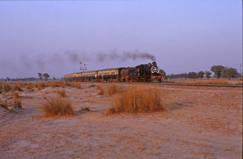
7321 Thatta Mahla 20 november 1990

7323 Thatta Mahla 20 november 1990

7324 Thatta Mahla 20 november 1990

7325 Thatta Mahla 20 november 1990

sun-spotting

7322 Thatta Mahla 20 november 1990
Topographic Map of Attock District, Pakistan
Find elevation by address:

Places in Attock District, Pakistan:
Places near Attock District, Pakistan:
Domel
Govt School
Thatta
Attock
Akhori
Parshai
Jand
Chhachh Dam
Dhok Ghulam Ali
Rawalpindi
Chakrala
Chakwal
Peshawar Road
Rawalpindi
Kashmir Highway
Rawalpindi
Sachal Sarmast Road
G 11 Markaz
G-11 Markaz
National University Of Medical Sciences (nums)
Recent Searches:
- Elevation of Corso Fratelli Cairoli, 35, Macerata MC, Italy
- Elevation of Tallevast Rd, Sarasota, FL, USA
- Elevation of 4th St E, Sonoma, CA, USA
- Elevation of Black Hollow Rd, Pennsdale, PA, USA
- Elevation of Oakland Ave, Williamsport, PA, USA
- Elevation of Pedrógão Grande, Portugal
- Elevation of Klee Dr, Martinsburg, WV, USA
- Elevation of Via Roma, Pieranica CR, Italy
- Elevation of Tavkvetili Mountain, Georgia
- Elevation of Hartfords Bluff Cir, Mt Pleasant, SC, USA