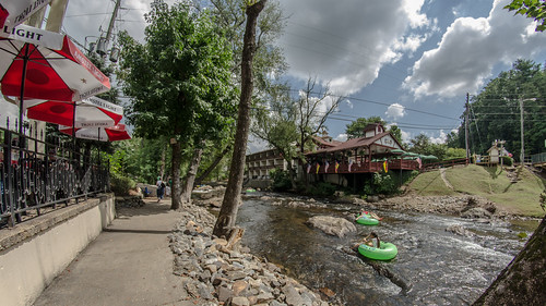
Elevation of Anna Ruby Falls, Georgia, USA
Location: United States > Georgia > White County > Sautee Nacoochee >
Longitude: -83.712121
Latitude: 34.7634275
Elevation: 672m / 2205feet
Barometric Pressure: 94KPa
Related Photos:
Topographic Map of Anna Ruby Falls, Georgia, USA
Find elevation by address:

Places near Anna Ruby Falls, Georgia, USA:
75 Easy Run Rd
Easy Run Road
3526 Tray Mountain Rd
3526 Tray Mountain Rd
Andrews Cove Campground
97 Chinquapin Ln
28 Twilight Dell
64 Archery Ln
309 Monroe Ridge Rd
487 Chimney View Rd
80 Windchase Ln
Unicoi State Park & Lodge
2128 Sautee Trail
256 Wilfar Strasse
280 Wilfar Strasse
310 Blue Ridge Dr
119 Chestnut Point
71 Hawks Nest
354 Howell Mill Dr
Innsbruck Resort & Golf Club
Recent Searches:
- Elevation of Corso Fratelli Cairoli, 35, Macerata MC, Italy
- Elevation of Tallevast Rd, Sarasota, FL, USA
- Elevation of 4th St E, Sonoma, CA, USA
- Elevation of Black Hollow Rd, Pennsdale, PA, USA
- Elevation of Oakland Ave, Williamsport, PA, USA
- Elevation of Pedrógão Grande, Portugal
- Elevation of Klee Dr, Martinsburg, WV, USA
- Elevation of Via Roma, Pieranica CR, Italy
- Elevation of Tavkvetili Mountain, Georgia
- Elevation of Hartfords Bluff Cir, Mt Pleasant, SC, USA


