Elevation of 9 S Valley Rd, Naselle, WA, USA

Location: United States > Washington > Pacific County > Naselle >

Longitude: -123.81082

Latitude: 46.3650883

Elevation: 8m / 26feet

Barometric Pressure: 101KPa

Elevation Map:

elevation map of 9 S Valley Rd, Naselle, WA, USA

Satellite Map:

Satellite map of 9 S Valley Rd, Naselle, WA, USA

Related Photos:

abandoned aged ambientlight availablelight batterymurphy color daylight daytime derelict deserted fortcolumbia historic military neglected nikkorlense nikon nikond7000 olympicpeninsula outdoors parksandrecreation rain rainyday statepark urban washington wet chinook unitedstates 98614
Battery Murphy
geotagged geo:lat=46317 geo:lon=123706666666667 geo:dir=2398
20955.jpg
geotagged geo:dir=3039 geo:lat=46295 geo:lon=123723666666667
20899.jpg
geotagged geo:lon=123703666666667 geo:dir=368 geo:lat=463133333333333
20951.jpg
square squareformat lomofi iphoneography instagramapp uploaded:by=instagram foursquare:venue=3498162
View on 101
geotagged geo:dir=1498 geo:lat=463136666666667 geo:lon=123676833333333
21000.jpg
geotagged geo:lon=1236955 geo:lat=463265
20918.jpg
geotagged geo:lon=123695666666667 geo:dir=828 geo:lat=463296666666667
20939.jpg
geotagged geo:dir=352 geo:lon=123920333333333 geo:lat=464601666666667
19556.jpg
geotagged geo:lat=463123333333333 geo:lon=123704 geo:dir=1499
20949.jpg
geotagged geo:dir=779 geo:lat=463271666666667 geo:lon=123706833333333
20914.jpg
geotagged geo:lat=463145 geo:lon=1237125 geo:dir=2871
20911.jpg
geotagged geo:lon=123831333333333 geo:lat=463845 geo:dir=495
19602.jpg
washington handheld hdr coastranges rvpark riversendcampground
River's End RV Park, WA
geotagged geo:lon=123903 geo:lat=464916666666667 geo:dir=786
19512.jpg
geotagged geo:dir=285 geo:lat=464206666666667 geo:lon=123937166666667
17989.jpg
geotagged geo:lat=463926666666667 geo:lon=123840333333333 geo:dir=784
19599.jpg
geotagged geo:lat=463081666666667 geo:lon=123672166666667 geo:dir=3505
20971.jpg
geotagged geo:lon=123839833333333 geo:lat=462653333333333 geo:dir=3317
20847.jpg
geotagged geo:lat=462856666666667 geo:lon=123958833333333 geo:dir=475
16613.jpg
geotagged geo:dir=1014 geo:lon=123698833333333 geo:lat=463353333333333
20937.jpg
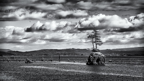
rock altoona wahkikumcounty landscape monochrome washington pilings blackandwhite marine columbiariver
Small Private Island
20140915-23533604
PIX-IMG_6957HDTV-Test-g
coast coastline landscape landscapephotography nature naturephotography northamerica originalphotographers pacificcounty pacificnorthwest photooftheday photographersontumblr photography shoreline unitedstates usa washington washingtonstate water willapabay winter
Shoreline, Willapa Bay, Washington, Winter 2017
usa abstract concrete washington unitedstates northwest pacificnorthwest northamerica beast fortcolumbia
The Beast
geotagged geo:dir=324 geo:lon=123856166666667 geo:lat=464238333333333
19586.jpg
coast coastline forest landscape landscapephotography longislandslough nature naturephotography northamerica originalphotographers pacificcounty pacificnorthwest photooftheday photographersontumblr photography shore shoreline slough trees unitedstates usa washington washingtonstate water willapabay winter
Long Island Slough, Pacific County, Washington, Winter 2017
usa water river landscape coast washington ship unitedstates northwest shipwreck columbiariver pacificnorthwest northamerica coastline hydrofoil plainview ussplainview ageh1
Shipwreck of the USS Plainview, Columbia River, Washington, 2014
trees blackandwhite usa monochrome forest river spring woods unitedstates northwest estuary pacificnorthwest northamerica willapa
Early Spring Forest, Willapa Bay, Washington, 2014
blackandwhite usa monochrome barn rural landscape washington unitedstates northwest farm farming pacificnorthwest northamerica rosburg wahkiakumcounty
Old Barn, Rosburg, Washington, 2014
bridge washington pacificnorthwest wa astoriameglerbridge
Astoria Megler Bridge
geotagged geo:lat=463126666666667 geo:lon=123713 geo:dir=1349
20958.jpg
geotagged geo:dir=268 geo:lat=463733333333333 geo:lon=1238055
19603.jpg
Mt. Dog (43)
blackandwhite usa tree monochrome rock river square landscape island washington unitedstates northwest scenic columbiariver northamerica altoona
Trees on a Rock Island, Columbia River, Washington, 2014
Fort Columbia State Park
geotagged geo:lat=463278333333333 geo:lon=123639333333333 geo:dir=3282
20973.jpg
geotagged geo:lat=463766666666667 geo:lon=124012333333333 geo:dir=2312
18183.jpg
geotagged geo:dir=541 geo:lat=463101666666667 geo:lon=123710833333333
20960.jpg
sunset water 365
365/338 - 12/4/11- Sunset on Baker Bay!