Elevation of Wolf Ridge Rd, Lake Toxaway, NC, USA

Location: United States > North Carolina > Transylvania County > Hogback > Lake Toxaway >

Longitude: -82.934274

Latitude: 35.166784

Elevation: 994m / 3261feet

Barometric Pressure: 90KPa

Elevation Map:

elevation map of Wolf Ridge Rd, Lake Toxaway, NC, USA

Satellite Map:

Satellite map of Wolf Ridge Rd, Lake Toxaway, NC, USA

Related Photos:

flower sundewordrosera blueridgeparkway
Macro view of a Sundew or Drosera
night stars evening mountain overlook blue ridge parkway north carolina glow
From The Darkness at Devil's Courthouse
blue hour sky evening color hue night dusk mountain northcarolina dark clouds
Blue Hour in the Blue Ridge
balsamgrove geo:lat=3530277600 geo:lon=8289552600 geotagged northcarolina unitedstates usa appalachianmountains awesome beautiful blueridgemountains blueridgeparkway clouds devilscourthouse exploring forest mountains nature outdoors photoopportunity pisgahnationalforest scenery sightseeing sony sonya6500 sonyalpha6500 sonymirrorless sonyα6500 summer sunnyday touristattraction transylvaniacountync transylvaniacountynorthcarolina westernnc westernnorthcarolina wnc
Devil's Courthouse (Blue Ridge Parkway)
motion waterfall nc northcarolina waterfalls appalachian appalachia blueridgemountains blueridgeparkway mountainstream westernnc
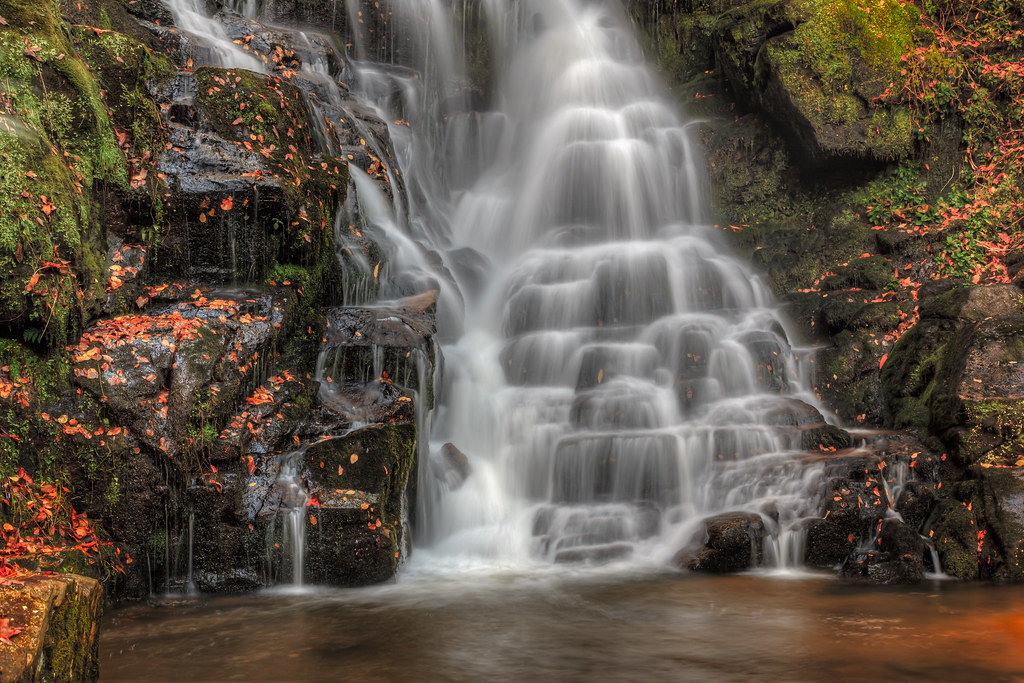
North Carolina Blue Ridge Waterfall - Stillness and Movement
pisgahastronomicalresearchinstitute pari astronomicalobservatory radiotelescope pisgahastronomicalresearchandscienceeducationalcenter space outerspace parsec rosmansatellitetrackingstation balsamgrove nc northcarolina mountains blueridgemountains wnc westernnorthcarolina pisgahnationalforest aerial aerialphoto aerialphotography aerialphotographer sigint signalsintelligence nsa nationalsecurityagency telescope base station spy spying rosmanresearchstation rrs transylvaniacounty satellite satellitedishs nasa nationalaeronauticsandspaceadministration militaryintelligence astronomy telescopes radioastronomy radiotelescopes eavesdropping projectladylove topsecret classified clandestine rosman unitedstatesofamerica
Pisgah Astronomical Research Institute Aerial View - PARI
blinkagain bestofblinkwinners blinksuperstars bestofsuperstars
Lower Eastatoe Falls View 2
river waterfall nc northcarolina frenchbroadriver nikkor1685vr frenchbroadfalls nd8xfilter gitzotripodwithmarkinshead livingwatersministriesproperty
French Broad Falls - Explore #316
2jtrip2009 birdrockfalls carolinas cothronphotography johncothron nc northcarolina transylvaniacounty nature outdoor water waterfall
Birdrock Falls
baldrock baldrockmountain baldrocknc baldrockaerial baldrockmountainaerial panthertownvalley sapphirevalley panthertownvalleyaerial sapphirevalleyaerial community realestate property luxury fairfieldlake mtn aerial aerialview littlebaldrockmtn baldrockmtn mountainproperty nature forest autumn autumncolors fallcolors fall landscape horizontal colorful foliage jacksoncounty northcarolina usa unitedstates aerialphotography aerialphotographer advertising marketing commercial trees peakcolor art fineart cashiers unitedstatesofamerica
Bald Rock Mountain Aerial View of Autum Colors in Panthertown Valley in Sapphire Valley, North Carolina
autumn northcarolina panoramic fallfoliage blueridgeparkway autumncolor wolfmountain balsamfir
"A Patchwork Quilt"
bird water rock stone creek river flow nc high nikon rocks stream dynamic cathedral stones north falls stack zen western carolina stacking range hdr stacked hdri wnc photomatix sigma50th
Zen by the River
flowers trees lake mountains water grass rock nc northcarolina resort explore bearlakereserve nikkor1685vr blraug2010gsmnp
Bear Creek Lake aka Bear Lake - Explore #436
eastatoefalls waterfall rosman
Eastatoe Falls - View from the bottom
rockymountain rockymountainaerial cashiers cashiersaerial cashiersrealestate jacksoncounty jacksoncountyrealestate realestate mountains autumn fallcolors autumncolors chattoogaridge ridgeline trees forest rockymtn nantahalanationalforest nationalforest panthertown panthertownvalley weather haze hiking recreation northcarolina wnc outdoors explore nature aerial aerialview aerialphotography aerialphotographer blueridgemountains southernappalachians art fineart advertising commercial marketing imagery overcast unitedstatesofamerica
Rocky Mountain on Chattooga Ridge in Nantahala National Forest near Cashiers in Jackson County, North Carolina Aerial View
blueridgeparkway northcarolina devilscourthouse courthouse brp pisgah pisgahnationalforest nature views foilage transylvaniacounty
Devils Courthouse
Devil's Courthouse Tunnel
northcarolina nc wnc westernnc blueridgeparkway lightrays rays beams sunbeams blueridgemountains mountains appalachians appalachia landscape autumn fall light outdoor
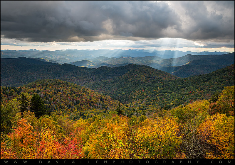
North Carolina Blue Ridge Parkway - Autumn Arrives
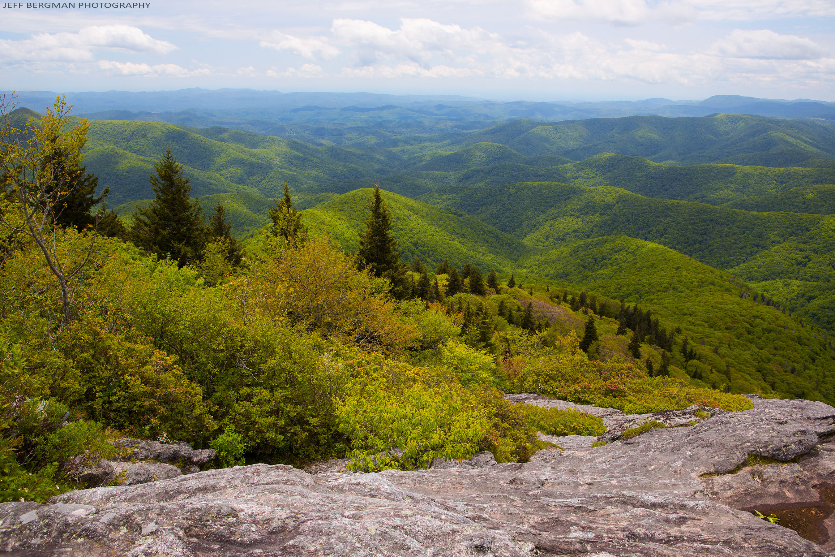
View from Devil's Courthouse, Balsam Grove, NC
uploadedviaflickrqcom waterfall falls stream creek mountains eastatoefalls blueridgemountains appalachianmountains northcarolina canonrebelt4i water unitedstates america waterfalls usa waters musicofwaters
Closer View of Eastatoe Falls
waterfall eastatoefalls
Eastatoe Falls
fog sunrise nc asheville northcarolina wnc brp westernnorthcarolina mountainridges valleyfog courthousevalleyoverlook
Sunrise from Courthouse Valley Overlook on the Blue Ridge Parkway
lake reflection shore bearlakereserve tuckasegeenc
Bear Lake at Bear Lake Reserve
Sunrise Over Courthouse Valley
northcarolina ncmountains transylvaniacounty parks nationalparks blueridgeparkway devilscourthouseoverlook blueskywhiteclouds cloudslongexposure longexposure nd10stop windy april2019 april 2019 canon16354l explore
Blowin' in the Wind
Eastatoe Falls in the Rain
northcarolina nc wnc blueridgeparkway light rays lightrays sunbeams crepuscular mountains appalachians appalachia blueridge outdoor scenic asheville mountain landscape photography appalachian scenery outdoors nature outdoorphotographer
North Carolina Blue Ridge Parkway Autumn NC Scenic Landscape
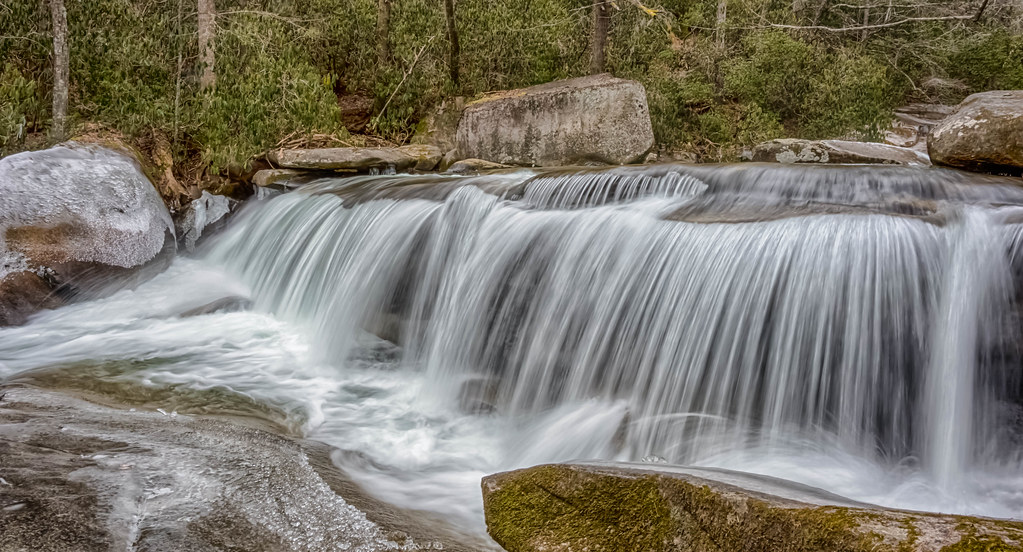
2jtrip2009 5dclassic 5dc cpl canonef24mmf14l cothronphotography johncothron nantahalanationalforest tanaseecreek afternoonlight circularpolarizingfilter creek environment falling flowing forest freshwater landscape longexposure nature outdoor outside partlycloudy protected river scenic spring stream travel water waterfall northcarolina img670620090509coweb852018 ©johncothron2009 dillfalls
Dill Falls
mountains pisgahnationalforest brp devilscourthouse
Taking It In
geo:lat=3511028770 geo:lon=8281713009 geotagged middlefork unitedstates usa brevard brevardnorthcarolina cascada cascade cascades creek northcarolinawaterfall eastatoe eastatoefalls eastatoefallsrosmannc estatoefalls fallingwater falls landscape motion nature nikon nikond800 northcarolina northcarolinawaterfalls outdoor pisgahforest pisgahnationalforest pisgahnationalforestrosmantransylvaniacountynorthcarolina pisgahrangerdistrict rock rosman rosmannc rosmannorthcarolina shoalcreek sky transylvaniacounty transylvaniacountynorthcarolina trees vattenfall wasserfall water waterblur waterdefinition watermist waterpath watercourse waterfall waterfallofnorthcarolina waterval wave westernnorthcarolina westernnorthcarolinawaterfall wnc водопад شلال झरना น้ำตก 폭포 瀑布 flickrtravelaward
Eastatoe Falls (Rosman, North Carolina)
longexposure autumn leaves rock waterfall nc rocks smooth northcarolina rhododendron silky rhodo jacksoncounty schoolhousefalls waterfallphotography davidhopkinsphotography
Autumn at the Falls
mountains green sc water rock landscape outdoors waterfall southcarolina upstate lush cascade nationalgeographic upcountry jocassee pickenscounty forested foothillstrail southcarolinadepartmentofnaturalresources jocasseegorges laurelforkcreek virginiahawkinsfalls laurelforkheritagepreserve jimtimmermanwildliferesourcesarea 50lastgreatplaces destinationofalifetime undisturbedarea
Virginia Hawkins Falls - Jocassee Gorges
falls forest gorgesstatepark horsepostureriver nature nc nc281 northcarolina outdoor pisgahnf river trail tree trees water waterfall waterfalls westernnorthcarolina wnc
Rainbow Falls-0047
waterfall balsamgrove
Cascade on the North Branch French Broad River
waterfall balsamgrove shoalcreekfalls northbranchofthefrenchbroadriver
Close-up of the Confluence of the North Branch of the French Broad River and Shoal Creek Falls in Balsam Grove, NC
nikond90
More From Eastatoe Falls
pentaxk100d
Eastatoe Falls or The Old Name, Chapman Falls
waterfall eastatoefalls
Eastatoe Falls