Elevation of Volcano Union Inn, Consolation St, Volcano, CA, USA
Location: United States > California > Amador County > Volcano >
Longitude: -120.63081
Latitude: 38.4431062
Elevation: -10000m / -32808feet
Barometric Pressure: 295KPa
Elevation Map:
Satellite Map:
Related Photos:

Rainy view of our 2004 30' Classic Airstream
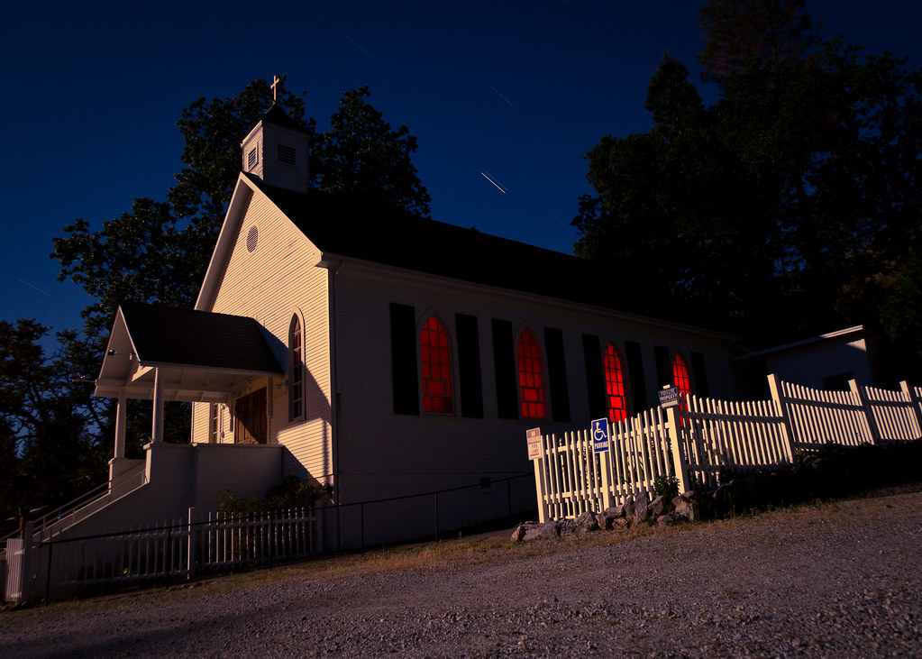
St. Bernard's Church

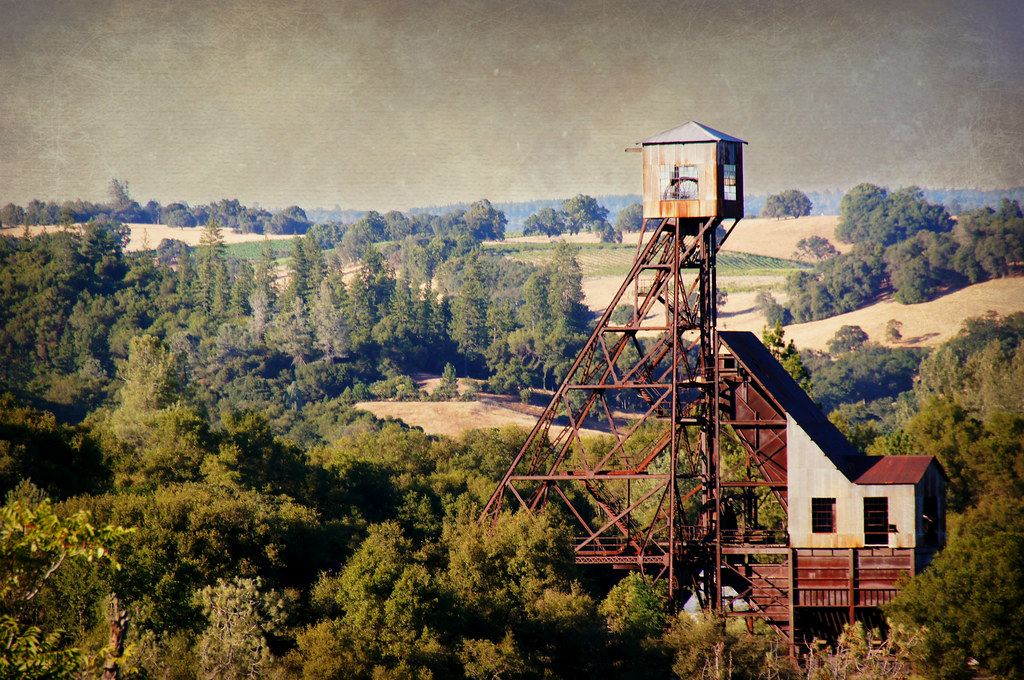
Digital watercolor Old Kennedy Gold Mine Equipment

Old Kennedy Gold Mine Equipment HDR

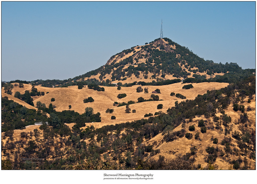
Looking east towards the mountains

Happy Fence Friday

Little Church in the Sierra Nevada Foothills HDR

Sierra Nevada Foothills HDR

Looking east towards the mountains

Looking east towards the mountains

Happy Fence Friday
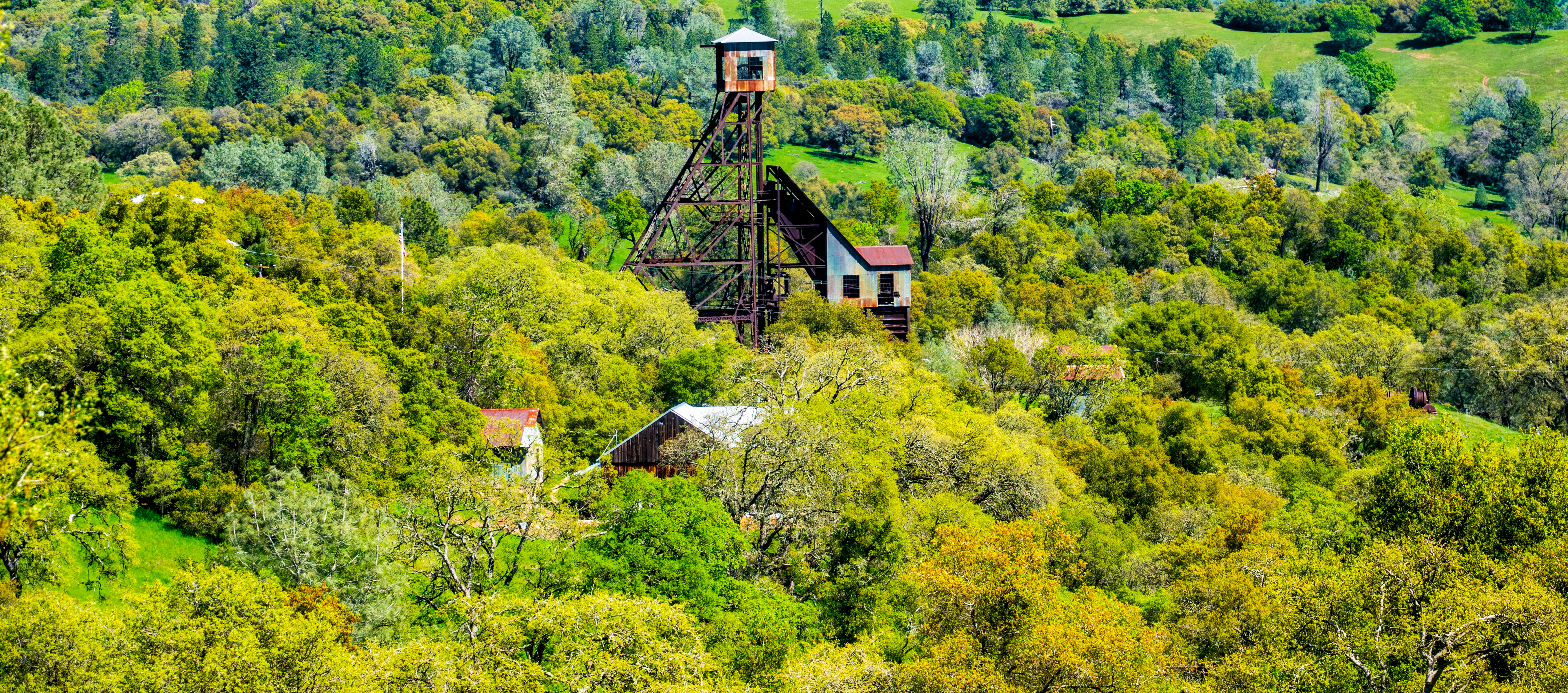
Old Kennedy Gold Mine Equipment HDR - Happy Sliders Sunday
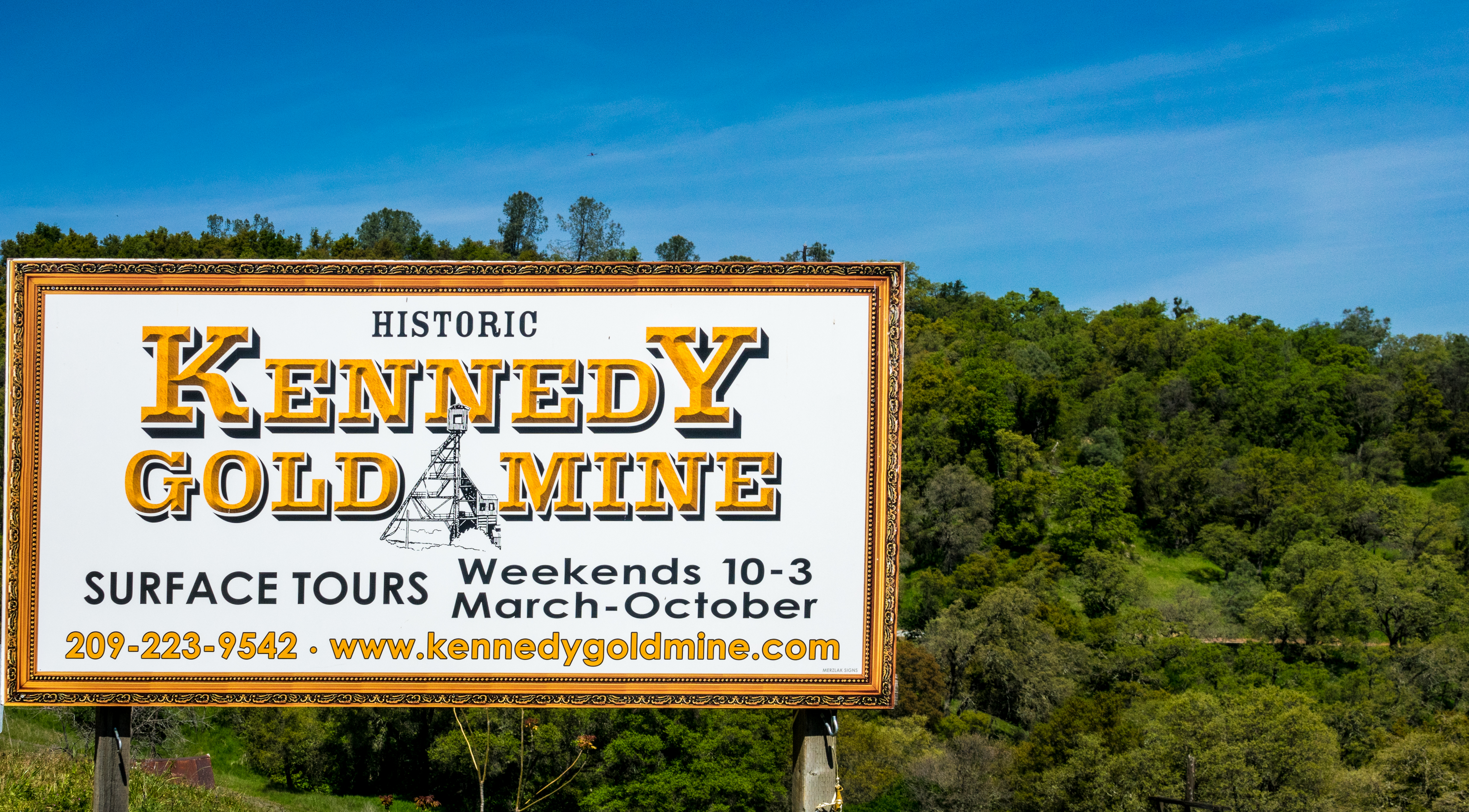
Historic Kennedy Gold Mine - Happy Sign Sunday

Miwok Ceremonial Roundhouse, 6 of 6

Outside the Cheese Shop

Indian Grinding Rock
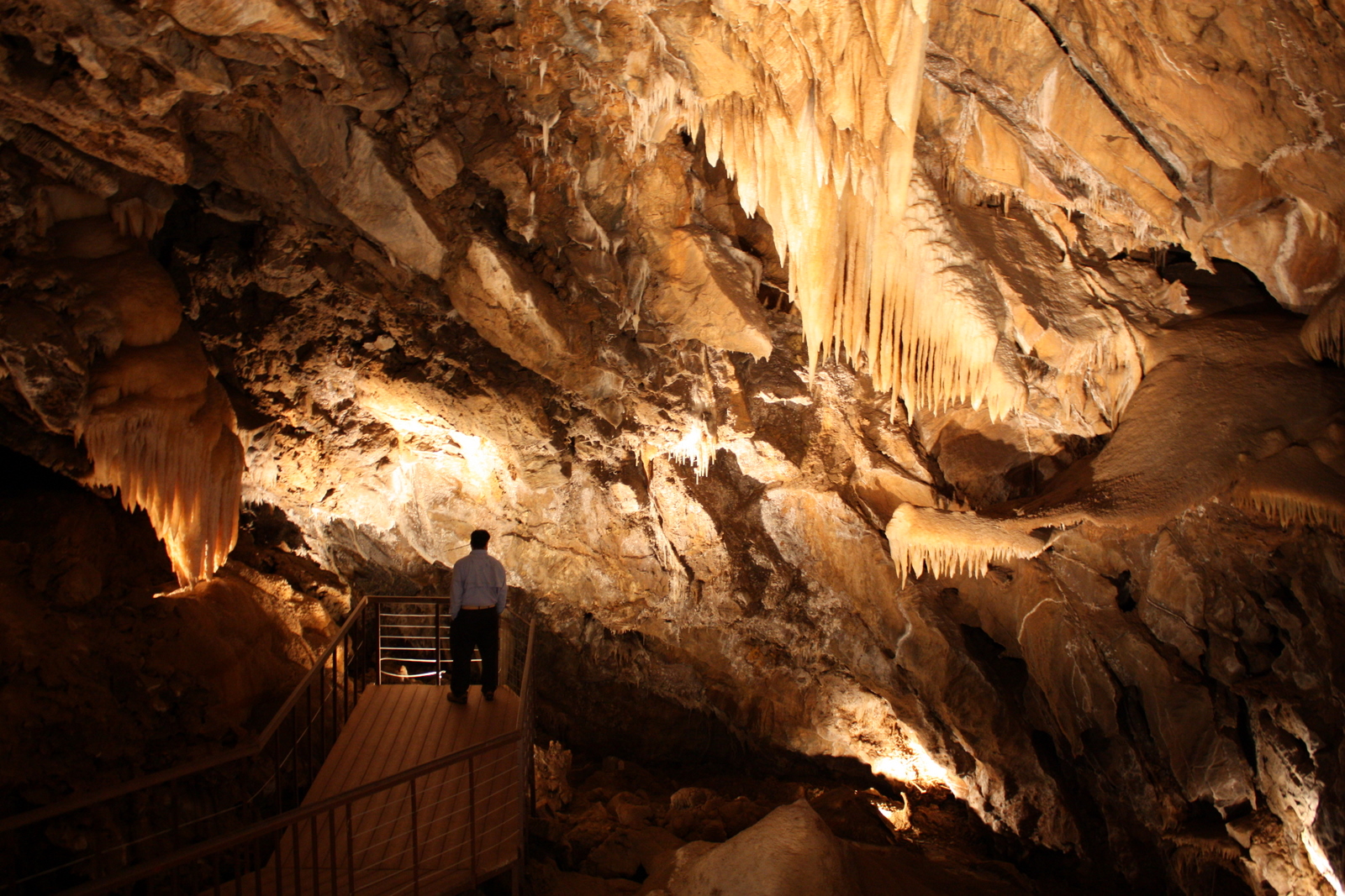
Black Chasm Cavern

Miwok Ceremonial Roundhouse, 4 of 6

Miwok Ceremonial Roundhouse, 5 of 6

Miwok Ceremonial Roundhouse, 2 of 6

Sobon Estates view

Blooming hills

Outside Amador City

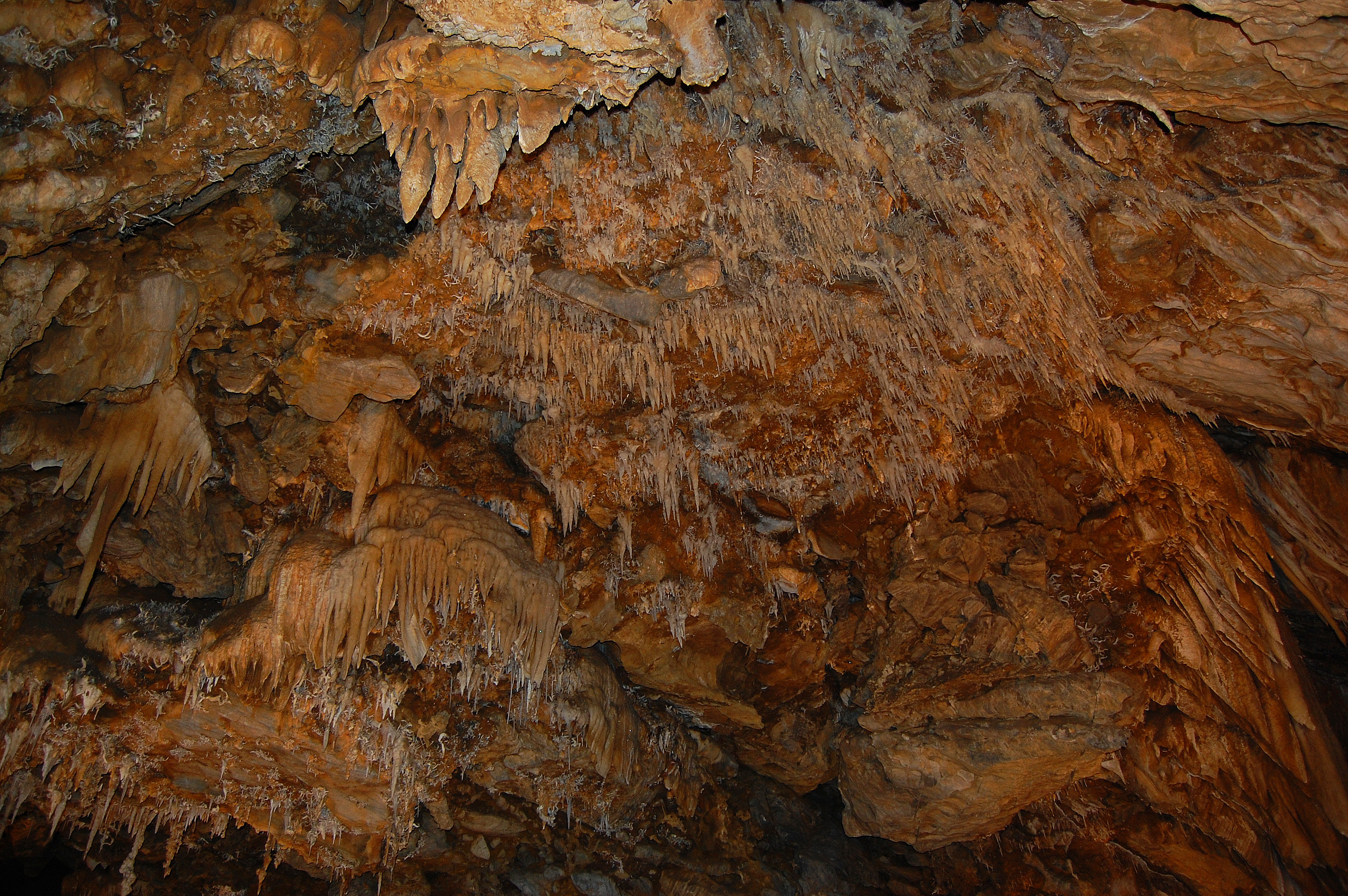
Drapery Stalactites

Stalactites in Black Chasm Cavern, Volcano, California
Highway 49, California

Kennedy Mine Tailing Wheel Park

The Veins of an Oak at Sunset - Sutter Creek, CA

Protected by the shadows
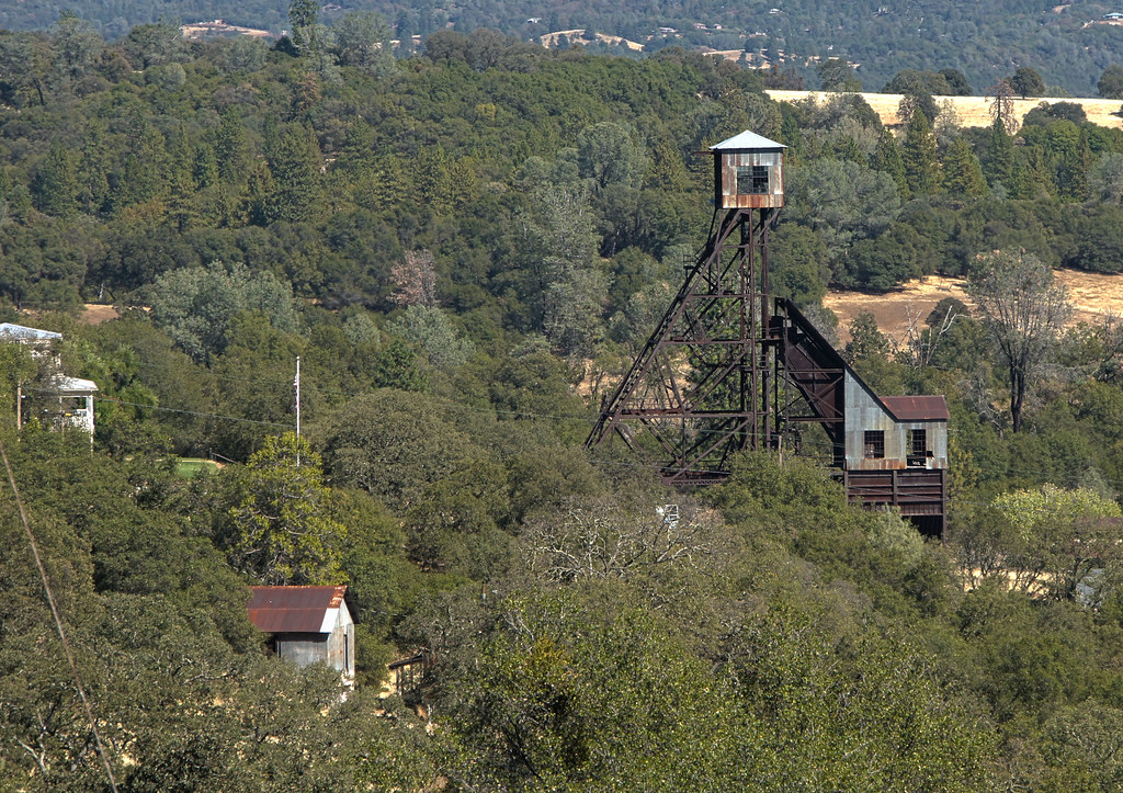
Kennedy Goldmine Headframe
Jackson Butte from Mokelumne Hill Airstrip (2)

Black Chasm Cave Tour

Railroad Flat
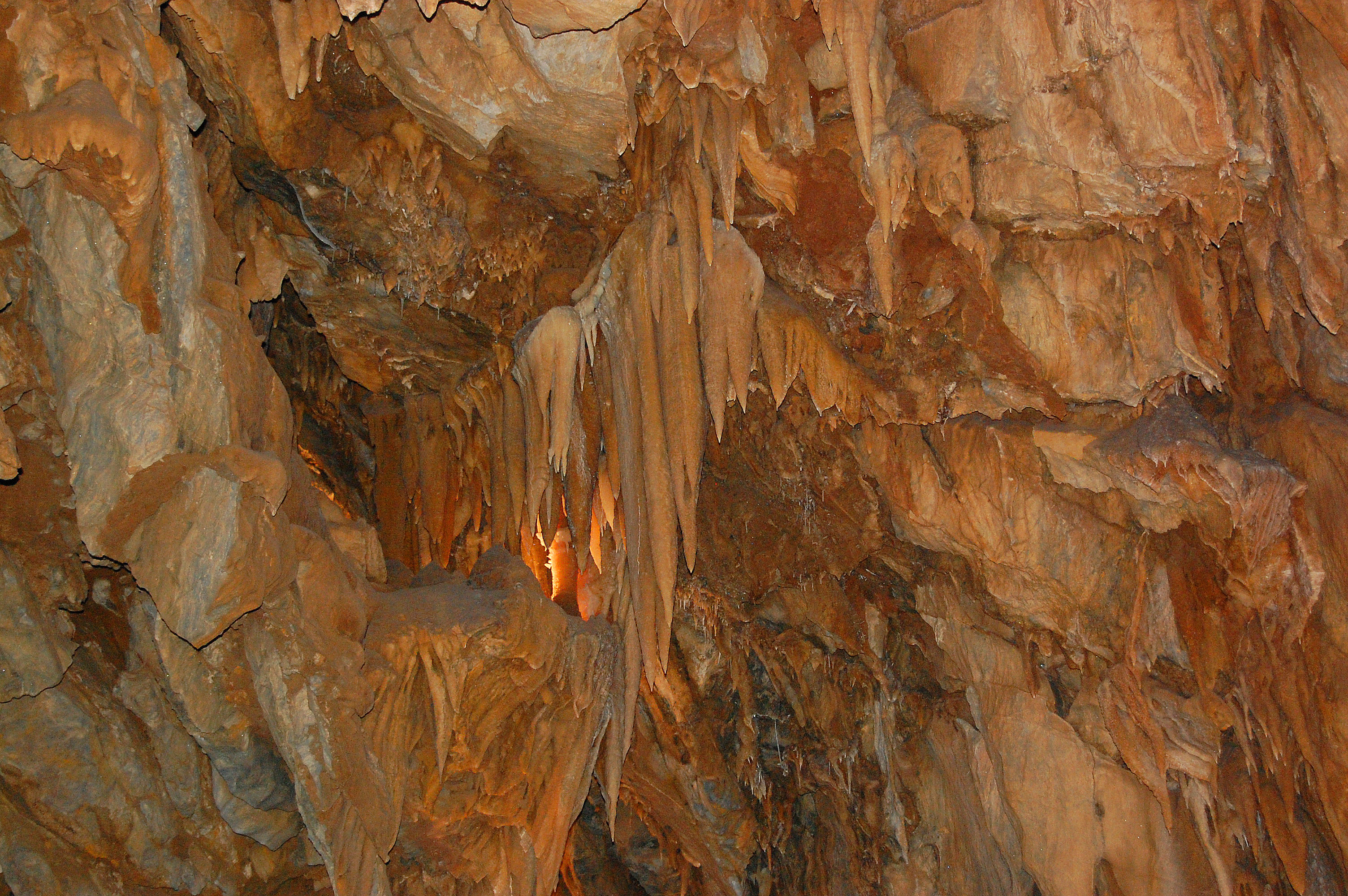
Black Chasm Cavern
Black Chasm Cavern, National Natural Landmark

Sutter Creek

Black Chasm Cavern

Big Oak

Stalactites & Helictites

Black Chasm Caverns
Topographic Map of Volcano Union Inn, Consolation St, Volcano, CA, USA
Find elevation by address:

Places near Volcano Union Inn, Consolation St, Volcano, CA, USA:
Volcano
Volcano Country Store
United States Postal Service
Saint Bernards Catholic Church
St George Hotel
Pine Grove Volcano Road & Sutter Creek Volcano Road
Masonic Cave Road
Indian Grinding Rock State Historic Park
Pine Grove Volcano Road & Bryson Lane
15250 Mitchell Mine Rd
Pine Grove Volcano Road & Tobacco Road
Pine Grove Volcano Road & Tobacco Road
Pine Grove Volcano Road & Aqueduct Volcano Road
20485 Wild Iris Ln
20485 Wild Iris Ln
20485 Wild Iris Ln
19540 W Mitchell Mine Rd
14446 Knoll Ct
14424 Knoll Ct
19382 Laurel Canyon Rd
Recent Searches:
- Elevation of Pykes Down, Ivybridge PL21 0BY, UK
- Elevation of Jalan Senandin, Lutong, Miri, Sarawak, Malaysia
- Elevation of Bilohirs'k
- Elevation of 30 Oak Lawn Dr, Barkhamsted, CT, USA
- Elevation of Luther Road, Luther Rd, Auburn, CA, USA
- Elevation of Unnamed Road, Respublika Severnaya Osetiya — Alaniya, Russia
- Elevation of Verkhny Fiagdon, North Ossetia–Alania Republic, Russia
- Elevation of F. Viola Hiway, San Rafael, Bulacan, Philippines
- Elevation of Herbage Dr, Gulfport, MS, USA
- Elevation of Lilac Cir, Haldimand, ON N3W 2G9, Canada